The city
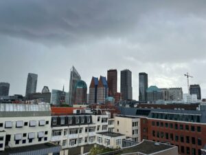
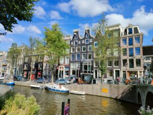
New day, new city. Today we left by train with our bikes from Amsterdam Central Station towards Den Haag. Holland’s third-largest city, Den Haag is a majestic and regal location, filled with sumptuous palaces, home to embassies and luxury residences, as well as boulevards and green parks. The Hague, whose official name is ‘s-Gravenhage (‘Count’s Hedge’), is the seat of the Dutch government and the residence of the royal family. It was also the country’s capital until 1806, when Louis Bonaparte established his government in Amsterdam. Eight years later, with the expulsion of the French, the government was again moved to The Hague, but Amsterdam retained the title of capital.
During the 20th century, the city became the seat of numerous international legal bodies, including the United Nations International Court of Justice, where important trials are regularly held that propel Den Haag into the headlines. The city is also home to all foreign embassies in the Netherlands, and is inhabited by a large community of foreign residents.
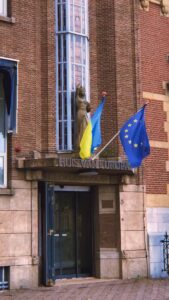
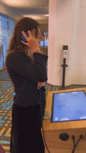
Welcome to the Europe House
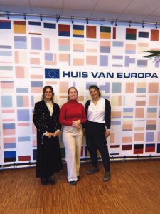
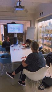
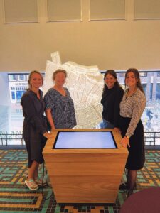
Indeed, we are here because of institutional commitments. Since Gloria is an Ambassador of the European Climate Pact, we have been hosted at the Europe House, home of the Representation of the European Commission and the European Parliament Liaison in the Netherlands. Here we met the Coordinator of the House of Europe, Amber Scheele, to whom we presented Navigandum per hereditatem project and started discussing presenting our report. It would be the perfect place where to talk about our experience!
In addition to institutional activities, the House of Europe is an information point where you, as a citizen, can just walk in and see, in an interactive way, what the European Union can do for you. This is the place where you can learn about Europe. You can also stop by this meeting place and take away leaflets on all kinds of topics related to the European Union. There are also people ready to answer your questions. If you want to voice your own opinion, you can do that too at the House of Europe. Debates are organized, and the meeting and debate room can accommodate more than 100 visitors. Under certain conditions, civil society organizations can use this space free of charge.
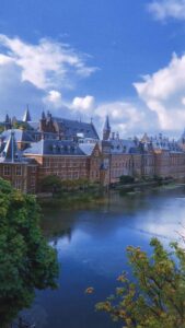
After chatting with Amber and visiting the beautiful building, we had lunch in front of the ancient Parliament, the Binnenhof. The Binnenhof is a group of buildings located near to the Hofvijver lake in the heart of the city. Along with the Ministry of General Affairs and the office of the Dutch Prime Minister, it serves as a meeting venue for both chambers of the Netherlands’ States General. The Gothic fortress, which was mostly constructed in the 13th century, served as the counts of Holland’s primary residence before it was transformed into the political hub of the Dutch Republic in 1584. The top 100 Dutch heritage sites include it. The Binnenhof is one of the oldest still-in-use Parliament buildings in the world.
A full immersion into Dutch Art
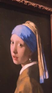
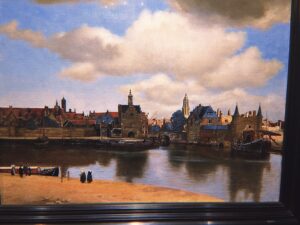
But it started raining little later, so we decided to enjoy the city visiting the famous Mauritshuis Museum, which is particularly known for its collection of paintings, which includes masterpieces by artists of the Dutch Golden Age-including Joannes Vermeer, Rembrandt van Rijn, Carel Fabritius, Jan Steen, and Paulus Potter-as well as other Dutch and European painters such as Hans Holbein the Younger, Jan Brueghel the Elder, Peter Paul Rubens, and Anthony van Dick. The museum houses also the most well-known of Vermeer’s works, Girl with a Pearl Earring. It is a “tronie,” a painting of an imagined figure, rather than a portrait. Tronies often feature a specific kind or character, in this example a female dressed exotically with an oriental turban and a surrealistically big pearl dangling from her ear. Light was Johannes Vermeer’s specialty. The girl’s gentle features and the glimmers of light on her moist lips in this photograph demonstrate this. Of course there is also the brilliant pearl.
Visiting Mauritshuis, we also had a chance to look at Rembrandt’s amazing works. The Dutch Golden Age painter changed his style and techniques throughout his life. Among his first masterpieces, there is for sure The Anatomy Lesson of Dr Nicolaes Tulp (1632). When Rembrandt was commissioned to create the portraits of the Amsterdam surgeons, he was only 25 years old. The doctors are shown in action by Rembrandt, and each of them is focused on a different object. The stark contrasts between light and dark give the scene more dynamism. The teenage artist showcased his renowned technique and his exceptional aptitude for painting lifelike portraits in this group portrait.
Instead, if we look at the end of his life, we find a new expressive freedom. For instance, in Self Portrait (1669) it’s amazing how he painted the face with such forceful brushstrokes. Rembrandt suggests a real-life guy with his thick, almost model-like layers of paint. This is truly a work of art.
This collection of Dutch art permitted us to discover much more about the Holland style and cultural background. So, we concluded our day in Den Haag artistically fulfilled.
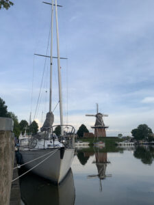
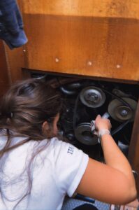 The quiet of Enkhuizen is perfect to check the engine before leaving. We noticed that the
  The sea was flat and there was
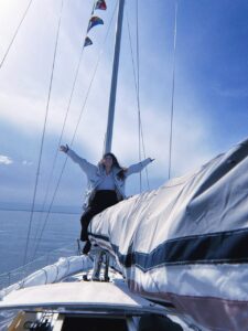
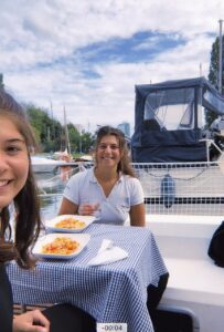 Finally, we had a restful lunch on board and a little power nap just to be more energetic. Once rested, we rode our bikes and went around the
 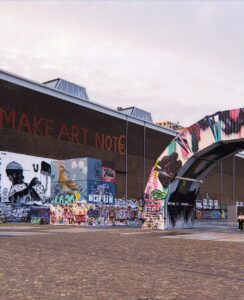 Another peculiarity of Noorderhof is street art. The neighbourhood is mostly a shipyard with a lot of vacant structures. It has developed over time into a
  known for his container street art, is one of them. The iconic
 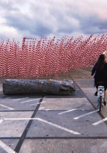 magnificent murals, but also new installations. For example, we came across the “
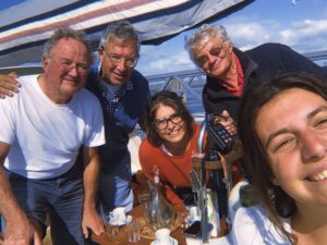 The journey from
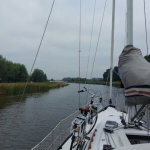
  So, after these fascinating chatting, we finally started sailing and
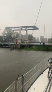
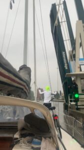
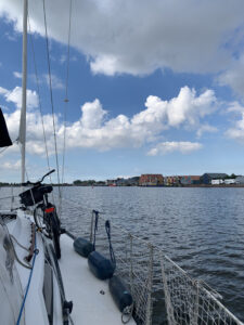
  En route to Enkhuizen, we had to cross the
 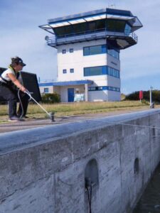 necessary to
 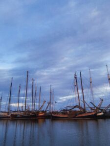 Then, we kept on sailing until
  Happily, numerous stunning fortifications and monuments have survived. For instance, we had the pleasure to have a drink in front of the beautiful “
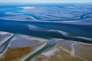 The Wadden Sea is one of the world’s largest tidal areas. The region stretches across three borders, from Den Helder to Danish Esbjerg. The
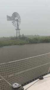
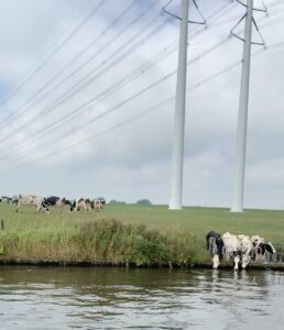
 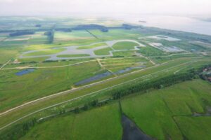 Therefore tomorrow we will not be able to leave the harbour as soon as Allegra arrives around 12:30 as the two sluisen (dikes) will be closed in order to protect the city of Harlingen, its canals, and the whole countryside behind. In fact, the main characteristic of Dutch geography is the flatness of the land: about half of the territory is less than one metre above sea level and a substantial part (27% of the total area, where 21% of the population resides) is below sea level. The lowest point, 6.7 metres below sea level, is located near Rotterdam. The highest point, the Vaalserberg, has a height of 321 metres and is located in the southwest, at the convergence of the borders of the Netherlands, Belgium and Germany. Today, 65% of the Netherlands would be underwater without the system of dikes, sluices and canals that regulate its level: a cohabitation painstakingly built over two thousand years of complex relations between man and nature. A polder is a Dutch invention that changed the physiognomy of the Netherlands forever and has been used in various other parts of the world since. Polder is a Dutch word that originally denoted a plot of grassy land that emerged from shallow marshes, land of this kind, later reclaimed, reclaimed is now called polder. This is how the use of windmills developed, around the 17th century, which used the power of the wind to operate the pumps with which to draw water from the polders. To increase the land needed for agriculture and a growing population, the Dutch built bigger and bigger dams and canals. For the past sixty years, everyone has had their feet dry and agricultural land, nature reserves and housing areas have increased without harming the climate. If one compares two maps, one from the 14th century and the other from the present day, one realises that
 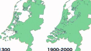 seventeen per cent of the country’s surface area has been claimed and obtained by water. After all, place names tell the story of centuries of Dutch engineering: ‘dam’ means dyke and the major cities have names associated with the first, ancient defence works. The Dutch have a unique bond with water, their best friend and most fearsome adversary. Economic prosperity has historically come along the waterways, a valuable element not only for trade but also for creating energy and for an agriculture that is now the world’s second-largest exporter after the United States. Water has, moreover, caused tragedies in the past, the last one in 1953. The flood came from the North Sea and eight thousand three hundred and sixty-one people died. The water swept away nine per cent of the cultivated area.
 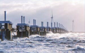 The
The 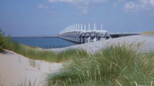 All defence works are a compromise with nature: the dams allow, except in critical conditions, the normal flow and, in this way, clean water enters and polluted water leaves. The barriers have made room for large green areas: the
 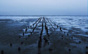 On top of that, in the North Sea, the currents are very strong and parallel to the coast. The sea is shallow and very flat, so much so that it looks like a continuum of land. The Wattenmeer (the sea between the coast and the Frisian Islands) has a depth of about 30 metres, while in the more central area of the North Sea it is about 200 metres deep. The Mediterranean Sea can be up to 4000 metres deep. The North Sea is therefore characterised by the large difference between the Flut (high) and Ebbe (low) tide. This major difference is due to the currents parallel to the coast and its shape. The tides depend on the attraction that the moon and the sun have on the earth. A lunar month lasts 28 days and is divided into four weeks in which the phases of the moon alternate: full moon, first quarter, new moon and last quarter. Each week the moon is in a different position in relation to the sun: there is a maximum tide in the full and new moon phases, i.e. when the moon and sun are aligned on the same axis. In this case, the vectors of the moon and sun add up and the tide is called a sigiziale. There is a minimum tide in the first and last quarter phases i.e. when the moon and sun are perpendicular and not on the same axis.
 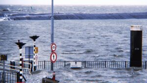 Tomorrow we will not only have flut tide, but an exceptionally high one, a trend more and more common in the Netherlands because the sea level has risen by 12 to 20 centimetres between 1902 and 2010. The rate at which sea levels are rising has accelerated. It has risen twice as fast in recent years as it did in the twentieth century, at a rate of 4 to 5 millimetres per year. The rate at which the sea level is rising also continues to increment. The study “Effects of sea-level rise on tides and sediment dynamics in a Dutch tidal bay” demonstrated that sea-level rise (SLR) not only increases the risk of coastal flooding, but it also has the potential to change tidal regimes in estuaries and coastal bays.
 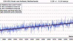 The study considered the impact of SLR on tidal dynamics in the adjacent North Sea. The findings show that compared to the nearby shelf sea, the bay experiences higher increases in tidal amplitude and stronger nonlinear tidal distortion as a result of SLR up to 2 meters. Tidal asymmetry during SLR up to 2 meters influences an essential part of sediment transport. The altered tidal asymmetry may result in increased export when merely taking into account sand bed-load transfer, which could have effects on coastline management.
 Fons Janssen
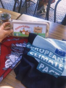
 The ancient cities of the Hanseatic League have preserved to this day a culture unparalleled in Europe, from Germany to the Netherlands to the Scandinavian countries. Zwolle, in the Netherlands, is one of them. The current capital of the province of Overijssel, with 115,000 inhabitants, is located about 120 km from Amsterdam and very close to another Hanseatic city, Kampen. Zwolle is not a seaside town, as perhaps its history might suggest; the powerful German league chose it for its river connections: today the city is situated on the waters of the Zwarte, a small river that flows into the river Ijssel, but at one time this small hilly area was surrounded by three rivers (I]ssel, Vecht and Zwarte). The name Zwolle derives from Suolle
 (hill), which was given to the town immediately after its foundation, which took place in the year 800 by merchants from Friesland and the troops of Charlemagne. In 1294, the city became part of the League and thus in 1361 took part in the war against Valdemaro IV of Denmark. In medieval times and especially in the 15th century, the city flourished economically, thanks to the trade brought about by membership of the league; art and culture followed as usual. Many palaces built in the period – sadly still – known as the Golden Age can still be admired in the old town, bearing witness to a rich and prosperous history.
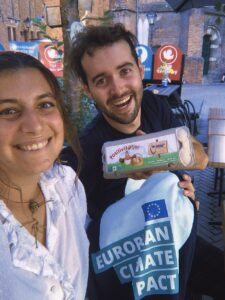 Immediately on a first visit, Zwolle appears as a lively city with many opportunities and a vital economy. Easily accessible by road, river and rail networks. Just north of the railway station, we find a bought medieval centre. Most of the ancient walls that once surrounded it have been demolished, but the defensive channel is still clearly outlined. Within walking distance of each other, one can find many old buildings and picturesque streets. Fons and I firstly enjoyed a coffee in Nieuwe Markt before a chill walking tour in
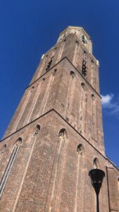 formerly used as the city’s guardhouse. Public executions were only carried out outside the Hoofdwacht. At the front of the building is an inscription with the text ‘Vigilate et Orate‘ (watch and pray), perhaps a warning when considering the terrible punishments once carried out here. One of the places we mostly enjoyed were the Onze Lieve Vrouwekerk (Church of Our Lady) located just outside the Ossemarkt, is an old Catholic church from 1399 with a difficult history. In 1580 it was closed to Protestants and was used for various purposes, was later returned to the Catholics and
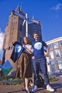 Find and I enjoyed an early dinner again in Nieuwe Markt during which we managed to better understand how we could cross our actions and he shared with me exciting plans for the
  Allegra confirms she will be joining Navigandum per Hereditatem as of Tuesday! She has recently graduated and was looking for something meaningful to devote her time to and she managed also to bridge it with her passion for sailing coming from her grandfather.
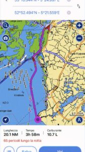 The morning was devoted to replanning the whole trip as the days that will be spent in Harlingen will delay the sailing too much and will prevent us to be in Bruxelles and Bruges in time for our meetings. So instead of completing the whole itinerary by boat, we decided to leave the boat in Amsterdam and move around by train hoping to find hosts in the two Belgian cities we will visit. Afterwards, instead of sailing through Zeeland, we will sadly have to get back, but this way we managed to get some extra time to visit the Randstad. This is a large polycentric conurbation in the Netherlands that consists of seventeen towns connected by a mixed network of fully integrated road, rail, and river routes. We will also have extra time to visit Floriade thanks to the tickets sponsored by the City Council of Purmerend. The Floriade Expo 2022 is a celebration of green and sustainable technology that will take place in a park. At this living laboratory, guests will have the opportunity to learn about cutting-edge innovations in the fields of greenery, food, energy, and health, as well as solutions developed by national and international innovators that make our cities more enjoyable, more beautiful, and more environmentally friendly.
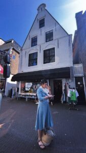 I dedicated the afternoon to following again the itinerary on the slave trade traces in Harlingen, discovered by my friend and artist
 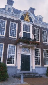 Admiralties were also involved in this overseas trade, which they secured with the power of cannonballs and grenades. The occupation of areas outside Europe as part of the Republic of the Seven United Netherlands’ Expansion Policy became associated with the slave trade and slavery. That was true both in Southeast Asia and in the Atlantic region. Harrowing histories of the transatlantic slave trade in West Africa, as well as plantation economies in Brazil and later the Caribbean, have long been known. We now know more about the Asian world’s slavery and forced labour, which Dutch administrators, planters, traders, clergy, and sailors used to relieve their own work and gain status. Slavery and colonial trade were inextricably linked from the 17th century until the 19th century. Friesland has never been an isolated region. On the contrary, the province developed into a dynamic centre of various markets, attracting many Frisians from the Baltic Seato the Wild Coast in South America, as well as those from Amsterdam, Cape Town, and Batavia, as well as Deshima, Japan. Approximately twenty-five thousand Frisian seamen and soldiers sailed and fought in the service of the VOC, the WIC, and the Admiralties during the 17th and 18th centuries. ‘Friesland had its own Amiralities department. Some interesting places to learn about Harlingen’s slave trade history include:
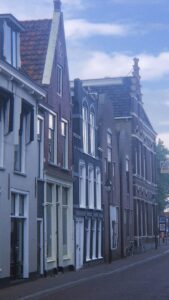 2. De Drie Roemers, a colonial-style grocery store;
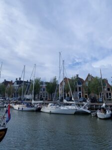
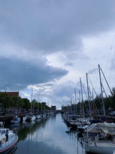
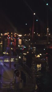 In the evening I was surprised by people setting up stages, stands, and dance floors all over the city, and filling the inner-city canals with lights. I did not know I was stranded in Harlingen on the very day the city commemorates one of its most famous festival. Harlingen is not called de voorstad van Londen (“the suburb of London”) for nothing. The city has a bustling harbour, lovely canals, historic buildings, and several nostalgic bridges. Sailing gives you a completely different perspective on Harlingen than walking along the canals. Harlingen Ongeschut was unquestionably one of the highlights of the city folklore since 2012. More than 350 boats of various shapes and sizes responded to the invitation to take part in the new Harlinger event. It was a grand, pleasant, and festive cruise through Harlingen’s canals. A request has been made to all residents and ship owners along the route to install/hang a light point outside along the quay and/or in the trees, as well as to decorate the ships. This year, especially for this festival, the SAS, the gateway to the Wadden Sea, closes the inner locks, allowing you to enjoy a fantastic and one-of-a-kind round of Harlingen. ‘Harlingen Ongeschut’ is also accessible by foot or bicycle. Various musical and theatrical acts surprised me during the cruise, and I experienced the fairytale atmosphere on the water.
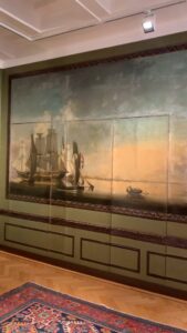 After getting married to Liesbet Scheltema in 1744, the merchant Sjoerd Hannema moved into the house they had just purchased. He had a new front wall constructed. The right side of the building can still be identified by this bell gable. Another member of the Hannema family, Sjoerd Jacobus Hannema, was responsible for the construction of the left wing of the house in 1825. This wing featured a cornice. Leendert Jacobus Hannema was the last descendant of the Harlingen merchant family to live in this house. He was known as Jacobus. In 1957, he established a museum in a portion of his home that he owned. He passed away in 1964, leaving the house as a bequest to the city of Harlingen, which carried out the terms of the will by maintaining the museum in the residence. Objects that are closely related to the history and art history of Harlingen are collected and displayed. These objects include Harlinger tile and pottery, maritime objects, centuries-old paintings (such as Granida and Daifilo by Jacob Adriaensz Backer), photographs, silverware, various old documents, and furniture. In addition to that, there is a room named after Simon Vestdijk. In this section of the museum, in addition to a number of other items associated with the Harlingen-born author, visitors will have the opportunity to view his entire body of work in its first edition form.
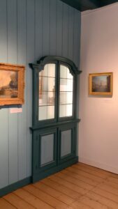 Entering the museum from the gift shop and passing into the original waiting room of the house suddenly made the reasons why I want to take this trip resurface. The meaningfulness of heritage sites and their impact on individuals and communities is invaluable, and the threat posed by climate change is real. Being Friday afternoon I did not manage to find a manager or senior employee of the Museum available to talk about its eventual adaptive strategies, therefore I simply enjoyed the visit.
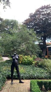 After passing a beautiful garden containing statues by local artists, I reached the second room that was dedicated to a focus on the sailing traditions of the Netherlands and on their history in Harlingen. Skilled hands constructed ship models with fine ropes and miniature pulleys for both decoration and crew training. Shipowners also enjoyed having their vessels painted, preferably at sea with full sails. The ship portraits represent the owners’ pride. In addition to objects such as a figurehead and a foghorn, the maritime collection also contains stories such as that of Commander Klaas Hoekstra. According to his journal, he left for Greenland in 1825 in order to hunt whales. His brand-new galley ship shattered in the Arctic ice, but after a year filled with horrors, the crew returned to Harlingen despite being presumed long dead. Additionally, the merchant navy and admiralty are discussed, and sadly no information was available on the role of Harlingen in the slave trade.
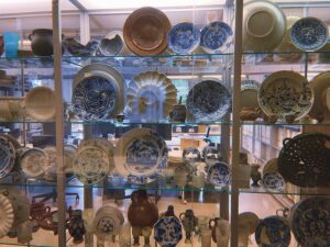
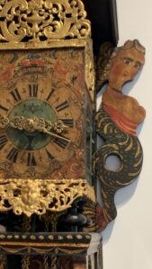 provides an excellent representation of what Harlingen has produced in recent centuries, including loose tiles, tableaus, an earthenware colander with a harbour view, playful saying dishes, and much more. Harlingen was also one of the most significant centres in the Frisian silver tradition. I could see how much silversmiths had to offer in the silver room. Harlingen family Radsma served as “city clock players” for more than 250 years; they determined the daily rhythm in Harlingen. The museum’s clocks are true works of art: the dials are exquisitely crafted and painted, and the cabinets are glued with fine veneers, inlaid with flower and bird motifs, and topped by angels playing the trumpets.
 The Museum, in conjunction with the City Council, is undertaking the project known as “Thoughts of the Sea.” At the top of the Zuiderpier in Harlingen is where you will find the city’s post box. Hikers are encouraged to share their own personal reflections, poems, drawings, and love letters by posting them in the red container. Anyone who wishes can write down their “thoughts by the sea” and place them in the former PTT’s red letterbox to share their thoughts (anonymously). The mailbox is emptied once a week. The initial idea was to create an annual booklet filled with beautiful, unique, or amusing letterbox contributions, but now some can be seen in the exhibition, which features a large number of very personal messages that, at times, can be quite moving.
 After the visit, I stayed a bit longer in the quiet library annexed to the museum working on notes and pictures from the previous day. In the meantime, I realized it rained and the sky was back to its deep grey. Walking back to Tetide and Mosè I received a positive message from a friend, Allegra Grillo, who was just looking for something to do after her gradu ation in Law. She told me she would let me know, after having properly thought it over, if she would have joined me in Navigandum per hereditatem.