


28/Aug – 31/Aug
Amsterdam was the first stop of my Beyond the Postcard journey, and an appropriate place to begin asking what it means for a World Heritage City to remain a living city.
I arrived from Lisbon on a rainy Friday afternoon, took the train from Schiphol and walked from Amsterdam Centraal to my hostel under the rain. Waiting for me was an envelope from Aafje Moonen, from the World Heritage Office of the City of Amsterdam, with a suggested route, postcards, brochures and personal recommendations.
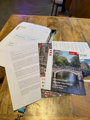
Her route became an important starting point. Rather than connecting landmarks, it followed the historical development of the Canal Ring and drew attention to the relationship between architecture, water and everyday urban life. This fitted particularly well with the broader question behind my project: heritage is not only what is physically preserved, but also the functions, movements, practices and relationships that allow a historic environment to remain part of a contemporary city.
Before exploring any of this, however, I needed dinner. I found a version of stamppot without pork and, while dealing with the receipt afterwards, learned an early practical lesson about Amsterdam: do not handle small and important objects too close to a canal. My hostel locker key disappeared directly into the water. Fortunately, the staff found the situation more amusing than catastrophic, opened my locker and gave me a new padlock — this time with three keys.
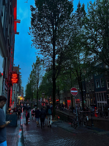
Later that evening, while wandering without much direction, someone knocked on a window to get my attention. Only then did I realise I had entered the Red Light District.
Earlier in the evening, the area still contained several forms of urban life at once: tourists finishing their day, people casually crossing the neighbourhood, curious visitors and groups slowly gathering. When I returned later, the same streets had changed completely. They were densely occupied, movement was difficult, and most people appeared to be there for a specific purpose.
This became one of my first observations in Amsterdam: the same physical place can perform very different urban functions according to time, users and expectations.
The Canal Ring as urban infrastructure
The following morning, still under heavy rain, I began Aafje’s route. From Amsterdam Centraal I walked towards Brouwersgracht, Noordermarkt, the Jordaan and Prinsengracht, passing the Anne Frank House, crossing the Negen Straatjes, continuing through the canals around Reguliersgracht and eventually reaching Magere Brug over the Amstel.
I did not follow the route strictly. Getting lost was useful.
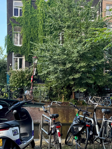
It is easy to read Amsterdam’s canals primarily as scenery. Yet the UNESCO-listed Seventeenth-Century Canal Ring Area of Amsterdam inside the Singelgracht originated as a major urban expansion associated with Amsterdam’s growth as a port and trading city. Water organised circulation, parcels, streets, housing and expansion. Centuries later, it remains a structuring element of the city.
Movement constantly requires negotiation between bridges, pedestrians, bicycles, trams, cars and boats. Some streets function as narrow corridors between buildings and water; others open into commercial axes or public spaces. The canals therefore operate simultaneously as heritage, infrastructure, mobility system, public landscape and tourist attraction.
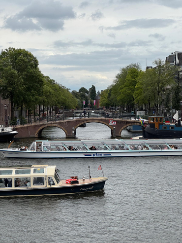
Aafje had suggested observing differences in the canal houses themselves, particularly as their dimensions change across phases of the Canal Ring’s development. Once noticed, those variations became difficult to ignore.
Yet what increasingly interested me was the functional landscape at street level.
Cannabis shops, souvenir shops, cannabis souvenirs, cafés, restaurants, hotels, hostels and specialised museums occupy large portions of the historic centre. Some are cultural or institutional; others are explicitly organised around novelty, spectacle and highly shareable visitor experiences.
Around the Anne Frank House, visitors accumulated in queues and around entrances. Elsewhere, groups gathered around attractions, canal tours and cafés. In the narrow streets of the Negen Straatjes, visitor density could alter the experience of an entire street within minutes.
Amsterdam receives around 24 million tourist overnight stays and another 22 million day visitors annually. For the World Heritage Office, visitor pressure is therefore not abstract. Overcrowding, litter and the sudden transformation of ordinary places into international destinations — increasingly accelerated by social media — have direct consequences for the functioning of the historic centre.
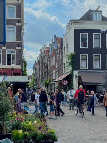
The interesting question, however, is not simply how many tourists are present, but how visitor pressure changes the functional geography of the city.
A historic ground floor occupied by a grocery shop and the same ground floor occupied by a souvenir business may be architecturally equivalent, but they support very different relationships with neighbourhood life. A façade can remain perfectly preserved while the economic and social role of the street behind it changes substantially.
At the same time, central Amsterdam cannot be described as a city simply surrendered to tourism. Residents cycle home through the same streets visitors photograph. Groceries are carried across bridges. Children, workers and tourists occupy overlapping routes. Domestic windows sit only metres from some of Europe’s most intensely visited spaces.
There is no need to decide which Amsterdam is the authentic one. They coexist.
Urban stratigraphy and multiple landscapes
This coexistence became particularly evident around Chinatown and the Oude Kerk. One of Amsterdam’s oldest monumental buildings stands almost directly beside the red-lit windows that constitute another globally recognised image of the city.
The area can almost be read archaeologically. Urban periods and functions do not simply replace one another; they accumulate. Religious heritage, housing, nightlife, tourism, commerce and contemporary regulation occupy nearly the same space. This produces a form of urban stratigraphy in which historical, economic and social layers remain simultaneously active.
That idea became increasingly important to my project.
A World Heritage City may appear as a single object on a map, but in practice it contains several overlapping landscapes: residential, tourist, commercial, institutional, infrastructural and patrimonial. These landscapes may reinforce each other, but they can also compete for the same buildings, streets and public spaces.
Their boundaries are rarely identical.
This complexity helps explain why managing a World Heritage City involves considerably more than conserving façades or monuments.
Aafje described several challenges faced by Amsterdam’s World Heritage Office. Tourism is only one. Climate change introduces concerns related to heat, drought, storms, water conditions and flooding. Buildings and infrastructure need to become more sustainable, while interventions must remain compatible with a protected historic cityscape. Electrification requires changes to the electricity grid; solar panels and energy-efficiency measures raise questions around historic buildings and protected views.
Historic quay walls introduce another layer. Some became structurally unsafe and require major repair programmes. What may initially appear to be an engineering issue rapidly becomes a question of heritage, mobility, visual quality, maintenance, budgets and long-term urban management.
Behind all of these issues is institutional capacity. The World Heritage Office itself is becoming smaller while the problems it has to coordinate are becoming more interconnected.
Heritage management is therefore not simply about preventing change. It is about managing change in a place where existing values constrain, inform and sometimes complicate future interventions.
Walking beyond the postcard
My final day provided an unintended spatial experiment. I had to move from the historic centre to accommodation near Sloterdijk before travelling to Bruges.
The direct route was already long, so naturally I made it longer.
I passed Dam, Singel and Prinsengracht again before gradually entering areas where the canals appeared less strongly oriented towards visitors. Around Lijnbaansgracht, some sections remained historic but felt quieter, more residential and occasionally rougher around the edges.
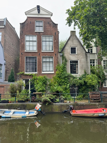
This mattered because World Heritage can create an expectation of visual perfection: restored façades, monumental views and carefully maintained public space.
A living city contains something else as well: deliveries, rubbish, scaffolding, maintenance, deterioration, construction and adaptation.
These are not necessarily failures of heritage management. They may simply indicate that a place continues to function beyond its value as an image.
As I moved farther from the most intensely visited areas, tourism did not disappear at a clear boundary and everyday life did not suddenly begin outside the UNESCO property. Instead, the relative weight of different functions changed gradually.
This became one of the most useful lessons of Amsterdam: Administrative boundaries are precise on maps. Urban landscapes rarely are.
A World Heritage property can be represented as a polygon. Tourism, residential life, commercial specialisation, perceptions of crowding and everyday routines behave more like concentrations, gradients, networks and overlapping territories.
For a spatial approach, the question is therefore not only where heritage is formally located, but how different urban geographies intersect within and around it.
Keeping the centre alive
Amsterdam already recognises that conserving its historic centre cannot be separated from questions of livability.
Aafje introduced me to the Aanpak Binnenstad, or Inner City Approach, a long-term programme dealing with the functioning of the centre. Measures include reducing tourism-related nuisance, supporting greater retail diversity, introducing cultural uses into properties, limiting hotel capacity and addressing pressures associated with visitor flows.
Retail is particularly revealing; if businesses serving residents progressively disappear and are replaced by activities aimed primarily at visitors, a historic centre may remain architecturally intact while becoming functionally less capable of supporting everyday life.
A protected façade does not guarantee a living neighbourhood. This shifts the discussion from heritage preservation alone towards who and what the historic centre can continue to accommodate.
Residents need housing, groceries, public services, mobility and some degree of quiet. Businesses need viable economic conditions. Visitors want access to the city. Historic buildings require protection. Infrastructure must be renewed. Energy systems must change. Climate risks must be addressed.
All of these demands occupy the same limited urban space.
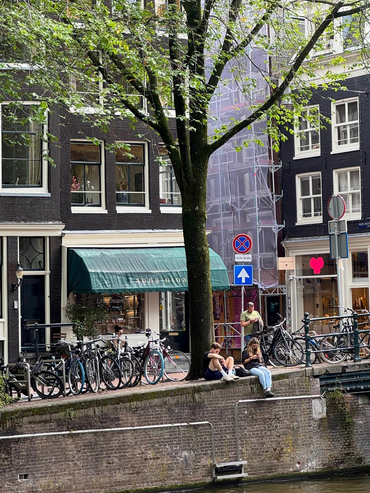
Reducing this tension to “residents versus tourists” would nevertheless be too simplistic. Tourism contributes to employment, culture, economic activity and Amsterdam’s international character. Visitors are themselves part of the contemporary city.
The more relevant question is how the scale and spatial concentration of particular uses affect the possibility for other uses to remain present.
This is also where I increasingly see the role of Beyond the Postcard. The project is not intended to replace more systematic urban analysis. Visitor numbers, housing prices, land-use data, mobility flows and demographic indicators are essential. But exploratory walking, conversations and spatial observation can help identify where those broader processes become visible, how they interact, and which questions deserve deeper investigation.
What Amsterdam left me with
Amsterdam contains several cities within the same physical city.
There is the Amsterdam of seventeenth-century canals, the Red Light District, cannabis shops, museums, Instagram queues and canal boats. There is also the Amsterdam of groceries carried home by bicycle, residential windows above tourist streets, quiet canals only minutes from intense visitor concentrations, and professionals attempting to adapt centuries-old infrastructure to contemporary environmental and technological demands.
These versions do not exist independently.
They overlap spatially, compete economically, change through time and depend on systems that visitors rarely see.
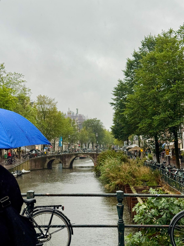
Amsterdam is therefore not simply preserving a historic city. It is continuously negotiating which functions, users and forms of change can coexist within the same extraordinary urban landscape.
Perhaps this is also a useful way to approach habitability in World Heritage Cities: not as a fixed condition to be measured once, but as the capacity to maintain a workable relationship between different claims on the same place.
Amsterdam in brief: many steps a day, plenty of rain, one locker key lost to the canals, and three days observing how quickly the same historic streets can shift between home, infrastructure, heritage and global destination.