After a few days in Lithuania, I arrived in Kraków – the last stop of my trip.
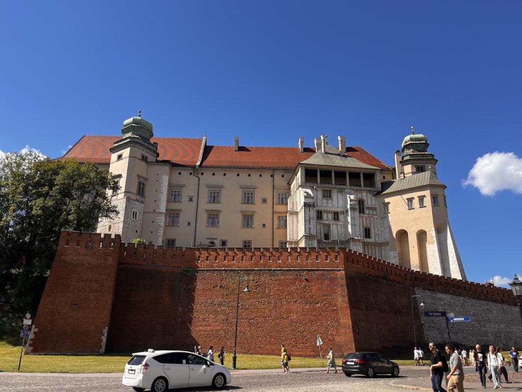
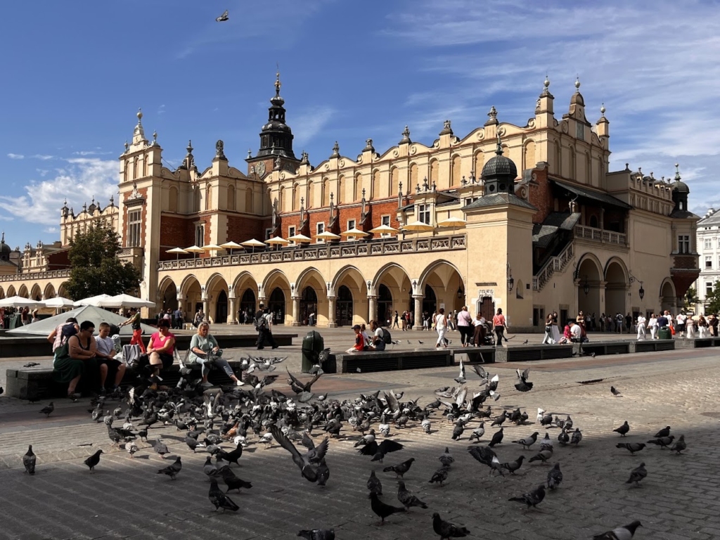
I started by exploring the historic centre. I walked around Rynek Główny, Kraków’s famous Main Market Square, passed the Sukiennice and St. Mary’s Basilica and eventually made my way towards Wawel Castle, one of the city’s most recognisable landmarks.
But, as with the rest of my trip, I wasn’t only interested in seeing the famous sights. I also wanted to find out where I could meet some younger locals and get a glimpse of everyday life in Kraków. So I stopped by the tourist information centre and asked if they could recommend places where I might meet young people who actually live in the city. And, of course, I had another very important question: where could I find the best ice cream in Kraków? They recommended Good Lood, so naturally I had to give it a try.
The weather was absolutely perfect. After spending so many days wearing sweaters and long trousers, it felt amazing to finally put on a dress and enjoy one of the last truly sunny days of the summer.
In the evening, I walked towards the Vistula River. The beautiful weather had brought everyone outside, and there were people everywhere – sitting by the water, talking with friends or simply enjoying the evening. I had already spotted a group of young people sitting on the grass near Wawel, playing cards, so I decided to approach them and ask if they would be willing to talk to me. Now, I decided to do the same by the Vistula.
It was such a nice way to spend the evening 🌅
Day 2
The next day, I started by exploring Kazimierz, Kraków’s historic Jewish quarter. I spent some time walking around the neighbourhood and taking in its atmosphere before heading to meet Natalia Zachwieja, who works with at the City Architect’s Office of Kraków.
We talked about how the city is developing and how Kraków tries to balance preserving its historic character with the needs of the people who live there. We also discussed some of the challenges the city faces, including graffiti in the Jewish quarter and Nowa Huta, a district I had first heard about from the young people I met the evening before. It was interesting to hear more about Kraków from a new perspective.
After our conversation, I continued exploring the city. I walked around Wawel and along the Vistula, and of course, I also had to try some traditional pierogi. In the afternoon, I took a train back home to the Czech Republic.
Nice felt like an appropriate place to end the journey because, perhaps more than any of the previous cities, its World Heritage story is about encounters.
Amsterdam had been structured by canals, Bruges by continuity, Brussels by multiple centres, Luxembourg by participation, Strasbourg by connections and Bern by landscape. Nice brought many of those ideas together through a different kind of urban history: a city repeatedly reshaped by people arriving from elsewhere.
I began in Vieux-Nice and later met Julie at the Centre Nice Patrimoine Mondial. That conversation immediately changed the way I understood the city.
Nice obviously has a history long before tourism. But the UNESCO property focuses on a very specific chapter: the transformation of the city into a cosmopolitan winter resort from the mid-eighteenth century onwards.
The Nice recognised by UNESCO is not simply the old Mediterranean town. It is also the city that expanded beyond it, deliberately adapting its streets, architecture, gardens and relationship with the sea to receive people arriving from Britain, Italy, Russia, France and elsewhere.
What exactly is World Heritage here?
The property is officially called Nice, Winter Resort Town of the Riviera and was inscribed on the World Heritage List in 2021.
It covers 522 hectares and includes a remarkably broad urban landscape: the coastline from the Promenade des Anglais towards Mont Boron, central districts developed for winter visitors, promenades, gardens, hotels, villas, apartment buildings, places of worship and parts of the hills.
This is important because Nice is not recognised primarily as a medieval city.
From the middle of the eighteenth century, increasing numbers of wealthy winter residents, initially especially British, began spending the colder months there. Nice was still part of the Kingdom of Sardinia, and in 1832 the Consiglio d’Ornato was established to regulate urban expansion and create a city increasingly adapted to this international population. The modest coastal path created with British involvement in the 1820s eventually became the Promenade des Anglais.
After Nice became part of France in 1860 and joined the European railway network a few years later, the process accelerated. New districts developed outside the medieval core, while hotels, villas, gardens, promenades and places of worship responded to an increasingly diverse international clientele.
UNESCO describes Nice as an exceptional fusion of British, Italian, French, Russian and other cultural influences. That mixture is visible in architectural styles, decorations, urban planning and even the functions of buildings themselves.
This became the central way I read the city. Nice did not feel defined by one heritage identity., it felt like a collage.
A city built through outside influences
After meeting Julie, I took the lift to Colline du Château, the hill separating Vieux-Nice from the port.
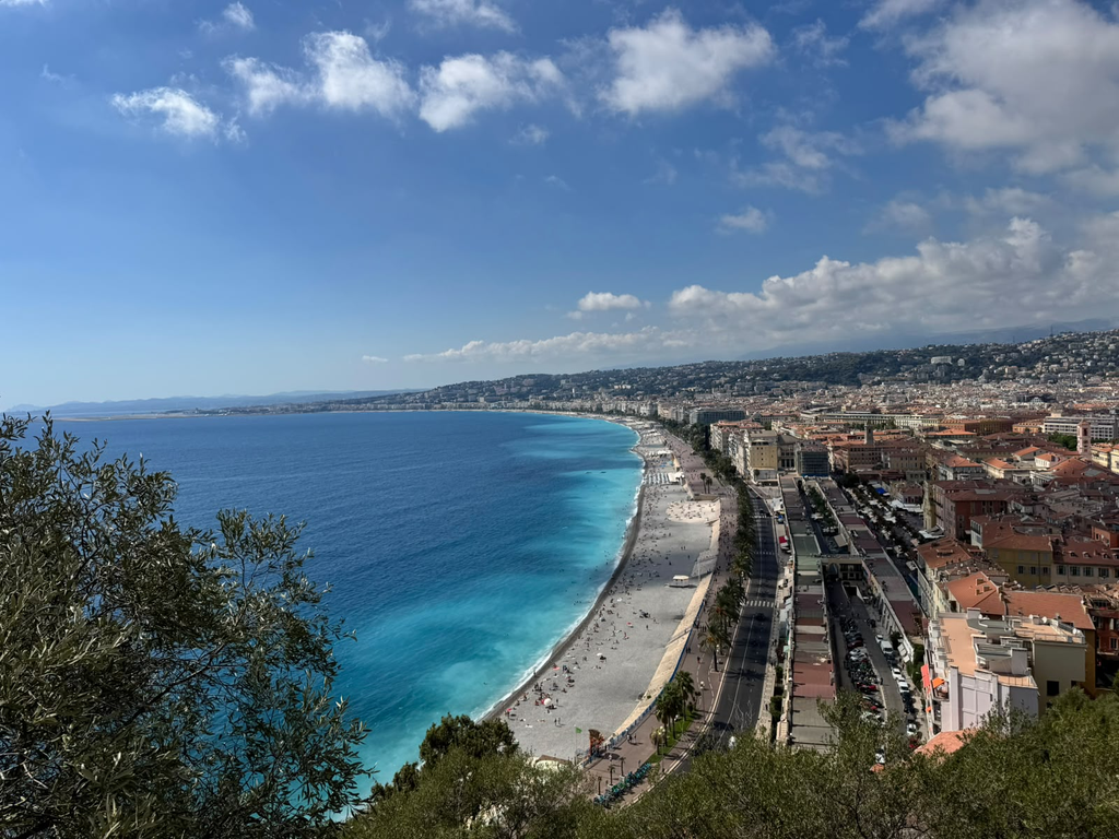
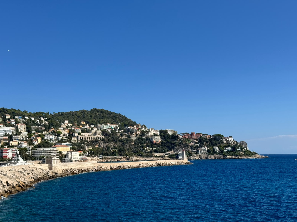
There is no château anymore, but the elevated park, its waterfall and viewpoints provide perhaps the clearest way to understand Nice spatially.
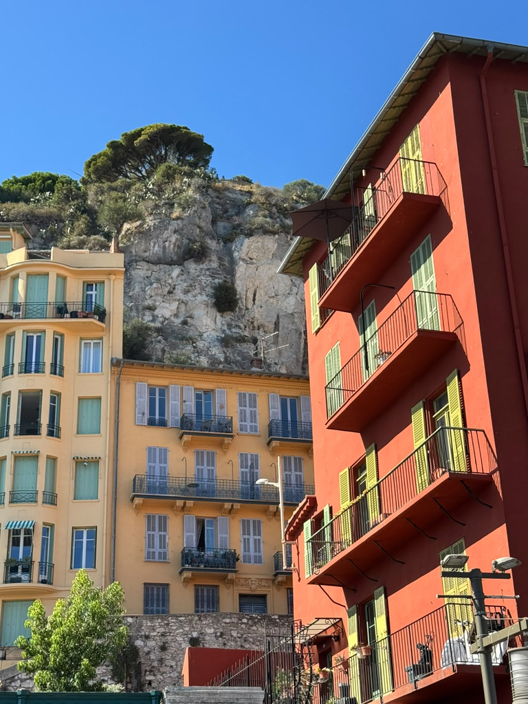
From above, the relationship between sea, city and hills becomes obvious. This geographical setting was not simply attractive scenery added to the World Heritage narrative. It was one of the conditions that produced it.
UNESCO identifies Nice’s mild climate, Mediterranean coastline, surrounding hills and views towards the mountains as fundamental attributes of the winter-resort landscape. The city’s urban form was deliberately organised to make use of sunlight, panoramas, vegetation and the relationship between sea and relief.
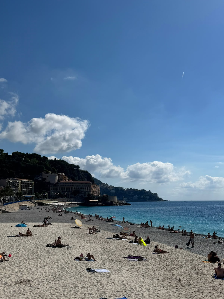
From the hill I continued along the waterfront, through the Promenade des Anglais and eventually towards the Port.
What initially looked like a straightforward coastal walk gradually became a lesson in how much of the city had been designed around movement, leisure and views. The promenades were not accidental spaces left between buildings and the sea. They were part of the urban model.
The same applies to gardens, terraces, broad boulevards and façades positioned to benefit from particular orientations. The Consiglio d’Ornato regulated parts of this expansion specifically to create an attractive and harmonious environment for residents and visitors.
Later, walking back inland, I began making small deviations whenever a building or street caught my attention.
Sometimes these choices were architectural. Sometimes they were much more practical. Nice was still hot, and I regularly changed direction simply because one side of a street offered more shade.
That seemingly trivial decision became unexpectedly useful.
The World Heritage description places considerable importance on vegetation, orientation and climate-conscious urban design. Parks, planted boulevards and private gardens were part of the image of a subtropical winter resort, but they also shaped the physical comfort of moving through the city.
The historical city designed to attract people through its climate is still experienced through climate today.
Reading cosmopolitanism in buildings
My second day became more architectural.
Rather than following one continuous route, I moved between buildings, gardens and districts associated with the development of Nice as a winter resort.
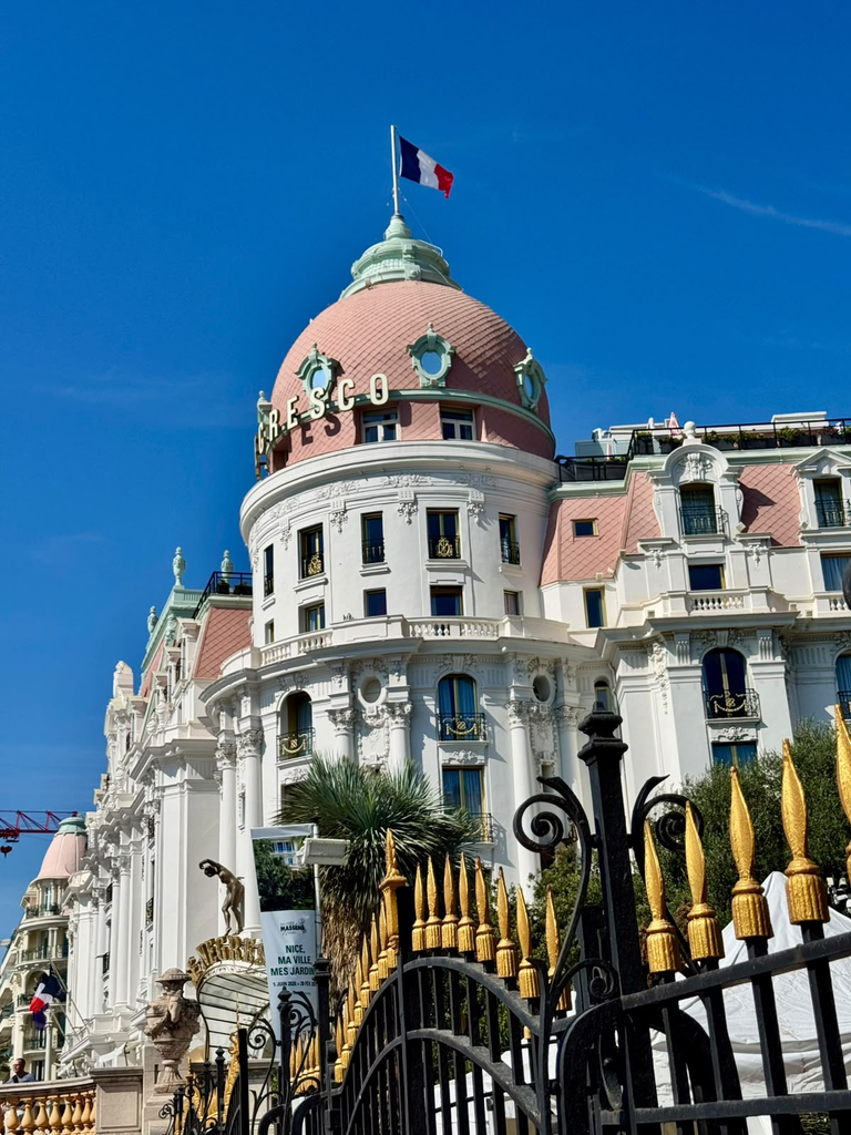
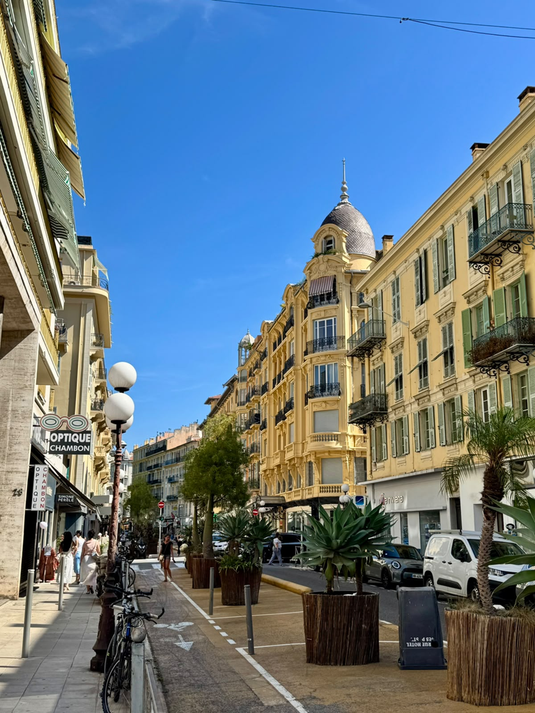
Places such as Hôtel Negresco, the façades and hotels along the Promenade des Anglais, the Masséna area, the Musiciens district, the gardens and villas around Cimiez, and later the architecture around Libération all reveal different stages of the city’s expansion.
The variety is striking.
Neoclassicism, historicism, eclecticism, Belle Époque architecture, regionalist influences and later Art Deco coexist within the World Heritage property. UNESCO explicitly connects this diversity to the international sponsors, architects and craftspeople who brought styles and techniques from elsewhere and adapted them to Nice.
This made the idea of “foreign influence” feel inadequate. These influences were not simply added on top of an otherwise fixed local identity, they participated in producing modern Nice.
The same is true of vegetation. Imported and acclimatised species became part of the image of the Riviera, helping create the exotic garden landscapes associated with winter residence.
Nice therefore raises an interesting heritage question. At what point does something introduced from elsewhere become local heritage?
Here, the answer seems to be: when generations of exchange become part of the city’s own development.
That is why describing Nice simply as “French”, “Italian” or “Mediterranean” always feels slightly incomplete. Its heritage rests partly on the fact that it became a meeting place between them.
Religion, migration and another layer of the city
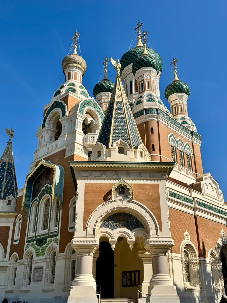
On my third day, I visited the Russian Orthodox Cathedral of Saint Nicholas.
Its scale and architecture are almost impossible to confuse with the surrounding city.
I arrived while a religious service was taking place, and the interior was filled with chanting.
That made the building feel very different from an architectural monument visited purely for its visual qualities.
The cathedral exists because Nice attracted a substantial Russian aristocratic presence during the winter-resort period. The city’s UNESCO interpretation specifically includes foreign places of worship among the urban functions created for international residents, and the Russian Cathedral lies within the inscribed area today.
But hearing the service made another point clearer.
Cultural influence is not necessarily something that belongs only to the past.
A building associated with historical migration can continue performing its religious function.
This is one of the more subtle dimensions of Nice’s heritage.
Hotels can remain hotels. Villas can remain residences. Churches can remain places of worship. Promenades can continue to be promenades.
UNESCO notes that many hotels, villas and apartment buildings within the property still retain their original or closely related functions. The continuity is therefore sometimes functional as well as physical.
That makes Nice quite different from places where preservation requires finding entirely new uses for historic structures.
Tourism as heritage, not simply pressure
Throughout the journey, tourism repeatedly appeared as a major urban force.
In Amsterdam it shaped commercial geography. In Bruges it concentrated particular functions. In Brussels it influenced the relationship between the historic centre and local everyday use. Nice complicated that discussion. Here, infrastructure created for visitors is itself one of the reasons the city is World Heritage.
The hotels, promenades, gardens, villas and leisure landscapes associated with tourism are not simply contemporary pressures acting on an older heritage city, they are part of the heritage.
This does not make current tourism neutral or remove contemporary housing and affordability questions. It simply means the historical relationship is different.
Nice grew partly because outsiders came to stay.
Its nineteenth- and early twentieth-century urban development was profoundly shaped by the infrastructure necessary to host them.
Preserving that history therefore also means preserving evidence of a city designed around hospitality, leisure, climate and international mobility.
This makes the usual opposition between “tourists” and “locals” much less useful. The visitor has been part of the urban story for centuries.
The more interesting question becomes how a city historically shaped by temporary residents continues functioning for permanent ones.
Who can occupy the Riviera?
That question became noticeable during my own stay.
Accommodation in central Nice was expensive enough that I stayed outside the city and travelled in each day.
I was therefore reproducing, on a tiny and temporary scale, a wider spatial relationship: the centre was where much of the activity and heritage I wanted to access was concentrated, but my everyday base was elsewhere.
I would be cautious about interpreting too much from my own travel budget. But the experience highlighted something spatially important.
Where people can afford to stay or live changes how they use the city.
A person living in central Nice has a different relationship with the Promenade, historic centre and public spaces from someone travelling into the city each day from elsewhere in the metropolitan area.
The city then becomes larger than its administrative or World Heritage boundaries through daily movement.
Nice also has a visibly luxurious side. Historic hotels, grand façades, waterfront properties and particular shopping or residential areas retain an atmosphere strongly associated with wealth. That is not incidental to the World Heritage history either.
The winter resort initially developed around aristocratic and upper-class visitors before broadening over time. The transformation from exclusive winter resort to larger tourist destination happened progressively, with seaside and summer tourism becoming increasingly important from the interwar period onwards.
This continuity between historic prestige and contemporary desirability is fascinating, but it would require much more data before drawing conclusions about who benefits from it today.
Housing prices, employment, tourism accommodation, commuting patterns and resident perspectives would all be necessary.
Again, walking revealed the question more readily than the answer.
A heritage city made from movement
This was perhaps the idea that stayed with me most. The World Heritage value of Nice is closely related to people arriving. British winter residents helped shape the Promenade. Russian communities left religious and architectural heritage. Italian and French political histories influenced planning and identity. Architects, craftspeople and investors brought styles from different parts of Europe. Rail connections dramatically expanded who could reach the city.
Different generations of visitors gradually transformed a winter resort into the Riviera destination recognised today. Movement is therefore not external to Nice’s heritage.
It is one of its historical engines.
This also explains why the World Heritage property is so spatially diverse.
It extends across the old town, coastline, planned central districts, hills, gardens and individual buildings whose relationship is not always obvious when encountered separately.
The common thread is not a single architectural style. It is the urban landscape created through cosmopolitan winter residence.
That distinction made Nice one of the most conceptually interesting stops of the journey.
What Nice left me with
Nice was the final city of Beyond the Postcard, and it challenged one of the assumptions that had quietly followed me through much of the trip.
I had often looked at heritage cities through tensions between local life and visitor pressure.
Nice showed why that relationship cannot be treated as universal.
Here, attracting outsiders was itself one of the forces that created the heritage landscape.
The Promenade des Anglais, international hotels, foreign churches, exotic gardens and eclectic residential architecture all document a city that developed through cultural exchange.
That does not mean contemporary tourism is automatically beneficial. It means its relationship with heritage must be understood historically before being evaluated spatially or socially.
Nice also brought the idea of multiple cities into a slightly different perspective. The different landscapes I encountered were not only residential, tourist or commercial. They were also cultural layers.
A Mediterranean city. A former Sardinian city. A French city. A British winter resort landscape. A Russian religious landscape. A Belle Époque city. A contemporary coastal metropolis. None completely replaces the others. They accumulate.
Perhaps that is why Nice sometimes feels less like a single historical narrative than a collage whose pieces gradually became inseparable.
Julie had helped me understand this at the beginning of the visit, and by the end it was visible almost everywhere: in gardens, façades, religious buildings, promenades, hotel architecture and the relationship between city, hills and sea.
For Beyond the Postcard, Nice became a final reminder that a living World Heritage City does not necessarily preserve one stable identity.
Sometimes its heritage lies precisely in the ability of different people, influences and ways of inhabiting a place to accumulate until they become part of the identity of the city itself.
Bern was perhaps the city where the relationship between heritage and landscape felt most immediate.
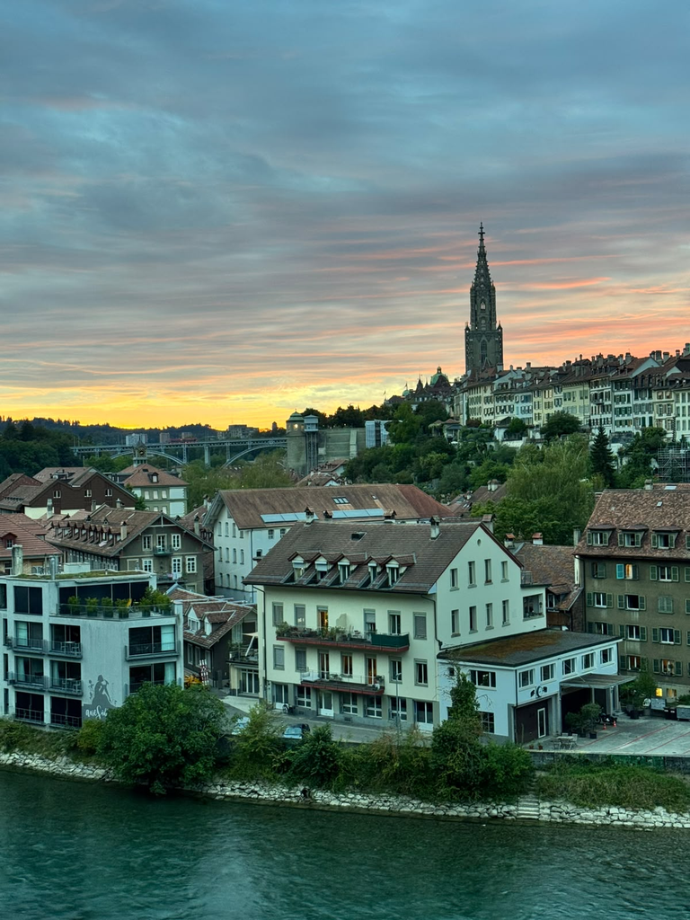
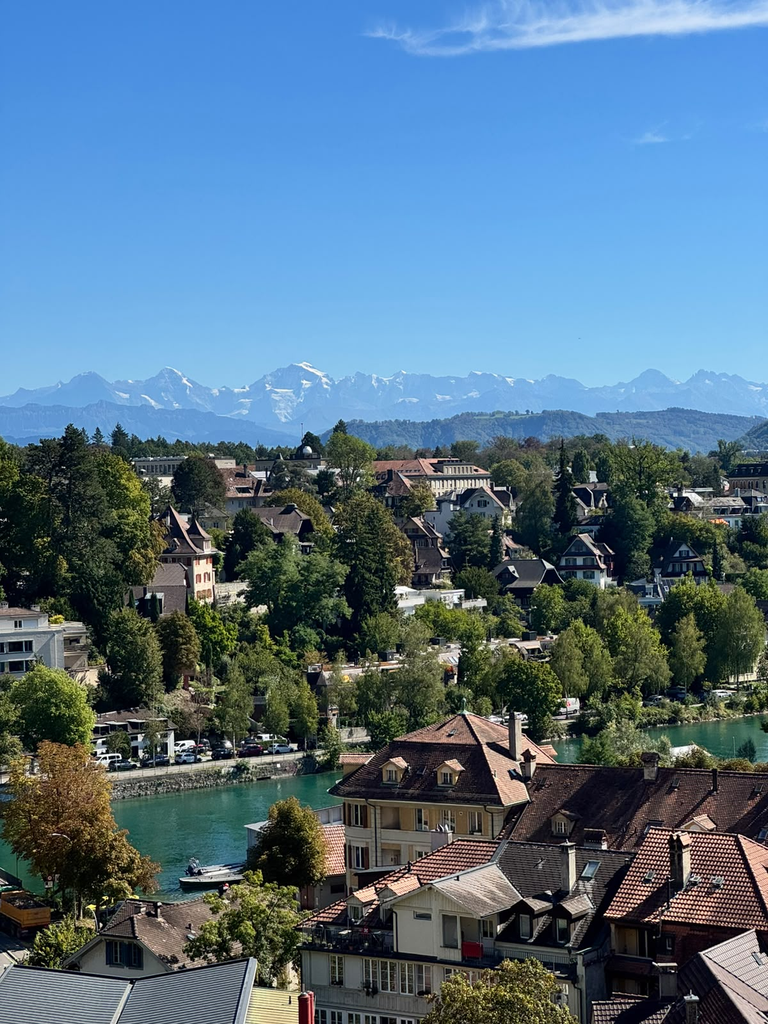
I arrived in the late afternoon and, rather than heading directly into the Old City, followed the Aare towards it. The river bends tightly around the historic peninsula, and that geography becomes part of the city almost immediately. The slopes, bridges and views towards the Alps give Bern a sense of being enclosed by nature without ever feeling isolated from it.
My first route took me past the Bear Park and towards the historic centre. I did not actually see any bears that day, but the place still worked as a kind of introduction to the city: the river below, the old town rising ahead and the hills beyond.
I spent that first evening walking without much structure. What caught my attention was not only how well preserved the centre seemed, but how consistently nature remained present around it. In Bern, heritage does not sit in front of the landscape. It is embedded in it.
What exactly is World Heritage here?
The Old City of Berne was inscribed on the UNESCO World Heritage List in 1983.
The property covers the historic city that developed on the peninsula enclosed by the Aare. Bern was founded in the twelfth century and expanded gradually from east to west according to a remarkably coherent urban plan. UNESCO highlights its wide market streets, narrow and deep plots, water infrastructure, arcades, fountains and the extraordinary continuity of the medieval urban structure.
The city was not preserved by remaining physically unchanged. Quite the opposite.
After a major fire in 1405, much of the wooden city was rebuilt in stone, and sandstone subsequently became one of the defining materials of Bern’s architecture. The arcades that today stretch for kilometres through the Old City also developed through this process of reconstruction and adaptation.
Later centuries brought fountains, patrician houses, monumental public buildings and further transformation. UNESCO’s significance statement is therefore particularly interesting: Bern is valued as an example of a city that continuously renewed its built fabric while respecting its original urban structure.
That made Bern highly relevant to one of the questions already emerging through Beyond the Postcard.
Preservation does not necessarily mean resistance to change. It can also mean maintaining a spatial structure capable of absorbing change over a very long period.
Looking at the city from outside
On my second day, I did something that initially had little to do with the World Heritage itinerary. I walked out of Bern towards the Bantiger.
The route took several hours and the transition out of the city was surprisingly quick. Buildings gradually gave way to smaller settlements, fields, livestock and open landscape.
What interested me was that the rural environment did not feel empty. Children were coming and going from school. Cars and bicycles moved through the roads. Farms, fields and houses appeared as part of an inhabited landscape rather than a clear “outside” to the city.
The distinction between urban and rural seemed much less abrupt socially than it initially appeared physically.
I had intended to reach the tower at the top, only to discover that the structure was a communications tower and that military personnel were present. At a certain point I was politely informed that I could go no farther.
Not quite the panoramic ending I had imagined, but by then the walk had already done something more useful: it had allowed me to see Bern from a distance for the first time.
The compactness of the city became much clearer against the surrounding landscape.
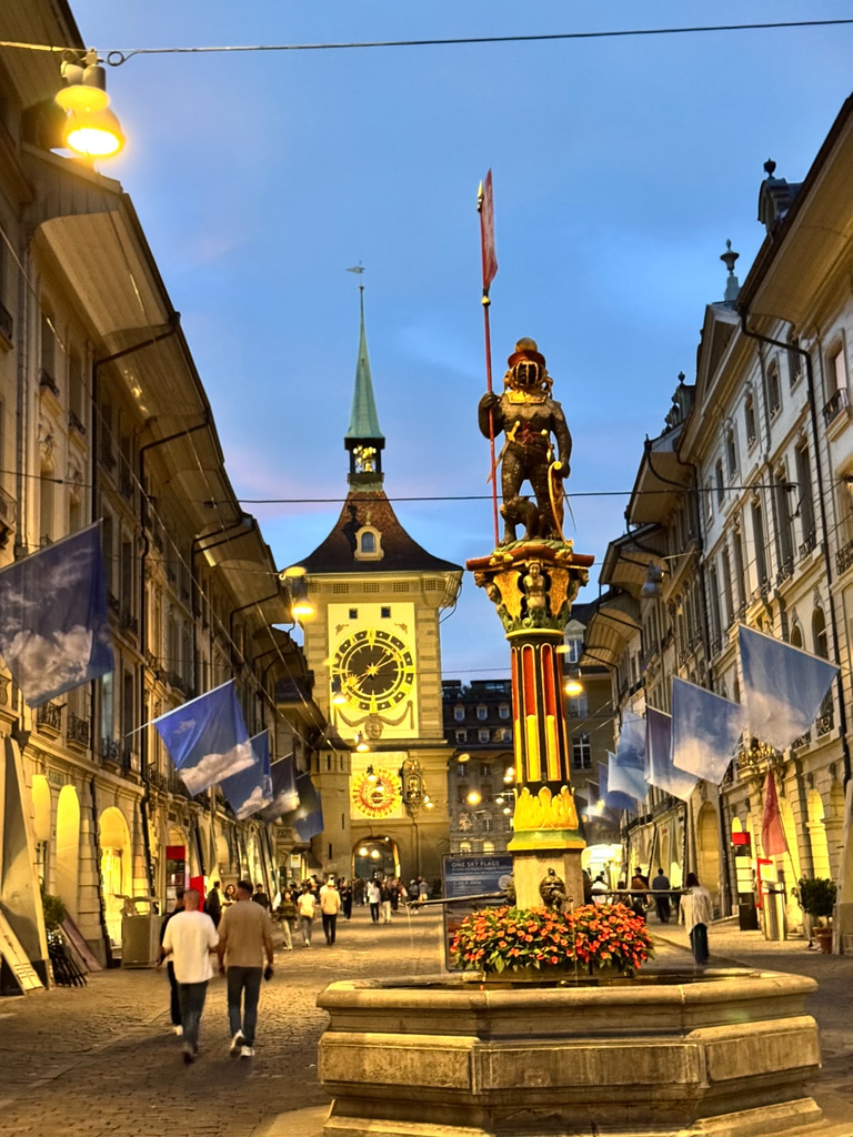
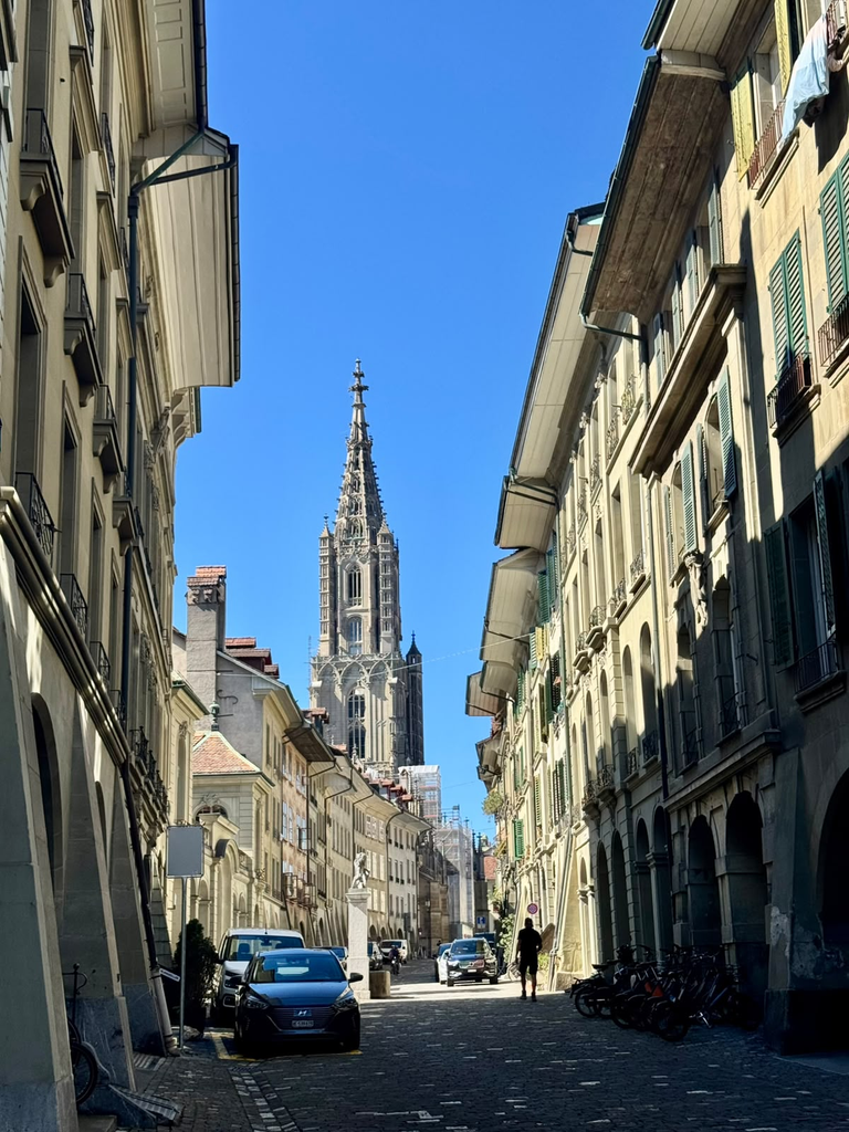
Later, when I returned to the centre, I revisited the main historic spaces: the Zytglogge, Kramgasse and Marktgasse, the fountains, Bundesplatz and the Parliament, Bern Minster and the Münsterplattform, before continuing through the lower parts of the Old City towards the river.
These are not simply isolated attractions. They reveal the logic of Bern’s urban plan.
The long streets remain strongly legible, the arcades connect commercial and public life across much of the centre, and the fountains punctuate routes that have remained active for centuries. Bern’s official tourism documentation notes around six kilometres of arcades, while the historic fountains were once important everyday meeting and water-supply points and remain part of the identity of the city today.
What impressed me most was how little the historic environment felt like a self-contained tourist district.
The streets remain strongly commercial. People commute through them, shop, stop at cafés and move between institutional and residential areas. UNESCO itself describes Bern today as maintaining a “very dynamic and contemporary urban activity” within the historic property.
This does not mean every function is evenly distributed, but the basic urban structure still supports a remarkable degree of everyday use.
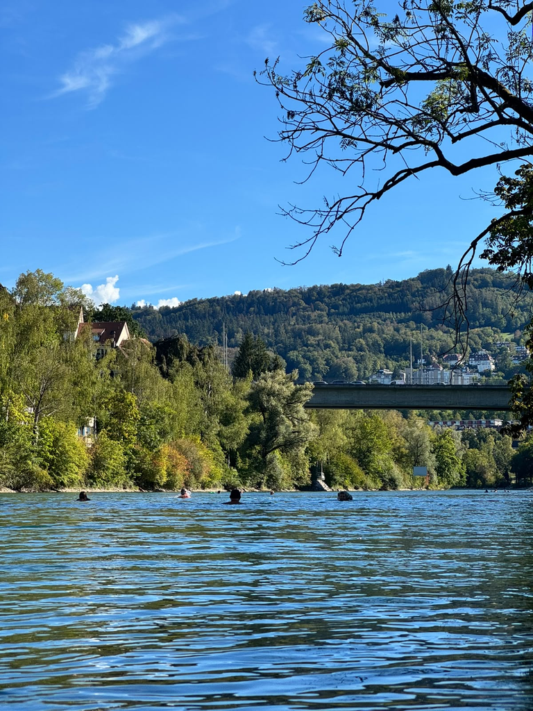
At the end of the day, I followed the Aare again and eventually did what appears to be a very Bernese thing to do: I went into the river.
The water was cold enough to make the decision feel questionable for a few seconds and entirely worth it afterwards.
The river as everyday infrastructure
Swimming in the Aare made me look differently at something that had so far appeared primarily as landscape.
The river defines the morphology of the Old City, but it is also actively used.
Bern’s own visitor information describes swimming in the Aare, walking under the arcades and looking towards the mountains as ordinary parts of local leisure culture. This is an important distinction: the river is not simply a natural feature that improves the heritage view, it structures routes, creates slopes and boundaries, shapes public space and becomes part of daily recreation.
In other words, the landscape that helps explain why medieval Bern developed where it did continues to influence how contemporary Bern is lived.
This relationship between heritage and landscape became even clearer on my third day.
I went up the Gurten, Bern’s local mountain, using the funicular.
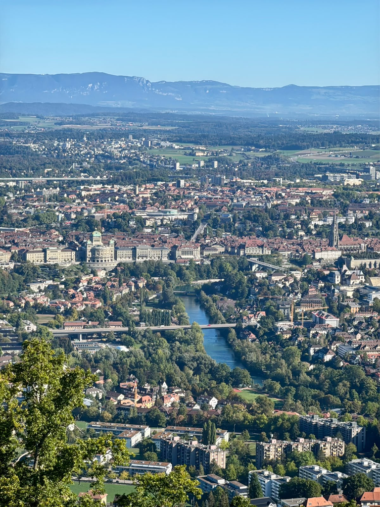
At 858 metres, the Gurten provides a wide view across the city, the Aare and towards the Bernese Alps. It is also very much an everyday leisure landscape, used for walking, families, events and outdoor activities rather than simply functioning as a viewpoint for tourists.
From above, Bern looks almost unusually compact.
The peninsula of the Old City becomes obvious. The river can be traced around it, and beyond the built-up area the landscape opens rapidly towards fields, hills and mountains.
This gave me a much clearer sense of why landscape matters so much to the character of the city.
The heritage property may be urban, but its experience depends strongly on what surrounds it.
Views towards the Alps, the green slopes of the Aare valley and the hills around Bern create a larger spatial setting that cannot be reduced to the World Heritage polygon.
A city designed to keep changing
Back in the Old City, I spent more time looking at the elements that make Bern immediately recognisable.
The Zytglogge remains one of the strongest points of orientation. The arcades turn entire streets into sheltered pedestrian environments. The sixteenth-century fountains add colour and smaller points of identity to an otherwise very coherent sandstone cityscape. Bern Minster anchors the skyline and the Münsterplattform opens the dense historic fabric towards the river valley.
There are also smaller passages, cellars, courtyards and changes in level that are easy to miss when moving only between the principal landmarks.
This was where one limitation of my experience became noticeable.
Bern’s physical heritage is exceptionally legible, but I sometimes felt I understood the city more through its form than through interpretation provided in the streets themselves.
The preservation is immediately visible. The reasons behind particular spaces, buildings or transformations are not always equally obvious without already knowing what to look for.
That does not mean interpretive material is absent. Bern offers guided tours and digital interpretation, including routes specifically focused on the UNESCO Old City.
My impression was simply that the urban fabric itself often speaks more strongly than explanatory infrastructure in public space.
For Beyond the Postcard, this raised an interesting question. A place can be extremely well preserved and heavily used while still containing histories that remain less visible to someone encountering it independently. Participation and interpretation are not the same thing, but both concern how people connect meaning to place. What residents recognise intuitively through familiarity may require another form of translation for outsiders.
Who gets to experience the centre?
There was another aspect of Bern that I could observe but not fully investigate: prices, food, accommodation and everyday consumption felt significantly more expensive than in most of the cities I had visited before.
For me as a traveller, this immediately affected how I used the city: where I ate, how long I stayed in particular places and what activities seemed accessible.
But I did not speak with enough local residents to understand how far my experience as a visitor reflected everyday realities for people living in Bern. So I would not turn that impression into a conclusion about accessibility or exclusion.
It did, however, raise a useful question about habitability and heritage.
A historic centre can be physically public and beautifully maintained while the economic conditions of using it vary greatly between people.
Who can live nearby? Who can spend time there without thinking constantly about cost? Which activities remain accessible across different incomes?
These questions would require housing, income, commercial and demographic data, alongside local perspectives, before anything meaningful could be concluded.
Again, walking identified a question rather than answering it.
That distinction has become increasingly important throughout the project.
Seeing Bern twice
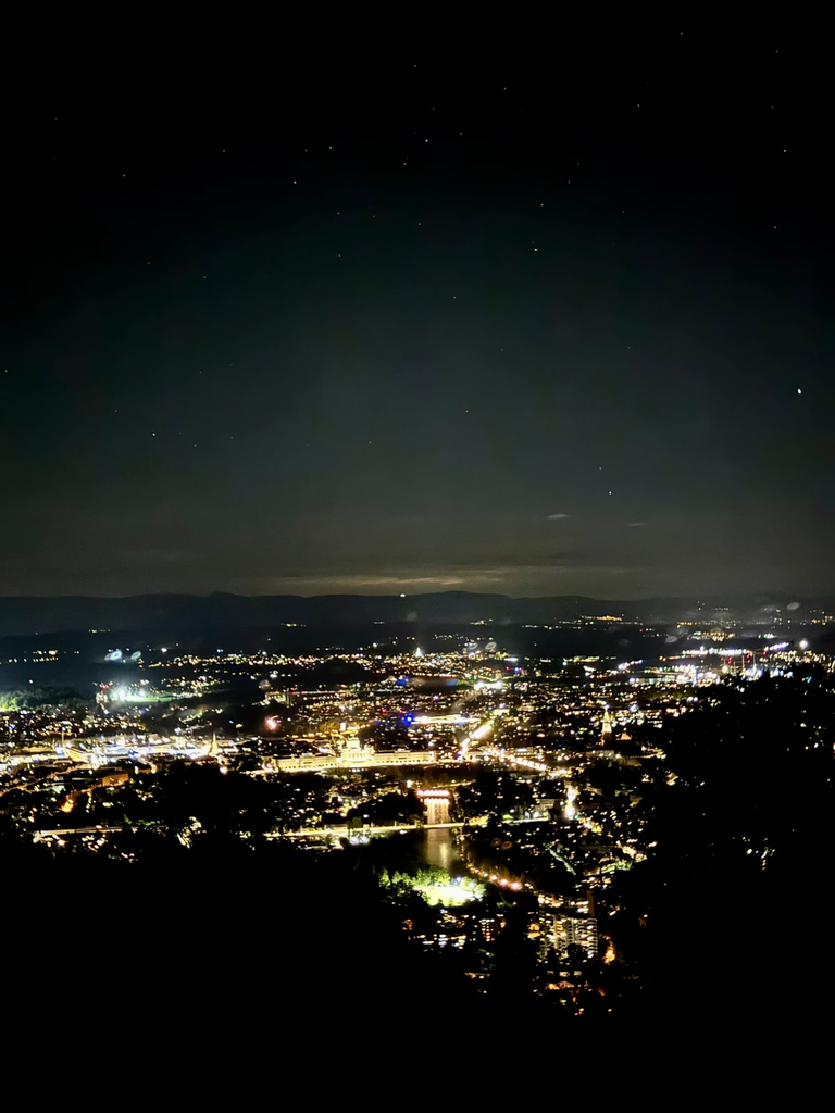
That evening I returned to the Gurten.
The reason this time was not heritage at all. I wanted to see the stars and look at Bern from above at night.
It ended up being one of the most useful ways to finish the city.
During the day, the city can be read through buildings, streets, monuments and people.
At night, much of that detail disappears.
What remains is the larger geography: a compact concentration of light, surrounded by darkness, hills and the wider landscape.
The Old City becomes harder to distinguish as individual heritage objects but easier to understand as part of a territory.
That shift in scale was important.
World Heritage management necessarily works with boundaries, buildings, regulations and particular attributes of Outstanding Universal Value. But the experience of a heritage city rarely remains inside those categories.
The Aare, Gurten, surrounding countryside and distant Alps are not simply background scenery to Bern.
They help organise how the city is perceived, reached and used.
What Bern left me with
Bern added another layer to the journey.
Amsterdam had emphasised overlapping urban functions. Bruges raised questions about continuity of use. Brussels showed how several centres can coexist inside one capital. Luxembourg made participation and different lived geographies much more explicit. Strasbourg highlighted connections across historical and political boundaries.
Bern made me think about the relationship between the heritage city and its wider landscape.
Its World Heritage value rests strongly on the remarkable continuity of the medieval urban plan. But that plan itself was created in response to geography: a hill enclosed by the Aare.
Eight centuries later, that geography still matters.
The river remains an everyday recreational space. The slopes and bridges shape mobility. The surrounding hills provide immediate access to landscapes that feel rural while remaining closely connected to the city. The Alps remain visually present enough to become part of the identity of urban space.
At the same time, Bern demonstrates something important about preservation.
Its historical character did not survive because the city stopped changing. UNESCO specifically recognises the repeated renewal of its buildings while retaining the fundamental urban structure.
That makes the Old City less an example of a preserved historical moment than of long-term adaptation within a durable spatial framework.
For Beyond the Postcard, perhaps that is Bern’s most useful contribution.
Habitability is not only about what happens inside buildings or how streets are commercially used. It is also about the relationship between a city and the landscapes, resources and everyday practices around it.
Walking from medieval streets into the river, from the city into farmland, and finally looking back towards Bern from the surrounding heights made that relationship difficult to ignore.
The city remained recognisable every time. But from each position, it was a slightly different Bern.
Strasbourg felt different from the cities that came before it.
In Amsterdam and Bruges, water had been central to the way I understood the historic city. Brussels had made me think about fragmentation and multiple urban centres. Strasbourg seemed to bring several of these ideas together, but with another layer that became increasingly difficult to ignore: the city is defined by connections across periods, landscapes and borders.
I arrived knowing Strasbourg primarily through its cathedral, its European institutions and its position next to Germany. Walking through it made those elements feel much less separate than they appeared on a map.
The medieval streets of the Grande-Île, nineteenth-century avenues of the Neustadt, canals, parks, European institutions and the Rhine all belong to different chapters of the city, yet they remain surprisingly close to one another.
That became the thread of my three days there: following the city from its historic centre outward, watching one Strasbourg gradually become another without ever completely leaving the previous one behind.
What exactly is World Heritage here?
The UNESCO property is Strasbourg, Grande-Île and Neustadt.
The Grande-Île, the historic island at the centre of the city, was first inscribed on the World Heritage List in 1988. In 2017, the property was extended to include significant parts of the Neustadt, the large urban expansion developed while Strasbourg was under German administration between 1871 and 1918. Today, the property covers 183 hectares, with a much larger buffer zone around it.
That extension is especially important because it changes how the heritage of Strasbourg is understood.
The World Heritage value does not lie only in a medieval centre dominated by an exceptional Gothic cathedral. UNESCO describes the Grande-Île and Neustadt together as an urban ensemble shaped by the interaction of French and Germanic influences over several centuries. Medieval and Renaissance architecture, French eighteenth-century classicism and the monumental urbanism of the German imperial period coexist within the same city.
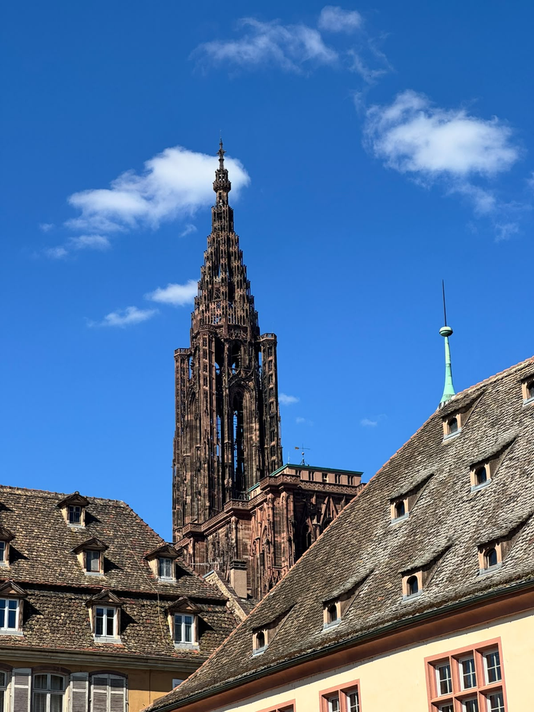
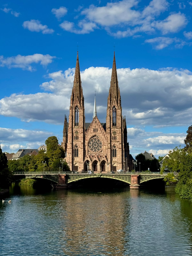
The cathedral remains the major visual reference point. Its spire repeatedly reappeared during my walks, sometimes from surprisingly far away. But Strasbourg’s heritage is also about the city that accumulated around it.
That made the property particularly relevant to Beyond the Postcard. Here, historical layering is not something hidden beneath the present city. In many places, it determines the urban structure itself.
Learning the city through its history
I spent much of my first full day around the Grande-Île, moving through places such as Place Kléber, Place Gutenberg, the Cathedral district, Palais Rohan, the canals around Petite France, the Ponts Couverts and Barrage Vauban.
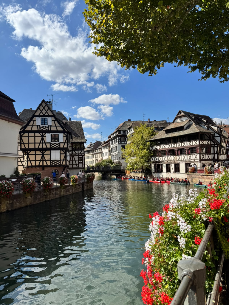
These are the places through which most visitors first encounter Strasbourg, but walking between them also makes clear how strongly the city is organised around water.
The Grande-Île is literally surrounded by branches of the Ill, while canals and quays repeatedly open and close views through the historic centre. The cathedral appears at the end of narrow streets, disappears behind buildings and then returns again from bridges and squares.
One of the most useful stops was the Musée Historique de la Ville de Strasbourg.
The museum follows around nine centuries of the city’s history, from the medieval period through successive political changes and eventually to the establishment of European institutions. Its central object is an enormous relief model of Strasbourg from 1727, commissioned during the reign of Louis XV.
Seeing the city in miniature was particularly interesting after walking through it.
Streets I had just crossed became part of a wider defensive and urban system. Strasbourg’s position between different political worlds, which can sound abstract when described historically, became much more spatially understandable.
The museum also helped make sense of something that would become central during the rest of my stay: Strasbourg has repeatedly changed political context without completely erasing the city that came before.
It has been a free city within the Holy Roman Empire, incorporated into France, transformed under German rule after 1871, returned to France and later developed into one of Europe’s principal institutional centres.
The result is not a city divided neatly into historical periods. They remain physically mixed.
From the Grande-Île to the Neustadt
The transition from the Grande-Île towards the Neustadt is one of the most interesting walks in Strasbourg.
Around Place de la République, the scale changes.
The narrow medieval fabric gives way to broader avenues, monumental public buildings, gardens and long perspectives. This was part of an ambitious expansion developed after Strasbourg became part of the German Empire in 1871. The Neustadt was conceived as a modern administrative and residential city, influenced partly by Haussmannian planning but expressed through a distinctly German architectural language.
Walking from one to the other makes the logic of the UNESCO extension very convincing.
They are different Strasbourgs, but not isolated ones.
The medieval centre and the nineteenth-century city form a continuous landscape in which the cathedral still acts as a visual anchor. UNESCO explicitly identifies this relationship between Grande-Île and Neustadt, together with the city’s waterways, as part of what gives Strasbourg its particular urban character.
For my project, this raised a slightly different question from the previous cities: what does continuity mean when heritage includes change itself?
Strasbourg’s value depends partly on the fact that new political regimes did not simply reproduce what already existed. They introduced new architectural languages, new institutions and new ways of organising the city.
Preservation here therefore cannot mean fixing Strasbourg at one preferred historical moment.
It requires recognising how multiple histories remain legible at once.
This became visible even through relatively ordinary details. The monumental Notre-Dame Cathedral was continuously filled with visitors, while another historic church I entered, Saint-Pierre, was almost empty.
Two religious buildings can belong to the same historical city while occupying completely different places in its contemporary mental and visitor geography.
The difference was not architectural importance alone. It was also about visibility, narrative and how people move through the city.
A European city beyond the historic centre
By my third day, I deliberately moved farther away from the most obvious heritage landscape.
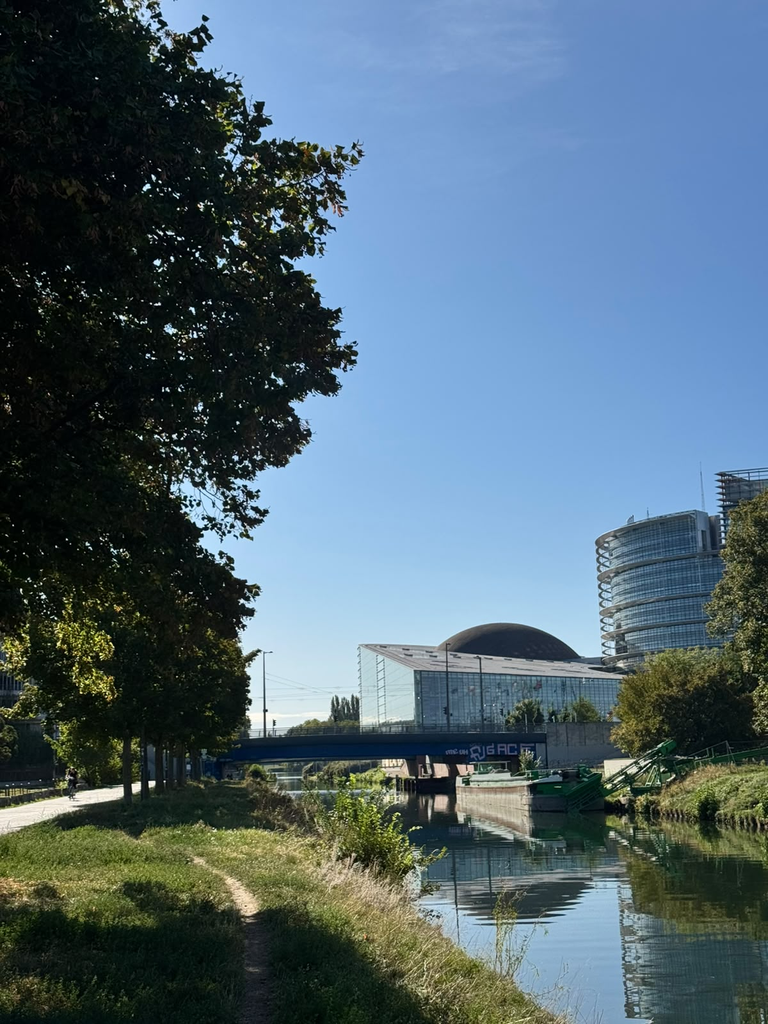
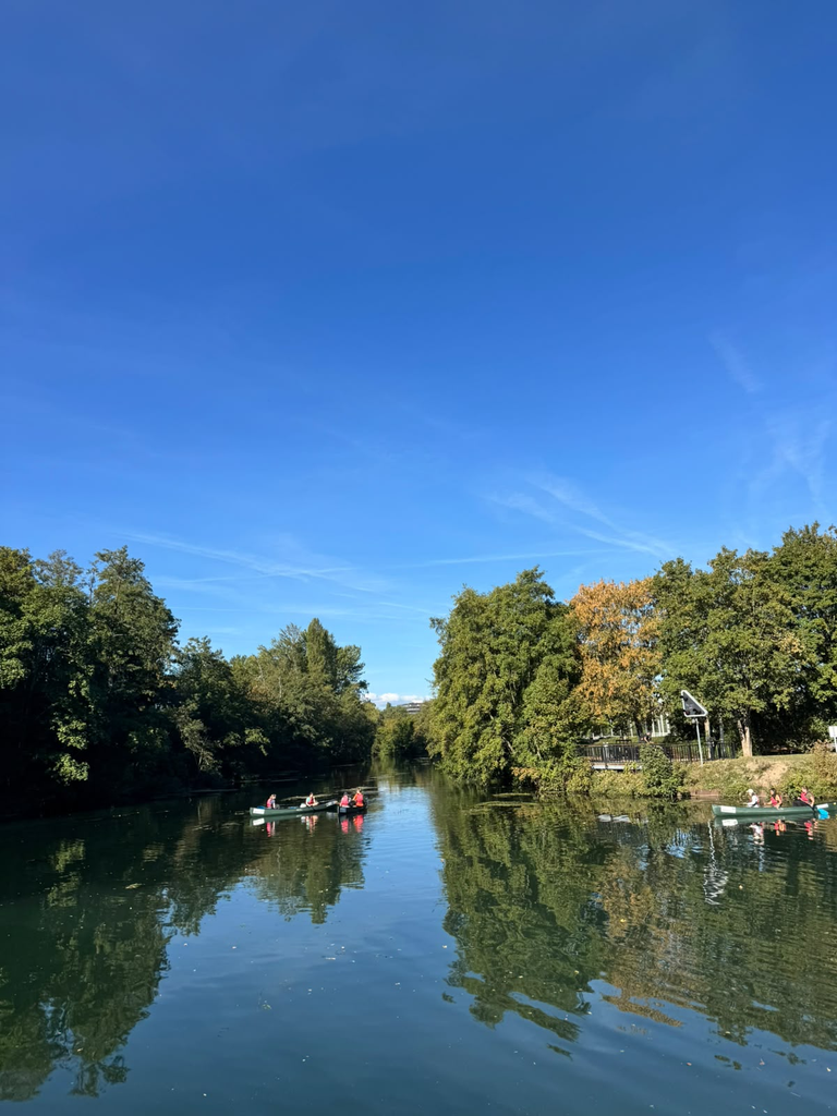
Following the Canal de la Marne au Rhin, the urban scenery gradually changed until the large contemporary buildings of Strasbourg’s European district began dominating the horizon.
The European Parliament is difficult to miss. Nearby, the Council of Europe and the European Court of Human Rights reinforce the impression of a city whose international role has become physically embedded in its landscape.
This part of Strasbourg initially looks disconnected from the cathedral and historic streets.
Architecturally, it largely is.
But historically the relationship is more interesting.
A city repeatedly positioned between France and Germany eventually became one of the symbolic centres of European cooperation. Strasbourg today hosts the European Parliament as well as major Council of Europe institutions. UNESCO itself notes the city’s contemporary role as one of Europe’s institutional capitals alongside Brussels and Luxembourg.
That does not mean there is a simple historical progression from conflict to European unity, but the spatial sequence is striking.
In a relatively short walk, it is possible to move from medieval religious architecture to German imperial urbanism and then to institutions created within twentieth-century European political structures.
Once again, several versions of the city exist almost side by side.
Green space as part of the city
From the European district I continued towards the Parc de l’Orangerie.
After several days focused strongly on buildings, heritage boundaries and dense historic streets, the amount of green space in Strasbourg became increasingly noticeable.
The park did not feel like an attraction that needed interpretation. People were walking, running, sitting, moving with children and simply spending time there. That ordinary use mattered.
World Heritage discussions easily become centred on exceptional places. Habitability is often much more visible in spaces whose value comes precisely from being ordinary enough to use without thinking about them.
This relationship between heritage and environmental quality is not separate from current heritage management either. UNESCO has documented Strasbourg’s work to incorporate natural values, vegetation and microclimate into the management of the Grande-Île and Neustadt, explicitly linking these questions to the city’s liveability.
That is useful because it widens the meaning of conservation.
Protecting a historic urban landscape is not only about façades and monuments. Trees, waterways, shade, mobility and public space influence how that landscape can actually be inhabited.
Strasbourg made that connection particularly visible because water and greenery repeatedly provide continuity between very different parts of the city.
Walking until France became Germany
I continued east until Parc des Deux Rives.
This was one of the places I most wanted to experience because here the idea of connection becomes almost literal.
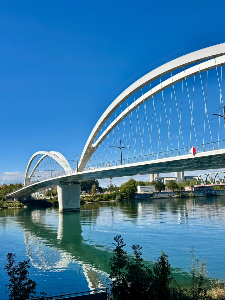
The park occupies both banks of the Rhine, one in Strasbourg and the other in the German city of Kehl. Between them is the pedestrian and cycling Passerelle Mimram, created as part of the cross-border garden and conceived explicitly as a symbol of cooperation between the two sides.
There was no dramatic transition: a river, a bridge, people walking and cycling, and suddenly I was in Germany.
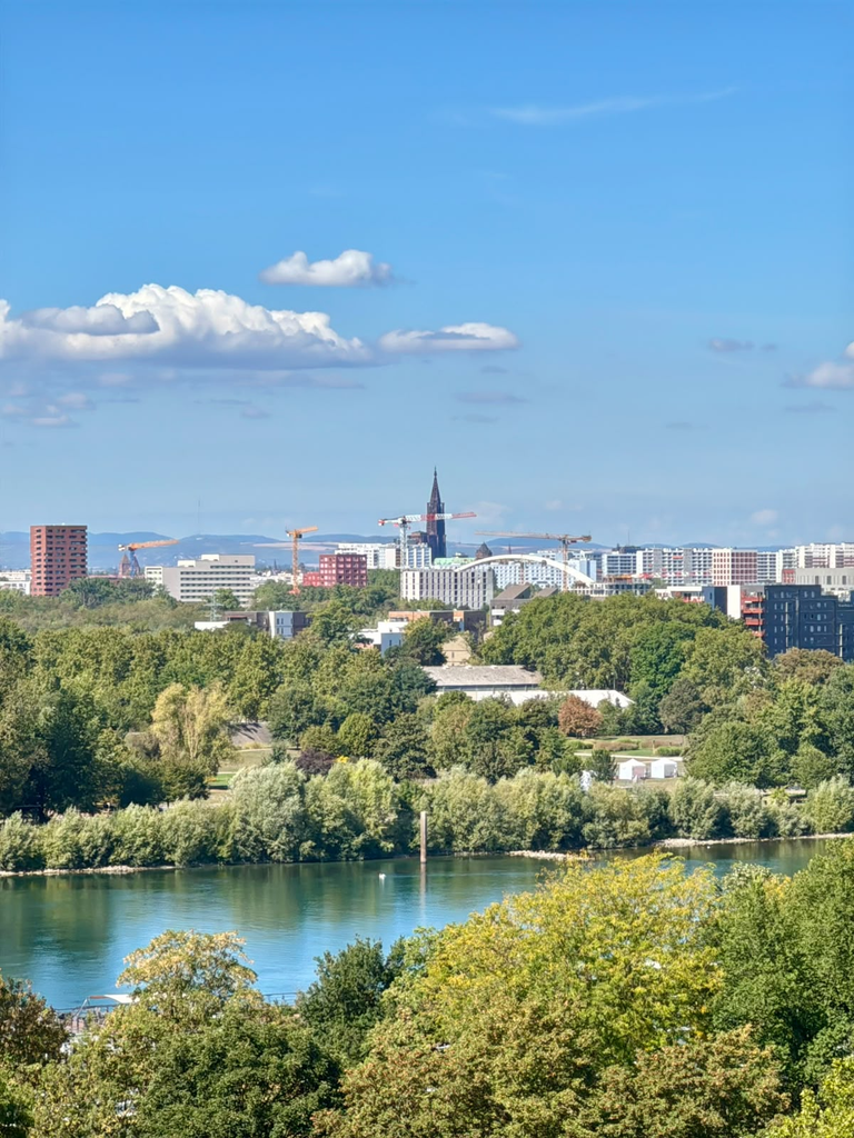
I wandered through Kehl and eventually climbed a viewing tower in one of its parks. From there Strasbourg appeared again in the distance.
What surprised me was how recognisable the cathedral remained.
After spending the day moving through contemporary institutions, canals, parks and another country, the same medieval spire still anchored the city visually from across the Rhine.
It was probably the clearest single image of Strasbourg I took away from the trip.
The border exists politically. Historically it has mattered enormously. Spatially, however, contemporary everyday life can cross it almost casually.
This is not merely symbolic. Strasbourg and Kehl are connected through public transport, pedestrian and cycling infrastructure and a wider cross-border metropolitan reality. A heritage city therefore does not necessarily become less itself by becoming more connected beyond its boundaries.
In Strasbourg, connection seems to be part of the identity.
Continuity without sameness
I returned towards Strasbourg through a very different landscape from the one in which the day had begun.
The European district, Orangerie, Rhine and Kehl had pushed the World Heritage property physically into the background, but they had not made the questions of the project less relevant.
If anything, they made the limitation of looking only inside the UNESCO boundary clearer.
A formal heritage polygon tells us where particular Outstanding Universal Value has been recognised. It cannot by itself describe all the systems that make that place function.
Residents may work outside it. Visitors arrive through infrastructure beyond it. Parks outside the property contribute to quality of life within the city. Political institutions elsewhere shape Strasbourg’s identity internationally. And daily movement extends across a national border.
For a spatial approach, heritage therefore becomes part of a broader network rather than an isolated area. This also affects participation.
The people with an interest in the historic city are not necessarily limited to those living directly inside the UNESCO property. Someone living in the Neustadt, commuting through the centre, studying nearby, crossing daily from Kehl or simply using the parks and public spaces can develop a very different relationship with Strasbourg.
Understanding a living heritage city therefore involves asking not only what is located inside a protected area, but which relationships connect people to it.
That distinction is becoming increasingly important to Beyond the Postcard.
What Strasbourg left me with
Amsterdam had made me think about overlapping urban functions. Bruges brought the question of functional continuity. Brussels emphasised connections between different centres. Luxembourg pushed the project towards participation and the possibility of mapping different lived experiences.
Strasbourg added something else: continuity does not require sameness.
The Grande-Île and Neustadt were created under different political systems and according to very different urban principles, yet today UNESCO recognises them together.
The European district introduces another architectural and political language.
The Rhine is simultaneously a geographical division and a space of connection.
Historic streets, canals, tramways, parks, international institutions and cross-border movement all contribute to a city whose identity seems to have been constructed through repeated encounters with what lies beyond itself.
That perhaps explains why Strasbourg felt surprisingly coherent despite containing so many distinct layers.
The coherence does not come from everything looking the same, it comes from the relationships between them.
Walking from the cathedral to the German border made that visible in a way a list of monuments probably never could. The city gradually shifted from medieval streets to monumental nineteenth-century avenues, contemporary European institutions, large parks and eventually another country, while certain elements — water, movement, landscape and the distant cathedral — continued linking those experiences together.
For Beyond the Postcard, Strasbourg became a reminder that a World Heritage City is not only defined by the landscapes it preserves.
It can also be understood through the connections that allow different landscapes, histories and communities to remain part of the same city.
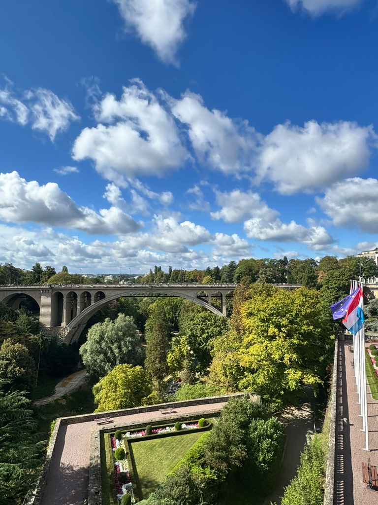
Luxembourg was the only stop on this journey that did not feel entirely like an arrival.
I had lived and worked there before, knew parts of the city well and already had friends and professional connections. That changed the project immediately. In Amsterdam, Bruges and Brussels I was largely trying to understand a city in a few days. In Luxembourg I could return to places I already knew, but with a different question in mind and, thanks especially to Shaaf Milani-Nia and the people she connected me with, with much greater access to those who interpret, manage, research and make decisions about the city.
That made Luxembourg less of a first impression and more of a conversation.
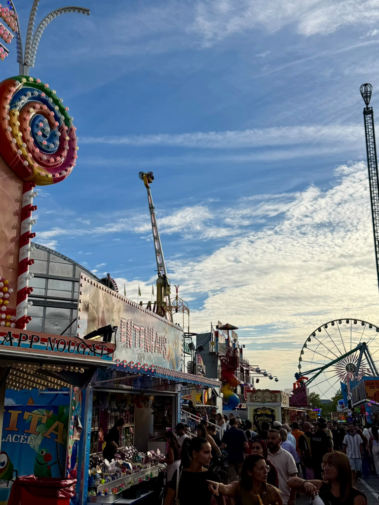
My first evening, however, started somewhere much less formal: the Schueberfouer.
I knew the fair existed, but I had underestimated it completely. The whole Champ du Glacis had become an enormous landscape of rides, food stalls, lights, music and people. What seemed at first almost unrelated to the World Heritage project quickly became a useful introduction to another side of heritage.
The Schueberfouer was founded in 1340 by John the Blind as an annual market. It first took place around the Plateau du Saint-Esprit, later moved towards Limpertsberg and eventually settled at the Glacis in 1893. Over centuries it evolved from a commercial and cattle market into the large funfair it is today, while remaining deeply embedded in local collective life. In 2026, 214 fairground establishments occupied the site.
It was an unexpectedly appropriate beginning. Heritage in Luxembourg was going to be much easier to understand if I stopped thinking only about what was built.
A fortress that became a city
The UNESCO property is officially called City of Luxembourg: its Old Quarters and Fortifications. It was inscribed on the World Heritage List in 1994 and covers 29.94 hectares, surrounded by a 108.73-hectare buffer zone.
Its geography explains much of its history.
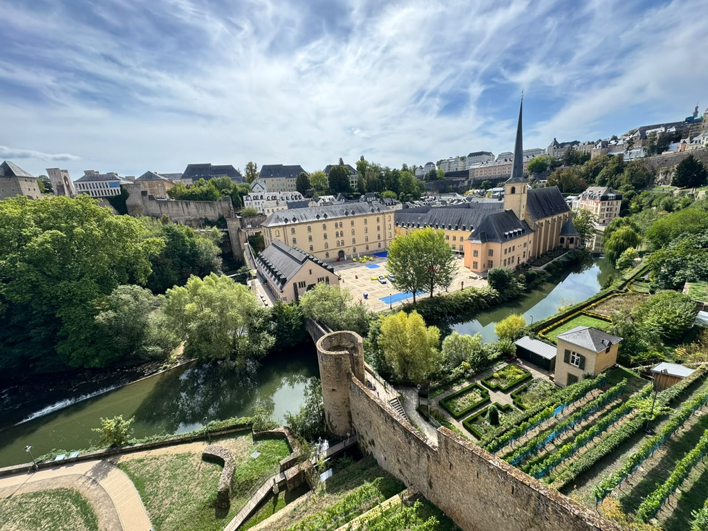
Luxembourg developed around the Bock promontory, a steep rocky outcrop above the Alzette valley. Count Siegfried acquired the site in 963 and established a castle there, while settlements developed both above and below the cliffs. Over the following centuries, Luxembourg’s strategic position made it one of Europe’s most important fortified cities. Burgundian, Spanish, French, Austrian and Prussian powers successively modified and reinforced its defences before much of the fortress was dismantled after the Treaty of London in 1867.
What remains is not simply one wall or one monument.
The World Heritage property is a combination of fortifications, streets, public buildings and old quarters whose form was profoundly shaped by defence, topography and the coexistence of upper and lower settlements. UNESCO itself describes the old quarters as carrying the imprint of the people who once lived and worked there.
This became much more tangible on my second day, when Pit, a guide from the Luxembourg City Tourist Office whom I had met through Shaaf’s network, offered to show me the city.
We started at Place Guillaume II. Four hours later, I was surprised four hours had passed.
We moved through most of the major places inside the World Heritage area, but the value of the tour was not simply seeing them.
Pit seemed to carry an archive of small stories.
Dates, buildings, political changes and military engineering were constantly mixed with anecdotes, legends and details that made individual places easier to remember. By the time we reached the Bock, the fortress no longer felt like a collection of disconnected remains.
The Bock Casemates made this especially clear.
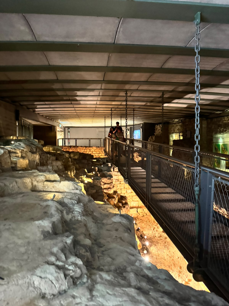
The promontory is where the city’s early history is conventionally anchored, while the underground defensive system developed much later. Spanish engineers began constructing casemates there in the seventeenth century, later expanded under French and Austrian control. Parts of the surviving network still allow the visitor to move physically through the military logic that once shaped Luxembourg.
Pit also told me the story of Melusina, the legendary wife of Siegfried who, after her secret was discovered, disappeared into the Alzette.
It would be easy to dismiss this as tourist folklore. Yet stories like this perform a different heritage function from a date on an interpretation panel. They connect landscape, memory and identity. The Bock becomes simultaneously geological formation, military infrastructure, foundation story and mythical landscape. The official tourism narrative still explicitly links Siegfried, the Bock and Melusina today.
This was one of the strongest lessons of the tour: a city’s heritage is held together not only by surviving structures, but also by the stories through which those structures are made legible.
Later that day, I visited Shaaf at the Ville de Luxembourg offices and met part of the team working around the World Heritage site and related city projects.
That shifted the journey again. Until that point, I had largely been looking at Luxembourg as an inherited urban landscape. The following days were increasingly about how that landscape is managed in the present.
Who gets to shape a heritage city?
The next morning, Shaaf and several colleagues joined me for a small discussion at the Lëtzebuerg City Museum.
We talked about the history of the World Heritage property, how interventions within and around it are approached, and something that had become increasingly central to my own project: how to bring people into decisions about the city they inhabit.
Luxembourg makes that question particularly interesting.
At the end of 2025, almost 70% of Luxembourg City’s residents were foreign nationals, and municipal information describes a city comprising a very large number of nationalities. This international character is one of the city’s defining qualities, but it complicates the idea of a single stable “local population”.
People arrive for work, study, European institutions or international companies. Some settle permanently; others remain for only part of their lives. Many people who experience Luxembourg every day do not live within the municipality at all.
So who exactly should be heard when discussing the future of a heritage city?
The answer cannot simply be “residents”, if residency itself contains such different relationships with place.
That discussion connected strongly with the direction Beyond the Postcard had been taking since Amsterdam. A physical city can be mapped with remarkable precision, but the cities people actually experience are much less stable.
A long-term resident, a recent international arrival, a cross-border worker, a student, a person living in the historic centre and someone commuting into it each morning may all occupy Luxembourg differently.
Their maps of relevance would probably not be identical.
This is where participation becomes more than consultation as a procedural step. It can become a way of identifying urban geographies that conventional spatial data do not necessarily reveal: places of attachment, perceived barriers, overlooked routes, spaces people avoid, places where different groups meet, or parts of the city that matter greatly to one community and almost not at all to another.
The challenge is then to connect this situated knowledge with the analytical tools already used to understand the city.
That intersection between participation and spatial analysis became one of the most important ideas I took from Luxembourg.
Several cities separated by a few metres of height
After our conversation, I walked down towards the Grund and followed the Alzette through the lower city.
Luxembourg’s topography makes the idea of multiple urban landscapes unusually literal.
The upper city, Grund, Clausen, Pfaffenthal and the plateaus around them can be very close geographically while feeling remarkably distinct. Elevation, bridges, lifts, roads and paths determine how those pieces of city connect.
Historically, the same terrain helped make Luxembourg defensible. Today it produces a very different set of questions about accessibility, mobility and everyday urban experience.
Walking along the river, past quieter residential areas and towards spaces such as the skatepark, I was reminded how many audiences a small city can accommodate within an extremely compressed geography.
The monumental city seen from the Bock is one Luxembourg. The low-lying neighbourhood along the river is another.
A skatepark under infrastructure, busy streets around the commercial centre, institutional spaces, green valleys and fortified viewpoints all belong to the same city, but they invite different behaviours and different people.
This is where the UNESCO property becomes particularly interesting from a spatial perspective.
The official boundary is precise. The experience of heritage is not.
A person may cross into and out of the World Heritage area without noticing a formal boundary, while a steep slope, bridge or lift may produce a much stronger perceived transition.
The shape of the city therefore matters not only historically, but experientially.
UNESCO’s own work in Luxembourg has already connected heritage with this broader understanding of access. An initiative developed for the anniversary of the inscription created accessible cultural routes in cooperation with community organisations and framed accessibility and inclusiveness as part of the management of the historic urban landscape.
That is a useful reminder that making heritage available does not only mean keeping a monument open.
It also means asking who can reach it, understand it, recognise themselves in it and use the city around it.
Beyond the World Heritage boundary
My final day moved deliberately away from heritage management in the narrow sense.
Through Shaaf, I met Maurice Bauer, who combines two perspectives that are especially interesting for Luxembourg: he is a member of the Chamber of Deputies and also an alderman of Luxembourg City. At Parliament, he gave me a tour of the Chamber and we discussed some of the major challenges facing Luxembourg today.
Two issues returned repeatedly: housing and mobility.
Neither is specifically a World Heritage problem. That was precisely why they mattered.
A heritage area does not exist independently from the housing market that determines where people can live, or the transport system that determines how they reach it.
Later, at LISER, I continued one of those conversations with Magdalena and Constance, focusing on housing.
The discussion did not produce a simple distinction between life inside and outside the UNESCO area, and I do not think one should be forced onto it. Housing in Luxembourg operates at a much larger metropolitan and national scale.
The pressure itself is well documented. Recent LISER research shows that housing costs for private-sector tenants have been rising faster than income, with housing costs reaching an average of 39% of income for private tenants in 2023.
But what interested me during the trip was a more experiential consequence.
Where you can afford to live changes how you experience the city.
Someone living within walking distance of the centre has one Luxembourg. Someone relying on a longer daily commute has another. Someone crossing the border each day may have a relationship with the city structured almost entirely around working hours, transport corridors and particular services.
These are not separate from questions of heritage and habitability simply because they happen outside the UNESCO polygon.
They shape who is present in the centre, when they are present, how long they stay and what kinds of everyday relationships they can build with it.
The same is true of mobility.
Luxembourg’s valleys and plateaus already produce a highly particular local geography. At a wider scale, commuting and residential location add another layer of distance.
This is why a heritage management question can quickly become an urban question.
And an urban question can just as quickly become regional.
Heritage as an ongoing negotiation
Returning to a city I already knew changed the way I understood the whole project.
When I lived in Luxembourg previously, I knew the Grund, the city centre, Kirchberg, public transport and housing difficulties as parts of everyday life. During this visit, the World Heritage framework made those same places appear connected in a different way.
The history of Luxembourg is a history of adaptation. The fortress was repeatedly rebuilt by different European powers. After 1867, enormous sections of its military infrastructure were dismantled, allowing the city to expand. Other parts survived and were repurposed. UNESCO itself notes that some former defensive structures were integrated into nineteenth-century urban projects and that historic buildings have acquired new administrative or cultural uses while maintaining their overall character.
So the question has never really been whether Luxembourg should change, because it always has. The more difficult question is how new interventions relate to what already exists and which values they preserve, transform or create.
This is also where the conversations with Shaaf and her colleagues became particularly relevant.
Managing a World Heritage City does not mean deciding between conservation and contemporary life. Housing, mobility, accessibility, public space, climate adaptation, infrastructure, tourism and demographic change all interact with the protected urban landscape.
And because those changes are experienced differently, the technical question of what can be built or modified is only part of the challenge.
There is also a social question: how do we know what matters to the people using the city?
Luxembourg’s international population makes this especially complex, but also especially promising.
If people have different durations of residence, languages, routines and levels of familiarity with the city’s history, traditional participation formats may not reach them equally.
The objective cannot simply be to ask “the local community” what it thinks, as if that were one homogeneous group.
It may be more useful to ask which communities are present, which are absent from a particular process, how different groups experience the same places and whether their perspectives can be connected spatially.
This is where I increasingly see a possible bridge between participatory approaches and GIS.
A map can represent the UNESCO property, buildings, land use, transport networks, population or housing data. Participatory methods can reveal another layer: perceptions, meanings, conflicts, attachments and experiences. Neither replaces the other.
Together, they can help expose the multiple cities contained within the same city.
For Luxembourg, that could mean understanding not only where heritage is located, but how different groups relate to it, which parts of the city they associate with everyday life, where physical or social barriers emerge, and how proposed changes are perceived across different urban experiences.
My four days were nowhere near enough to answer those questions, but they were enough to make them considerably more precise.
What Luxembourg left me with
Luxembourg was the city where Beyond the Postcard stopped feeling only like a way of observing and started to suggest how observation might feed into something more systematic.
The Schueberfouer showed how a centuries-old tradition can remain intensely contemporary.
Pit showed me how the physical city becomes meaningful through stories, details and memory.
The Bock and its casemates revealed how military geography still structures the way the city is understood.
Walking through the Grund made the city’s verticality and its multiple everyday landscapes visible.
The discussions with Shaaf and her colleagues shifted the question from how heritage is interpreted to who participates in defining its future.
Maurice Bauer and the researchers at LISER widened the scale again, showing how housing and mobility influence the relationship people are able to have with the city long before they enter a heritage discussion.
This was possible partly because Luxembourg was different from the other stops. I had lived and worked there before, and Shaaf’s openness gave me access to far more people and perspectives than I could reasonably expect during a short visit elsewhere. That makes direct comparison with the other cities inappropriate.
It also made Luxembourg exceptionally useful. Across the trip, I had been observing several versions of each city: visitor landscapes, residential landscapes, commercial landscapes, institutional landscapes and the quieter geographies of everyday life.
In Luxembourg, I began thinking more seriously about how those landscapes could be identified with people rather than only observed from outside.
The city is small enough for the Bock, Parliament, a riverside neighbourhood, an international workplace and a centuries-old fair to appear within an extraordinarily compact geography. Yet the people moving through that geography may inhabit very different Luxembourgs.
Understanding those differences seems to me increasingly relevant to the future of urban heritage.
The next step would not be to create another definition of what makes Luxembourg habitable.
It would be to build ways of listening more carefully to how different people already inhabit it, connect those perspectives to the places they refer to, and place them alongside the analytical evidence used to plan and manage the city.
That would turn participation into more than an addition to heritage management.
It could become another way of mapping the living city itself.
Brussels was the first city on the journey where I struggled to understand what exactly I was looking at.
Amsterdam had its canals. Bruges had an unusually coherent historic centre. Brussels seemed to change almost every few streets.
I arrived expecting this to make the city harder to read. By the end of three days, I was beginning to think that this apparent fragmentation was precisely what made it interesting.
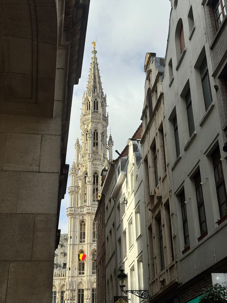
My walks took me through the Grand-Place and its surrounding streets, Marolles, Sablon, the Royal Quarter, the Art Nouveau neighbourhoods around Saint-Gilles and Ixelles, Matongé, the European Quarter and Cinquantenaire. These places are geographically close, but they can feel like very different cities.
Perhaps Brussels is not best understood by looking for one dominant urban identity. It may be better approached as a city made of many centres, landscapes and communities that overlap, sometimes connect naturally and sometimes seem to sit beside one another without fully meeting.
What exactly is World Heritage here?
Unlike Bruges, Brussels does not have an entire historic centre inscribed as one UNESCO property. The World Heritage landscape here is fragmented.
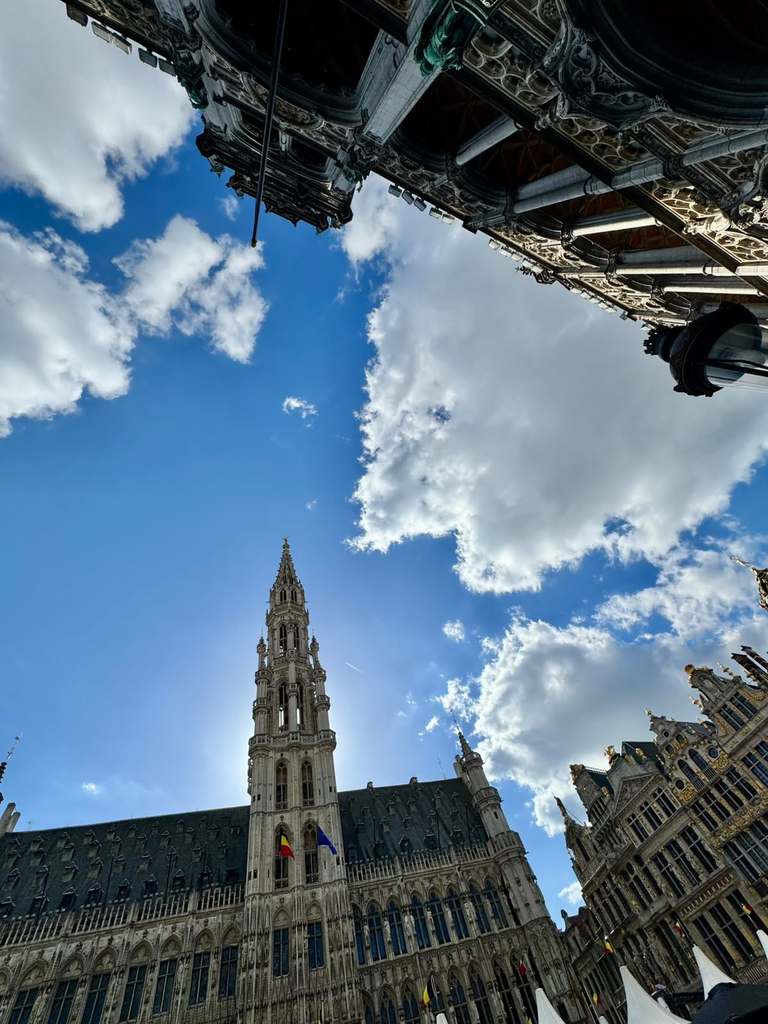
At the heart of the Lower Town is La Grand-Place, inscribed in 1998. The property itself is very small, but extraordinarily dense in historical meaning. The square developed as the political and commercial centre of Brussels and brings together the Gothic Town Hall with the richly decorated guild houses that were largely rebuilt after the bombardment of Brussels by French forces in 1695. UNESCO recognises it as an exceptional example of the successful blending of architectural and artistic styles associated with the political and commercial culture of the city.
Its surroundings are almost as important to understanding it. The buffer zone includes the historic Lower Town, traditionally known as the Îlot Sacré, where the medieval street morphology coexists with later interventions such as the Galeries Royales Saint-Hubert, the Bourse and the nineteenth-century boulevards created after the covering of the Senne.
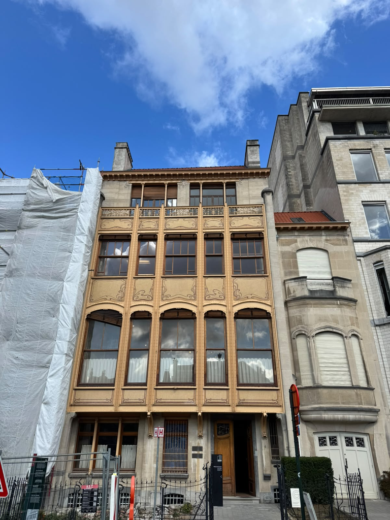
Brussels also contains another UNESCO property that tells a very different story: the Major Town Houses of the Architect Victor Horta, inscribed in 2000. Hôtel Tassel, Hôtel Solvay, Hôtel van Eetvelde and the Maison & Atelier Horta represent some of the most influential early expressions of Art Nouveau, with new relationships between structure, light, circulation and domestic life.
This already made Brussels unusual within the trip. The World Heritage here is not one continuous historical landscape. It ranges from a monumental civic square to individual houses dispersed through living neighbourhoods.
That fragmentation became useful for thinking about the city itself.
One square, many functions
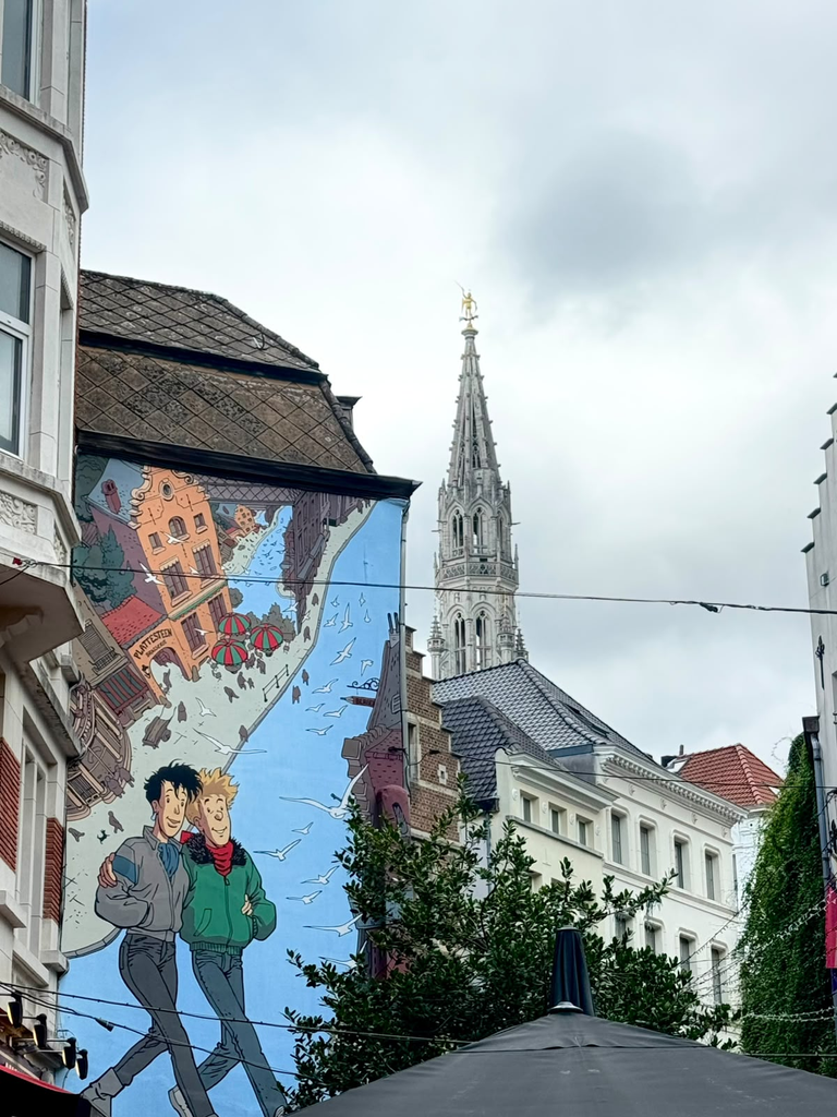
I first explored central Brussels through the familiar sequence of Manneken Pis, Rue du Chêne, the comic-strip murals, Notre-Dame de la Chapelle, Marolles, Jeu de Balle and Sablon before climbing again towards Mont des Arts, Place Royale and the Royal Quarter.
The transitions are surprisingly fast. Around the Grand-Place, historic architecture, restaurants, shops, visitors and municipal functions occupy an extremely compressed space. A short walk towards Marolles produces another landscape entirely. Continue towards Sablon and the commercial and architectural character changes again. Climb towards the Royal Quarter and another Brussels appears.
This became one of the strongest impressions of the city: distance alone explains very little.
A few hundred metres can separate places associated with very different forms of commerce, housing, public life, symbolic power and cultural identity.
The Grand-Place itself made this even clearer when I met Paula Cordeiro and Florence Papazoglakis, who work directly with the World Heritage site.
Our timing could hardly have made the square feel less like a static monument. Brussels Beer Weekend was taking place, the Grand-Place was busy and a torrential downpour began almost as soon as we started exploring it.
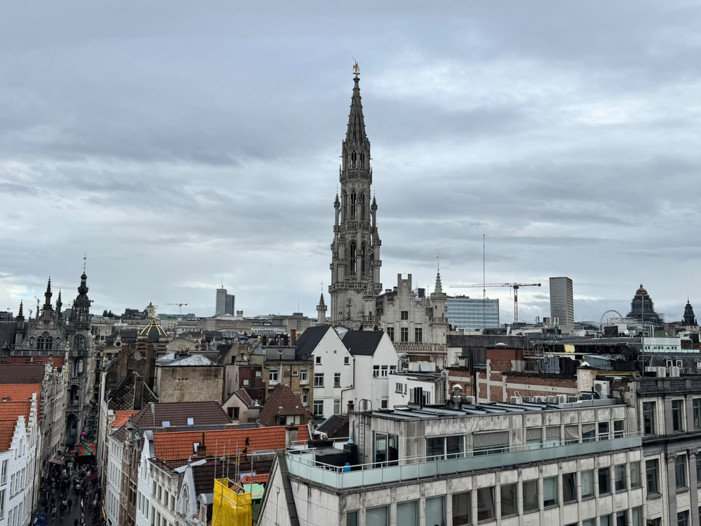
We first looked at the square from above and then moved through some of the surrounding spaces, including the small world of the traditional puppet theatre, before continuing across several rooftops. From above, the relationship between the Grand-Place and the dense city around it became much easier to understand.
Paula and Florence explained the history of the property, restoration work and some of the questions they encounter in managing such an intensely used area.
One of the themes was how to encourage the centre to remain meaningful for people who actually live in Brussels.
Tourism is obviously central to the economy and international identity of the area, but its concentration also influences which businesses can operate there, how streets are used and what reasons residents have to return to the centre in their everyday lives.
This is not simply a local impression. UNESCO itself identifies strong commercial, real-estate and tourism pressures within the Grand-Place buffer zone, alongside questions of mobility, housing, social mix, vacant buildings and upper floors. The management plan has explicitly sought a more diverse functional mix, including housing and higher-quality, more diversified commerce rather than an economy dominated by activities aimed primarily at mass tourism.
Walking the surrounding streets makes the issue tangible.
Chocolate, waffles, fries, beer and souvenir businesses appear repeatedly. These activities are part of Brussels and part of the experience visitors seek, but their concentration can also make parts of the historic centre increasingly specialised. The important question is not whether those businesses should exist.
It is what happens when one set of functions becomes much more competitive than others within a very limited urban area.
The floors above the city
One detail from my conversation with Paula and Florence stayed with me particularly strongly.
Ground floors are only one part of the centre.
Some commercial properties leave the upper floors unused or use them for storage, even where policies try to discourage vacancy. The issue appears in UNESCO’s own assessment of the buffer zone, which identifies abandoned buildings and storeys among the challenges faced by the historic centre.
Once they mentioned it, I started looking upwards. That changed the way I read the streets.
A ground floor can be intensely active while several levels above it contribute very little to the daily life of the neighbourhood. Architecturally, the street remains complete. Functionally, parts of it can be surprisingly empty.
In a city where housing affordability is a major concern and visible homelessness is part of the central urban landscape, those empty floors become difficult not to notice. My short visit could not establish the scale of the phenomenon or its relationship to the wider housing market, but it revealed precisely the kind of question that walking alone would probably not have led me to ask.
This is where conversations began to change the project. Observation had shown me commercial specialisation. Local professional knowledge pointed towards what was happening vertically, behind and above the façades. The city suddenly had another geography.
Many Brussels within Brussels
The following walks made this increasingly obvious.
In Marolles, Jeu de Balle and Rue Haute, the city felt markedly different from Sablon only a short distance away. Moving through Mont des Arts towards Place Royale introduced another layer associated with monumental institutions and state representation.
Elsewhere, Saint-Gilles and Ixelles added an entirely different form of heritage.
Victor Horta’s houses are remarkable precisely because they were conceived as places to live. Their innovation was not limited to decoration. UNESCO highlights the way Horta reorganised domestic space through open plans, light, new materials and circulation adapted to the lives of their occupants.
Today those buildings exist within neighbourhoods that continue to change around them.
Avenue Louise provides a particularly clear example. UNESCO notes that the environment of Hôtel Solvay changed significantly as what had been an elegant residential avenue became a major urban artery shaped by later property development and large office buildings.
This creates a very different relationship between heritage and city from the Grand-Place. At the Grand-Place, the challenge involves managing an extremely concentrated monumental and visitor landscape. With Horta, isolated heritage properties have to remain meaningful within broader neighbourhoods whose morphology, mobility and functions have continued evolving.
Walking onwards through Flagey and Matongé before reaching the European Quarter added still more versions of Brussels.
The changes were cultural as much as architectural: languages, businesses, rhythms of movement, public spaces and the people occupying them could vary substantially over very short distances.
By the time I reached the European institutions, the city had shifted again.
A city of centres
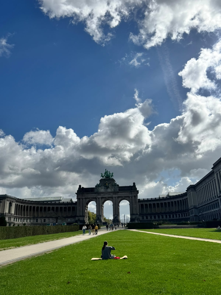
On my final day I spent time around Cinquantenaire, where something simple caught my attention: residents and visitors appeared to use the same monumental landscape quite naturally.
People exercised, crossed the park, sat on the grass, photographed the monuments and simply passed through.
It was a useful counterpoint to some of the more specialised spaces I had encountered in the historic centre.
Later that day I met Karel Dendooven from Bruges, and our conversation inevitably returned to tourism, urban functions and the question of who historic centres are ultimately able to accommodate.
What Brussels added to this discussion was a different spatial scale. Here, the issue did not feel limited to one historic core.
When I described the city to Paula and Florence as somewhat disconnected, they offered a more useful interpretation: Brussels is made of multiple small centres.
That distinction matters. What initially looks like fragmentation can also represent diversity and polycentricity. Neighbourhoods can maintain strong identities precisely because they are not absorbed into a single homogeneous centre.
The difficulty is how those centres relate to one another.
A city containing multiple identities is not necessarily problematic. In fact, this may be one of Brussels’ greatest strengths. The question is whether different populations, activities and places can intersect in ways that allow the city to remain shared rather than becoming increasingly specialised into separate territories.
Tourism is one example. Institutions are another. Housing, commerce, mobility and cultural identity produce their own geographies as well.
These landscapes do not align neatly.
Looking at the city through its connections
Brussels therefore pushed the project in a slightly different direction. Amsterdam had made me think about overlapping urban landscapes. Bruges made me consider the continuity of everyday functions within an extraordinarily coherent historic centre. Brussels introduced the importance of connections between landscapes.
A city can contain many different centres without needing to collapse them into one identity. Diversity is not something to solve. But understanding how these different Brussels interact requires looking beyond the physical form of individual heritage sites.
Who uses the Grand-Place, and when? What brings residents back to the historic centre? How does a commercial street change when the majority of its ground floors serve one type of user? What happens above those shops? How do residents experience the transitions between neighbourhoods that an outside visitor can only observe superficially? Which spaces successfully accommodate several different groups at once?
These are questions that neither heritage inventories nor demographic maps can answer by themselves.
Spatial data can show housing, mobility, land use, commercial activity and population patterns. Walking can reveal where transitions become perceptible. Conversations can explain processes that remain invisible from the street. More structured participation can then reveal something neither an external observer nor an aggregate dataset can provide: how different groups actually understand and use the same city.
This was becoming increasingly important to Beyond the Postcard.
The objective was no longer simply to look beyond the tourist image of each city. It was becoming a way of asking how many different urban realities can occupy the same geographical space, and how we might begin to recognise them.
What Brussels left me with
I never found one Brussels. And after three days, I no longer thought I was supposed to.
There was the monumental Brussels of the Grand-Place and Royal Quarter; the neighbourhood life of Marolles; the Art Nouveau city embedded in Saint-Gilles and Ixelles; the diasporic and commercial landscapes around Matongé; the institutional European city; and the parks and public spaces where some of those distinctions became less important.
They are not independent cities.
People move between them, economic pressures cross their boundaries and decisions taken in one part of the city affect others. Yet each produces a different experience of what Brussels is.
Perhaps this is why its World Heritage is so interesting.
The Grand-Place represents an extraordinarily concentrated historical centre. Horta’s houses are scattered pieces of architectural innovation embedded in everyday neighbourhoods. Around both of them is a contemporary capital that is multilingual, international, residential, commercial and institutional all at once.
Brussels made the idea of multiple cities within one city much less metaphorical for me. They can sometimes be walked between in a matter of minutes. The challenge, and perhaps also the opportunity, is not to make them identical, but to understand where they meet, who moves between them and what allows their differences to remain part of one shared city.
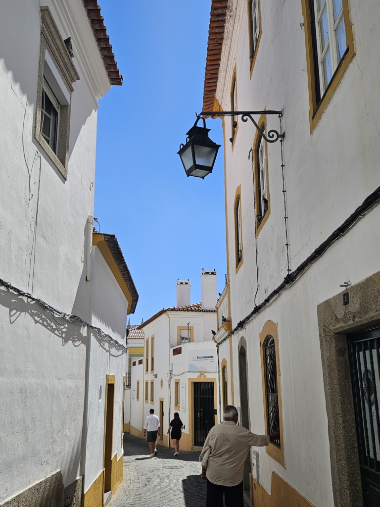
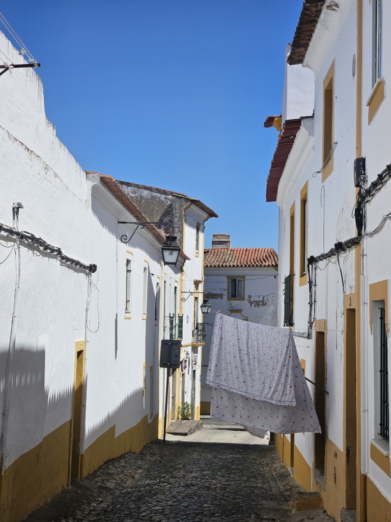
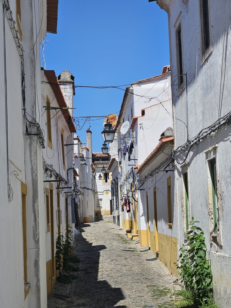
After enjoying a scenic train journey through the beautiful Alentejo countryside, we arrived in Évora. Once in the city centre, we set out to find some young locals. As we wandered through the narrow alleys, we were immediately captivated by the whitewashed houses with yellow trim. The winding streets and uniformly coloured houses made us feel as though we were in a maze.
Évora's narrow streets
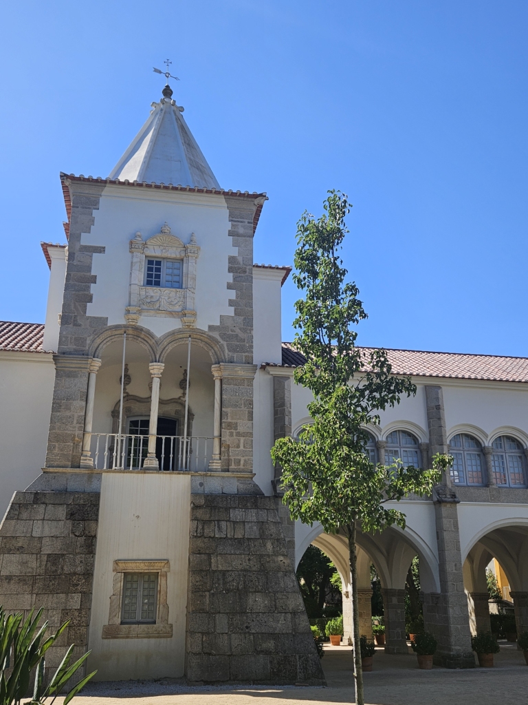
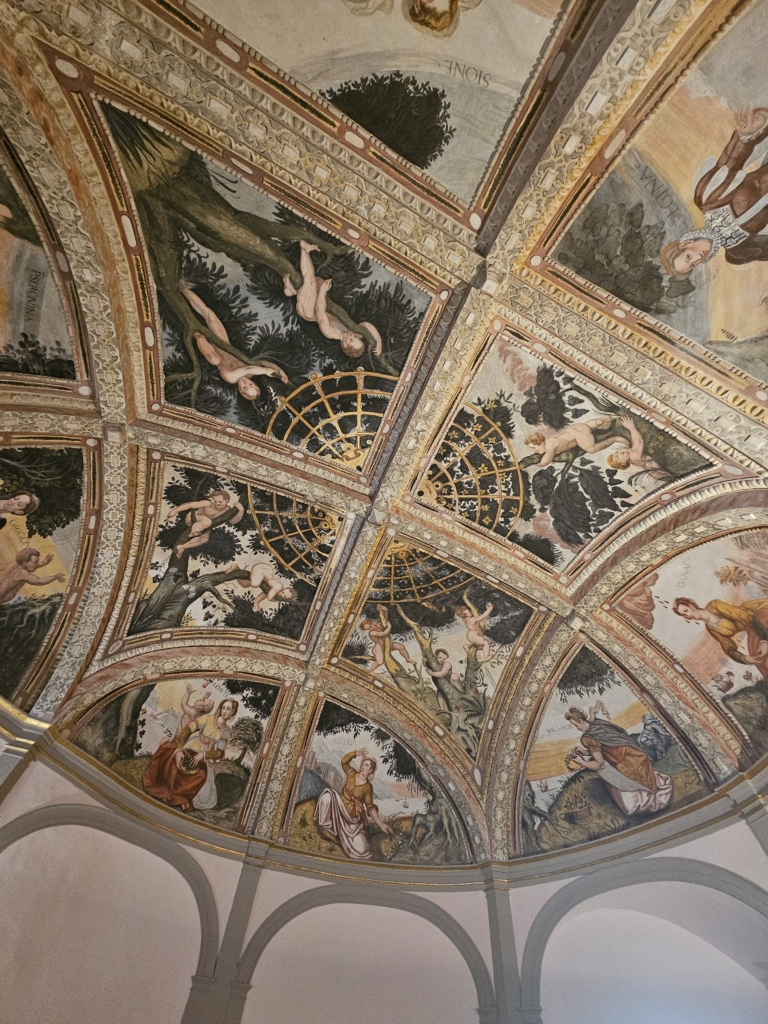
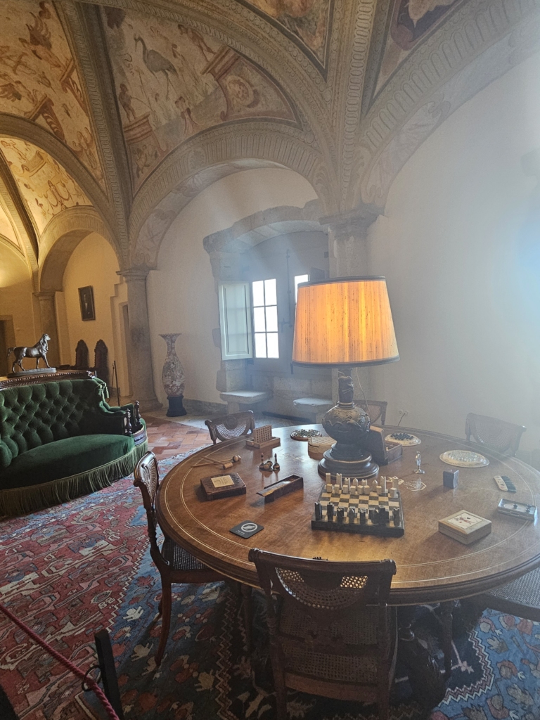
After dropping off our backpacks, we went to the Jardim Público and visited the Palácio de D. Manuel. Built in the late 14th century on the site of the former São Francisco monastery, the palace served as the seat of the Portuguese royal family for a long time. It was Manuel I, however, who transformed the palace into a magnificent royal residence in the 16th century, giving it his name.
Palácio de D. Manuel
Today, the palace houses a museum dedicated to the history of Évora. Évora became a Roman municipium under the name Ebora Liberalitas Julia. During the Roman era, the city acquired its initial infrastructure and fortifications, and the Roman Temple in the city centre is unsurprisingly also from that time. From the 7th to the 12th century, Évora was an Islamic settlement known as Yāburah. A mosque and a trading centre were established here, as well as settlements outside the city walls. It was subsequently conquered by the Portuguese in the 12th century, after which it became part of the kingdom. Évora gradually expanded, adding new city walls, a cathedral, an aqueduct and an university, while gaining political importance within the realm. Thus, Évora has a remarkably diverse history, reflected in its cityscape.
Afterwards, we made an somewhat unusual stop at the university, where an anime convention was taking place. There were lots of young people in cool outfits and elaborate cosplays, as well as numerous artists, selling handmade stickers, keychains, jewellery and other anime-themed items at small stalls. One of the highlights for us was the ‘K-Pop random play dance’: visitors gathered in an open area while short excerpts from K-Pop songs were played in succession. If they knew the corresponding choreography, they stepped out of the crowd and performed the dance. It was wonderful to see how the anime convention created a safe space where people could celebrate themselves and each other, drawing attendees from far beyond Évora, as we discovered through conversation.
Local perspective: calmness, close community and culture
Beatriz
Nada
Anna and Pedro
Beatriz
Beatriz has lived in Évora for almost a year. She moved here from Brazil to study at university. She likes living here because it is a friendly, relaxed city. However, she also sees some disadvantages, such as the supermarket being far from the city centre and there being too few public places for young people. She also feels that the public transport system could be better. She really enjoys the city’s energy and its historical and cultural aspects, as well as its young people. In her free time, she loves going to Praça Giraldo with her friends for coffee.
Nada
Nada grew up in Morocco and moved to Évora to study. She lived in Lisbon for a while, but returned to Évora because she feels calmer and safer here. She likes the fact that she can walk everywhere and doesn’t need to use public transport. In her free time, she enjoys visiting the Temple of Diana, the Praça de Giraldo and the Jardim Público.
Anna and Pedro
Pedro was born in Évora, while Anna was born in Germany and moved here when she was a child. She likes that the city is quiet and calm. Pedro also likes the close-knit community, where everyone knows each other from school or university. He especially enjoys spending his free time at Alto de São Bento, a hilltop with stunning views of the city. They both also enjoy the viewpoint next to the Roman Temple of Diana.
Sketch and watch: Jardim Diana
We set off for the viewpoint next to the Roman Temple of Diana, Anna and Pedro’s favourite spot. By the time we arrived at the park, the sun was setting. We knew right then that this was the place where we’d hold our final ‘sketch and watch’ session.
Sketch and watch in Jardim Diana
Sketch of Jardim Diana
Évora – shared sunset at Jardim Diana
Golden hour
Consuming the moment
Bilingual companion
Family holiday
Carpe diem
Golden hour
1. Jardim Diana is located right next to the Roman Temple in Évora. However, the park’s main attraction is not so much the nearby landmark, but the beautiful view of the northern part of the city with its narrow streets and yellow and white houses.
2. Our timing is perfect: we arrive at the park just in time for sunset. Many visitors are sitting on benches or leaning against the railing of the viewing platform. The setting sun casts its silhouette against the orange-lit building behind us.
3. This enchanting display of colour is complemented by a unique soundscape: several small flocks of birds swarm from tree to tree across the golden sky above Évora. Their collective chirping sounds like a mighty rumbling – both frightening and fascinating. Their singing ends just as the sun sets.
Consuming the moment
4. The many multilingual tourists on the viewing platform can be identified by their eagerness to capture the perfect sunset photo. Just before the golden moment, everyone jostles to reach the railing – it’s practically full to bursting. I, too, briefly pause my observations so as not to miss the beautiful sunset. I’m shocked that so many of the tourists leave the park straight away once the sun has set. They’ve just ticked that moment off their list – they haven’t really enjoyed it.
5. A man spends what feels like an eternity filming the sunset. Afterwards, he enthusiastically shows it to his wife. She seems uninterested. Instead, she hands her mobile phone to her husband. The purple sky and her purple evening dress provide the perfect backdrop for an Instagram photo – so, just to be on the safe side, a thousand photos are snapped from every angle.
Bilingual companion
6. A simply dressed man enters the park with his large dog on a red lead. Even at the entrance to the park, he has to calm the dog down, as it is very excited. They walk straight towards a water feature at the top of the platform. The dog dips its snout into the water – something it’s been looking forward to. They then walk over to a bench by the railing. The dog positions itself so that it can also look out at the sunset.
7. The dog stretches out on the bench, prompting its owner to strike up a conversation with an elderly woman sitting next to it. She starts talking in Portuguese, but they quickly switch to English – presumably because the man wouldn’t otherwise understand her. They chat about the dog whilst the woman strokes him. The dog is really enjoying it. The woman then gives the dog a command in Portuguese: ‘Sit!’ The dog obeys. Is he bilingual?
8. A young woman joins the group – they all greet each other warmly, speaking Portuguese. Equipped with a professional camera, she takes a photo of the woman, the dog and the owner. I’m confused. Why were they speaking English earlier? Are they strangers, friends or even family? Are they from Évora or are they tourists? In any case, the dog brings them all together – they enjoy the sunset in peace and conviviality.
Family holiday
9. An extended family makes their way to the viewing platform – they’re too late for the sunset. Some of them are taking photos of the view; children film videos and chase each other around the park; a boy is repeatedly pulled away from the parapet by his mother because he keeps trying to look over the edge. Depending on who is talking to whom, they switch between Portuguese and English. I get the impression that some of the twenty-strong family live in Évora, while the rest are visiting. One man in particular leads the group and tells the other members about what they’re seeing – the other group members are the ones taking most of the photos. After some of the family have already left the park, a loud whistle sounds, whereupon the remaining family members also slowly make their way away from the viewing platform.
Carpe diem
10. A young woman sits cross-legged between the water feature and the parapet. Although she has a perfect view of the sunset, she remains cut off from the crowd. Several plastic bags lie beside her. Every now and then she eats a little something from them. Before, during and after the sunset, she enjoys her little picnic. Did she deliberately choose to spend her evening like this? Or did she come to the viewing platform on a whim after her shopping trip?
11. A young couple approaches the balustrade – he leans casually against the railing, she snuggles smoothly up to him. They talk intimately, exchange glances and enjoy the last light after sunset. They had previously been sitting on a bench away from the hustle and bustle for quite some time, only moving to the platform when it was virtually empty. They wanted some space to themselves.
12. Throughout my observation, two men sit on two opposite benches in the park: one man is very old. With his legs crossed, he sits slightly stooped, reading his little green booklet, which he holds up with one hand. The second man is young and wears a blue durag. He is also engrossed in a book, which he has opened on his lap. Neither of them seems particularly interested in the sunset.
The sun’s rays have now disappeared, and with them, so have almost all of the visitors. They experienced the sunset in very different ways: many tourists came just for a photo and left soon afterwards. The locals enjoyed the tranquillity with their loved ones, had a picnic to see the evening draw to a close, or lost themselves in a book. Ultimately, however, the sunset belonged to everyone – locals, tourists, dogs and birds. But surely not all visitors were able to truly experience the enchanting tranquillity of the moment.
Day 2
On our last day, we first made our way to the medieval aqueduct. We were amazed to see how the historic structure had been incorporated into the city, with houses even built into it.
Aqueduct Água de Prata
We then moved on to the Roman Temple. It was not until the 19th century, following archaeological research, that the ancient temple’s unique nature was recognised and appreciated. Prior to this, it had even served as a butcher’s shop. There is a persistent (though unconfirmed) belief that the temple was dedicated to the goddess Diana. Consequently, the locals consistently refer to it as the Temple of Diana, whereas official English translations simply list it as the Roman Temple.
Our next stop was the Cathedral of Évora, which is apparently the largest medieval cathedral in Portugal. The cathedral’s roof offered a panoramic view of the entire city; surprisingly there was a large number of yellow butterflies up there. We were captivated by the blend of Romanesque and Gothic architectural styles in the cathedral, in particular also the interplay of light and shadow in the cloister.
Cathedral of Évora
After a brief visit to the beautiful and much larger-than-expected Igreja e Mosteiro de São Francisco, we took a short break and enjoyed some ice cream in the Jardim Público. While we were there, we saw lots of peacocks that apparently live in the park.
Our final stop of the day was the Paço de São Miguel, a building with a long history dating back to the city’s Muslim era. It has had numerous owners and undergone many changes. Highlights include the ceiling frescoes depicting Ovid’s Metamorphoses, the well-maintained garden, the extensive collection of kitchen copperware and the impressive furniture.
Interiors of Paço de São Miguel
Once again, we ended our day at the viewing platform by the Roman Temple. The sunset the previous day had been so beautiful that we wanted to enjoy it again on the last evening of our trip. Sadly, we had to leave Évora the next morning, but not before having a quick coffee with Paula from the Municipality of Évora!
The locals painted a picture of Évora as a tranquil place with a close-knit community. By the end of our trip, we could really feel this sense of unwinding. Although the city itself is small, it has a young, international population — largely thanks to the university — and is located in a beautiful region that lends itself to exploration, which is highly valued.
We took a day trip from Lisbon to Sintra. We arrived at the earliest possible hour and headed straight for the Palácio Nacional de Pena. After a dizzying bus ride along the winding mountain pass, we reached the entrance to Pena Palace—and we were far from the only ones there!
The former royal residence was built in 1840 on the orders of Ferdinand II, one of the last kings of the Portuguese monarchy. It was constructed on the site of a medieval monastery destroyed in the 1755 earthquake. The building’s blend of Egyptian, Moorish, Gothic and Renaissance elements reflects the spirit of the Romantic movement.
Pena Palace shrouded in fog
It was very windy at the palace – we never thought we’d get cold on this trip! Despite the large number of tourists and the somewhat hurried nature of our tour, the palace, both inside and out, was truly unique and beautiful. The views were stunning, too – you could see the city and the Moorish Castle, which we were due to visit afterwards.
During the construction work, Ferdinand was keen to honour the remains of the destroyed monastery by restoring parts of it. A new section of the palace was also added. The interior design truly showcases the palace’s eclectic style, and we found the recurring Moorish elements particularly fascinating. We were especially captivated by the ceiling of the Smoking Room, which is pictured here.
Impressions of Pena Palace
Once we had seen everything, we strolled through the vast palace gardens. They were like a dense forest, with many small, winding paths. We then came to a pond where ducks and geese were swimming. There, we briefly chatted with Kathi who was out riding in a horse-drawn carriage and who later gave tours to tourists. We continued on and arrived at a tower in the lake – It was like something from a fairy tale.
Magical garden and tower
From there, we walked to the Moorish Castle. It was used in the 9th century during the Moorish occupation. After Portugal was reconquered, however, it was abandoned. It’s amazing that such a fortification could be built in such a high, hilly location. The way the stone castle wound its way along the landscape sometimes reminded us of the Great Wall of China.
As it was less crowded and quieter here, we were able to explore the castle at our own pace. It was enormous and offered truly unique views!
Moorish Castle
After our tour, we took the bus back down and stopped at a small café run by an older man. He told us that we wouldn’t find many young locals in the old town itself, but rather on the street parallel to the train station, as there are good restaurants.
The café owner was right. We really struggled to meet any young locals on our way to and through the town centre of Sintra. Eventually, however, we met Rodrigo and Lorenzo. Lorenzo owns a large café near the centre and spent a long time speaking openly with us about the challenges of living in Sintra. Unfortunately, the microphone ran out of battery, so we lost the audio for almost the entire interview :/
Local perspective: nature, surroundings, community and Mass tourism
Rodrigo
Lorenzo
Kathi
Rodrigo
Rodrigo has lived in Sintra all his life and believes that the community and its people are the most important aspects of the town. Similar lifestyles bring people together, even if they don’t really know each other. He also likes the location because it doesn’t take long to drive to the beach, Cascais or Lisbon. In his free time, he likes to visit the coast of Sintra or go further afield, as there are so many tourists in the old town. However, he mentioned Pirequita, a spot in the old town, as a place where he and the locals like to sit and eat pastries.
Lorenzo
Lorenzo was born and raised in Sintra. Tourism has completely transformed life in Sintra for him and all the other residents. The streets where he used to play football as a child are now packed with tourists, even in the early morning. He said that hardly anyone from Sintra lives in the old town anymore, as they have moved over the mountains and towards the sea, since Sintra is so large. He owns a café in the old town, but he lives on the outskirts too. Although tourism creates many jobs, he wishes for more sustainability and for the local population to be better supported — in other words, he doesn’t want tourism and wealthy foreigners to dominate. He told us about his favourite bar, the ‘Fonte da Pipa’, which he used to enjoy visiting. Nowadays, the bar is very quiet and has changed its opening hours to cater for tourists, closing at 5 p.m. when they all head home.
Kathi
Kathi has lived in Sintra for four years, having moved here for family reasons. To her, it is a quiet little town that has everything she needs. She enjoys the natural surroundings and finds the village of Azenhas do Mar, perched on the edge of a cliff, very peaceful. She also likes to spend her free time there or at the Palace of Monserrate. She loves living in Sintra because of the many opportunities to enjoy the surrounding area in her free time, as well as the tranquillity and abundance of nature.
After our conversations, we walked to Piriquita, which Rodrigo had suggested, and to Fonte da Pipa, which Lorenzo had suggested. Piriquita was very crowded and busy, there were many tourists here.
Sketch and watch: Fonte da Pipa
We arrived at Fonte da Pipa shortly before 5 p.m. Seeing only a handful of people sitting on the terrace and noticing that the bar was about to close made us realise that this was exactly what Lorenzo had told us! It was clear to us that we should hold our ‘sketch and watch’ session there.
Sketch and watch at Fonte da Pipa
Sketch of Fonte da Pipa
Sintra - Closing Song at the Fonte da Pipa
At the end of the road
One more drink
Guest interactions
Alone
At the end of the road
1. Sintra’s historic town centre is absolutely packed. Germans, French and Americans are spending their money in souvenir shops or queuing up at a bakery to get their hands on one of the iconic queijadas de Sintra. Mass tourism is the order of the day.
2. At the end of the same street, we find the Fonte da Pipa. Although the bar is only a few minutes’ walk from the hustle and bustle, it’s clearly far enough away to attract hardly any tourists. The many seats on the small outdoor terrace are almost completely empty. From a distance, you can see that the tables haven’t been wiped down.
3. As we arrive, two young women are just about to leave. They stand up while continuing to chat in Portuguese to a garbage collector, who is leaning casually against the terrace railing. They don’t leave without shouting a goodbye to the barman inside the bar. Are they regulars?
One more drink
4. Even before we sit down, a man kindly informs us that the bar is about to close – it’s only five o’clock. We speak English, but he has a strong German accent. He carries two plastic cups of beer over to a table where his wife is already waiting for him. They are the only guests left.
5. As if on cue, the young barman hurries out of the door. He tells us in English that he’s closing soon. However, he still offers to get us a quick drink. There’s a certain sense of urgency in the air, so we hurry into his bar. He grows impatient as I rummage through my wallet for my card. Without a word, he places our drinks on the terrace railing. They’re also served in plastic cups – so that we can dispose of them ourselves later. But when it comes to choosing our drinks, his true charm as a host shines through: the barman leans casually against the bar and asks us what we’d like to drink. He pauses briefly when we ask for something non-alcoholic, but then kindly lists his entire range. He recommends the house lemonade.
6. I catch only a brief glimpse of the bar’s interior, which features large leather armchairs, bar stools, bottles of spirits hanging from the ceiling and other bits and bobs. You can still hear the 1980s American music out on the terrace. The path leading to the entrance is paved with cobblestones, as if the street continued right into the bar. The bar has a modern décor, yet retains a rustic charm – it looks cosy!
Guest interactions
7. The couple at the next table are chatting in English: they’ve had an overpriced breakfast, done some sightseeing and are planning to pop into a nearby supermarket later. The bar offers them a break. Two tourists wander down the street, discussing in German whether they should pop into the bar. The man replies to them in English that the bar has already closed. Later, when the couple ask us about Mia’s drawing, they also address us in English, even though they heard us speaking German. It’s clearly important to the German-speaking man that his wife understands all the conversations. She’s obviously still learning German – but she’s already making a pointed comment about the unpleasant weather with a simple “Kalt!”
8. Suddenly, small black chunks crash onto the couple’s table. We all look up at the same time. Pigeons have torn down parts of a wall. The man lets out an eccentric cry: HEY! The woman joins in: HEY! She imitates bird calls to scare the pigeons away. As the couple moves to another table, they joke about the man fishing the little chunks out of his drink with his hand. HANG ON: There are black bits in my drink, too! How on earth did that happen?!
9. The barman notices the situation: he hurries out and explains that, although the wall was cleaned only yesterday, they cannot clean the pigeons away. He jokes and apologises at the same time. He can’t stop the pigeons from doing what pigeons do, and somehow the situation has a certain charm to it.
Alone
10. Slowly but surely, the barman is closing up: you can hear him rearranging the furniture, closing the till and washing up glasses. The last ‘closing-time’ song is cut short. He also pops out briefly to dismantle two windowsills. There is place for several people to stand there and put their drinks down – but no one is doing that at the moment. After a brief chat with the garbage collector, the latter says his goodbyes and wheels rubbish bags and empty beer kegs up the hill. The barman locks the first door from the inside and the second gate from the outside. The bar is now officially closed.
11. Carrying a small rucksack and holding a motorbike helmet, he comes out onto the terrace. Whispering, he asks us to leave the bar in five minutes. Otherwise, the police will cause him trouble. We agree, and a short while later he whizzes past us on a moped, waving. Once the other couple have also said their goodbyes, there really is no one else there – apart from us.
A bar closing at five o’clock – that’s absurd! Mind you, I can well understand why: the peak visiting hours for Sintra are already over, and the Fonte da Pipa is obviously just far enough out of the way that only the most adventurous tourists end up here by chance. The locals aren’t in the mood to party just yet, or they live outside the city anyway. So why should the barman stay open any longer just for a few confused tourists like us? Yet at the same time, the young barman’s charisma, the two regulars, the plenty of seating and the cosy atmosphere give me the impression that it can be a great place to meet up with friends for a lovely evening. The Fonte da Pipa is certainly a second living room for many regulars. But as tourists, however, we weren’t part of the lively hustle and bustle of the locals in the bar – maybe it’s better that way, too.
After our day trip to Sintra, we headed back with mixed feelings. On the one hand, we were fascinated by the beautiful buildings, parks and views. On the other hand, we knew that tourism was taking space and opportunities away from residents, forcing them to move elsewhere and change their way of life. However, we also left feeling that we had only seen the touristy side of Sintra. At the same time, we became curious to explore the many places around touristy Sintra that locals cherish and frequent — spots that make life here so liveable, as we gathered from our conversations.
After an enjoyable train journey through the Ave region, we arrived in Guimarães. During our uphill walk into the historic city centre, laden with heavy rucksacks, we came across the town’s famous inscription: ‘Aqui Nasceu Portugal’, meaning ‘Portugal was born here’. Our first stop in the birthplace of the Nation was the tourist information centre, where we met Paulo. He provided us with all the information we needed to explore Guimarães, which we did over the following days:
Portugal was born here
After chatting spontaneously with a few locals in the city centre, we took their advice and headed to the large market hall.
However, by the time we arrived, the stalls were already being cleared away. We still wandered through the hall, which felt like a liminal space, when an elderly saleswoman spoke to us in Portuguese. We couldn’t exactly make out what she was saying, but she surely was trying to tell us in a friendly manner that they unfortunately were already packing up and we were a bit too late.
Mercado Municipal de Guimarães
Historical timeline
Our route took us to the Casa de Memória. The city museum is divided into two sections – Território and Comunidade.
The first section focuses on the historical and physical development of the city and its region – exploring its past, present and future. Here, we learnt why Guimarães is considered the birthplace of Portugal: Afonso Henriques was born in the town in 1109. He later fought for Portugal’s independence and was proclaimed the first King of Portugal in 1139 – making his birthplace the birthplace and capital of the kingdom.
The second section focuses entirely on the culture that has come to define Guimarães, and which is still practised by its residents today. It covers aspects of everyday life – such as idioms and baking traditions – as well as industrial heritage and the Nicolinas, an annual festival celebrated by Guimarães students. And, of course, this section doesn’t fail to highlight the city’s beloved football club, Vitória Guimarães.
We particularly liked how the impact of historical figures on the city was demonstrated, and how residents were given the opportunity to explain what their city means to them as part of an artistic project.
'I bought a house for a crust of bread!'
Local perspective: Heritage, culture and a sense of belonging
During our initial exploration of Guimarães, we had the opportunity to chat with a few young locals, who shared with us their connection to the town.
Theresa and Beatriz
Achmed
Melissa
Theresa and Beatriz
Beatriz describes the strong sense of belonging that the residents of Guimarães have, and how closely they are connected to their football club. She likes that, the town is also less crowded and touristy, so it’s a bit quieter. Theresa told us that she looks forward to attending the Festas Nicolinas every year. She also shared her favourite places with us: Praça da Santiago, Largo da Oliveira and Penha, where she has been spending time with her friends since childhood.
Achmed
Achmed has lived in Guimarães for five years; he grew up in Afghanistan and is studying music. What he likes about the city is that it isn’t too big and everything is close together. He also enjoys the tranquility of Guimarães. He likes to spend his free time on Mount Penha.
Melissa
We talked to Melissa, a museum attendant who moved to Guimarães from a big Brazilian city. This was quite a challenge and a big adjustment for her. But now that’s exactly what she likes about the city: she can walk everywhere, and she knows a lot of people in town. She studies theatre and really enjoys the Jardins do Palácio Vila Flor garden, which is right next to the theatre.
Sketch and Watch: Largo da Oliveira
Since many locals had told us about Largo da Oliveira—and, luckily, it was right next to our apartment—we went to the square that evening. Just one glance out our window made it clear: it’s a very popular spot in the evening!
So we decided to hold our ‘sketch and watch’ session there and found a spot.
Sketch and Watch at Largo da Oliveira
Sketch Largo da Oliveira
Guimarães - Oh, you’re here at Largo da Oliveira too?!
On our doorstep
Excuse my French
Is this seat taken?
(Un)welcome guest
On our doorstep
1. We don’t have to travel far for our observations today. Our rented apartment is located right on Largo da Oliveira – the largest square in the historic centre of Guimarães. Even from our sofa, we can already catch a first glimpse of the lively evening atmosphere in the square.
2. In front of the Gothic church and the impressive memorial archway, there are dozens of tables and chairs. Five establishments are spread across the Largo da Oliveira. One bar and three restaurants are practically full to bursting – we’re lucky to have managed to get a seat. Only the seating area of an empanada bakery is, absurdly, completely empty. Perhaps it’s no longer the right time of day for a stuffed pastry.
3. The mix of sounds at Largo da Oliveira is like a mesmerising beehive: the many conversations at the tables, a football match being broadcast on TV, the sound of children playing and jazz music from the neighbouring bar. Added to this is an enchanting atmosphere of light: the church is brightly lit, lanterns frame the square, and shutters and balconies are all uniformly decorated with fairy lights. Have the residents decorated them of their own accord, or is it all orchestrated? Well, never mind – it certainly adds a lot to the evening!
Excuse my French
4. We sit down and are immediately addressed by a waiter in Portuguese. Although we reply in English, he unconcernedly carries on speaking in Portuguese. Somehow, we manage to make ourselves understood anyway and order drinks – we have a laugh about it afterwards.
5. There are six elderly people sitting at the table next to ours, talking loudly in French. Just as I’m about to start describing them, one of the women tries awkwardly to take a photo of the whole group. She turns to me and even before she can ask, I kindly agree to take a photo of them. Meanwhile, the group asks me if I speak French. A bit rusty, I reply: ‘Un peu!’ Roaring laughter breaks out and I’m bombarded with questions in French, to which I respond with polite nods while taking photos. I hand the woman her mobile and she thanks me. She turns around again, looks at the pictures herself first and then shows them to the group in amazement. She likes the photos so much that she feels the need to turn around and thank me again in French. When everyone subsequently gets up and leaves, they say a polite goodbye to me – I manage to get out a “Bonne soirée”.
Is this seat taken?
6. Many other languages can be heard at Largo da Oliveira – such as English, German and Spanish – it’s no wonder that tourists are also to be found in the main square. Yet the large groups at the tables speak only Portuguese: a group of young adults has added two chairs from the neighbouring table to their own. Three more friends join them – they weren’t expecting them to turn up, but they are delighted to see them. Without further ado, they extend their table with one that has just become free a few moments ago. After a drink, they leave the restaurant again. A brief group discussion takes place in the square before they all disappear in the same direction: their Friday evening isn’t over yet!
7. A similar example at a neighbouring table: a group of people of the same age are crammed so tightly around a table that there is already a second row of chairs. Here, too, a man suddenly joins them; the group members greet him with surprise and warmth. A short while later, the man launches into a long monologue. His facial expressions and gestures are out of this world: He rolls his eyes, makes faces, pounds his thigh with his fist, traces a route on his palm with his finger and moves his hand towards his bottom with a sweeping motion. I can not (or will not) fathom the meaning of all of his remarks. The group is clearly entertained. Even before the man has a chance to order anything, they all stand up and move on together.
(Un)welcome guest
8. A middle-aged couple sit down at a table: she is still talking animatedly on her mobile when a waiter approaches them and asks her husband what they’d like to order. The woman responds to her husband with an indifferent wave of her hand. He mimics the same gesture, laughing, in the direction of the waiter. He asks the waiter for a menu, which he then studies intently – while wearing his glasses on his bald head. Suddenly, she hands him the mobile and he starts talking just as cheerfully. I get the feeling that they’re both probably talking to their child on the phone. Because long after the couple have finished their drinks and have almost nothing left to say to each other, a young couple arrives at their table, whom they greet warmly. Their son and daughter-in-law breathe new life into the conversation and they’re off to the next round of drinks. Had they been persuaded over the phone to pop by the Largo da Oliveira for a quick visit?
9. Two young women are engaged in a loud but heartfelt conversation. They’re casually holding hands and gazing into each other’s eyes for a long time. They seem like opposites: one in a summer dress and high heels, the other in workout clothes. There are empty glasses on their table; they wave the waitress over. She takes their orders, but not without having a quick chat with the women – they obviously know each other. Suddenly, a man joins them. He greets the woman in the summer dress with a kiss and the other woman with a kiss on the cheek. The tone of the conversation remains relaxed, but it’s different nonetheless. The man dominates the conversation and the women listen to him – not necessarily because they want to, but partly because they have to. The man has put a stop to the ‘girl talk’ session.
Largo da Oliveira is certainly no hidden gem – it’s the heart of Guimarães’ nightlife! Locals start their evening here with a few drinks and lively conversations, before moving on in groups. I am amazed at how the large groups at the tables keep getting bigger. There is always a place made at the table for any friend who joins them spontaneously! It is similar to when you’d go out onto the street as a child, knowing you’d bump into friends and have a great time with them. If you turn up at Largo da Oliveira on a weekend evening like this, you can be sure you’ll be in good company!
Day 2
On our second day, our first stop was a small flea market located right next to Largo da Oliveira. There were lots of antiques, comic books, porcelain, jewellery and cassette tapes.
After that, we headed to the Couros Zone, a UNESCO World Heritage Site which was once an industrial area named after the traditional craft of leather tanning. You can still see the old tanneries and workers’ houses here. Water was clearly important to the city!
Couros Zone
Jardins do Palácio Vila Flor
Next, we made our way to the Jardins do Palácio Vila Flor, which Melissa had recommended to us. The park was beautiful, like something from a fairy tale, and felt a little enchanted. It wasn’t crowded and was very quiet.
We then moved on to the Palace of the Dukes of Bragança. Built in the 15th century, it is the birthplace of the House of Bragança. Inside, we saw several large rooms adorned with elaborate tapestries depicting battle scenes. We also viewed collections of porcelain, paintings, furniture and sculptures. There was also a beautiful church with stunning stained-glass windows. The many chimneys, each connected to a fireplace, were particularly striking.
Palace of the Dukes of Bragança
Then we walked to the Castle of Guimarães. A crucial monument for the city, it was the first defensive structure built to protect Guimarães and the Monastery of Santa Maria, which is now located in the Largo da Oliveira, from Norman and Moorish attacks. Dating back to the 10th century, the castle has been remodelled and expanded several times throughout history. We strolled along the ramparts and enjoyed the beautiful views of the city and Penha.
View on the Castle of Guimarães
Vitória scarf
On the way back, we strolled along the city walls and spotted a scarf belonging to the local football club, Vitória, hanging from a balcony.
After a short lunch break, we were about to head to Penha Mountain when we saw a musical group of medical students called ‘Tuna de Medicina da Universidade do Minho’. They wore traditional costumes and carried unusual instruments. They didn’t just wave their flags — they danced with them, too! They were very enlivening for the Largo da Oliveira.
We then made our way to the cable car and rode up Mount Penha. Once we reached the top, we had a beautiful view of the city from the Penha Sanctuary. We kept walking and saw a pastry and fruit stand. We also saw many families having a big family gathering with a picnic in the woods on the mountain. We then just started walking along narrow paths and stairs that were built into the large granite boulders of the forest. Sometimes we had to duck a little, but it was really, really beautiful! Later, we walked through a cave—the Hermit’s Cave—where they were selling lots of fish dishes. On the way back to the cable car, we stopped to check out Saint Christopher’s Chapel. After all that walking on the adventurous paths, we took the cable car back down.
Saint Christopher’s Chapel
Climbing up Mount Penha
On our way back to our apartment, we walked briefly in the Igreja Nossa Senhora da Consolação. When we wanted to get out again, the church attendant ran after us and gestured that we could go back in and take a look around. After a more thorough visit, he held the door open for us as we left. We were really happy about how nice this interaction was!
That evening, an indie band was playing right in front of our apartment on Largo da Oliveira. We rounded off the evening with a delicious vegan buffet.
During our stay in Guimarães, we constantly sensed that the residents have a strong connection to their city and community—and let’s not forget Vitória! Precisely because its compact size, we think what makes Guimarães truly great is that it remains manageable and peaceful, yet is full of places where you can enjoy spending your free time with others.