


13/Sep – 16/Sep
Bern was perhaps the city where the relationship between heritage and landscape felt most immediate.
I arrived in the late afternoon and, rather than heading directly into the Old City, followed the Aare towards it. The river bends tightly around the historic peninsula, and that geography becomes part of the city almost immediately. The slopes, bridges and views towards the Alps give Bern a sense of being enclosed by nature without ever feeling isolated from it.
My first route took me past the Bear Park and towards the historic centre. I did not actually see any bears that day, but the place still worked as a kind of introduction to the city: the river below, the old town rising ahead and the hills beyond.
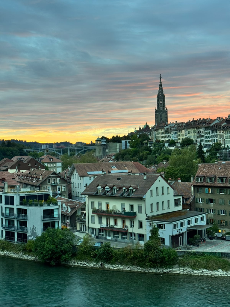
I spent that first evening walking without much structure. What caught my attention was not only how well preserved the centre seemed, but how consistently nature remained present around it. In Bern, heritage does not sit in front of the landscape. It is embedded in it.
What exactly is World Heritage here?
The Old City of Berne was inscribed on the UNESCO World Heritage List in 1983.
The property covers the historic city that developed on the peninsula enclosed by the Aare. Bern was founded in the twelfth century and expanded gradually from east to west according to a remarkably coherent urban plan. UNESCO highlights its wide market streets, narrow and deep plots, water infrastructure, arcades, fountains and the extraordinary continuity of the medieval urban structure.
The city was not preserved by remaining physically unchanged. Quite the opposite.
After a major fire in 1405, much of the wooden city was rebuilt in stone, and sandstone subsequently became one of the defining materials of Bern’s architecture. The arcades that today stretch for kilometres through the Old City also developed through this process of reconstruction and adaptation.
Later centuries brought fountains, patrician houses, monumental public buildings and further transformation. UNESCO’s significance statement is therefore particularly interesting: Bern is valued as an example of a city that continuously renewed its built fabric while respecting its original urban structure.
That made Bern highly relevant to one of the questions already emerging through Beyond the Postcard.
Preservation does not necessarily mean resistance to change. It can also mean maintaining a spatial structure capable of absorbing change over a very long period.
Looking at the city from outside
On my second day, I did something that initially had little to do with the World Heritage itinerary. I walked out of Bern towards the Bantiger.
The route took several hours and the transition out of the city was surprisingly quick. Buildings gradually gave way to smaller settlements, fields, livestock and open landscape.
What interested me was that the rural environment did not feel empty. Children were coming and going from school. Cars and bicycles moved through the roads. Farms, fields and houses appeared as part of an inhabited landscape rather than a clear “outside” to the city.
The distinction between urban and rural seemed much less abrupt socially than it initially appeared physically.
I had intended to reach the tower at the top, only to discover that the structure was a communications tower and that military personnel were present. At a certain point I was politely informed that I could go no farther.
Not quite the panoramic ending I had imagined, but by then the walk had already done something more useful: it had allowed me to see Bern from a distance for the first time.
The compactness of the city became much clearer against the surrounding landscape.
Later, when I returned to the centre, I revisited the main historic spaces: the Zytglogge, Kramgasse and Marktgasse, the fountains, Bundesplatz and the Parliament, Bern Minster and the Münsterplattform, before continuing through the lower parts of the Old City towards the river.
These are not simply isolated attractions. They reveal the logic of Bern’s urban plan.
The long streets remain strongly legible, the arcades connect commercial and public life across much of the centre, and the fountains punctuate routes that have remained active for centuries. Bern’s official tourism documentation notes around six kilometres of arcades, while the historic fountains were once important everyday meeting and water-supply points and remain part of the identity of the city today.
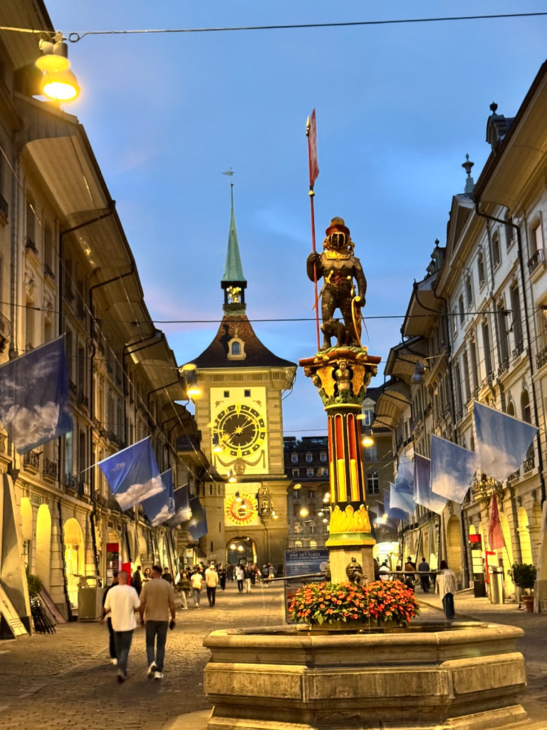
What impressed me most was how little the historic environment felt like a self-contained tourist district.
The streets remain strongly commercial. People commute through them, shop, stop at cafés and move between institutional and residential areas. UNESCO itself describes Bern today as maintaining a “very dynamic and contemporary urban activity” within the historic property.
This does not mean every function is evenly distributed, but the basic urban structure still supports a remarkable degree of everyday use.
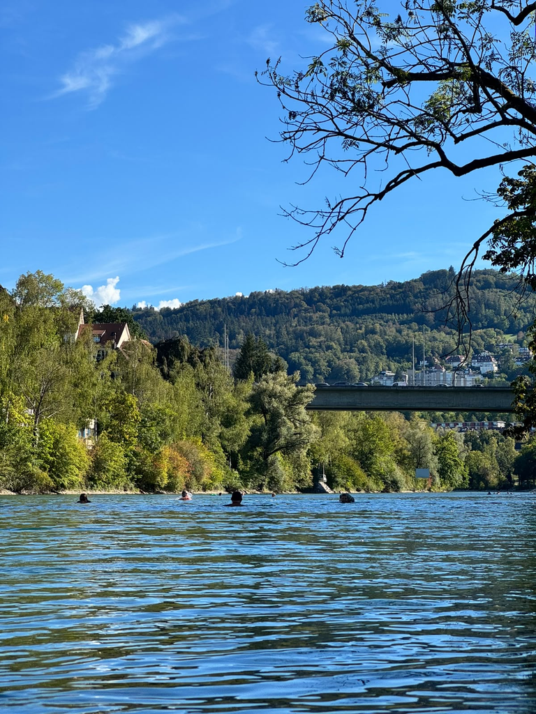
At the end of the day, I followed the Aare again and eventually did what appears to be a very Bernese thing to do: I went into the river.
The water was cold enough to make the decision feel questionable for a few seconds and entirely worth it afterwards.
The river as everyday infrastructure
Swimming in the Aare made me look differently at something that had so far appeared primarily as landscape.
The river defines the morphology of the Old City, but it is also actively used.
Bern’s own visitor information describes swimming in the Aare, walking under the arcades and looking towards the mountains as ordinary parts of local leisure culture. This is an important distinction: the river is not simply a natural feature that improves the heritage view, it structures routes, creates slopes and boundaries, shapes public space and becomes part of daily recreation.
In other words, the landscape that helps explain why medieval Bern developed where it did continues to influence how contemporary Bern is lived.
This relationship between heritage and landscape became even clearer on my third day.
I went up the Gurten, Bern’s local mountain, using the funicular.
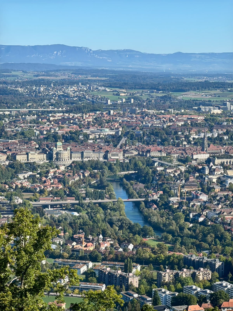
At 858 metres, the Gurten provides a wide view across the city, the Aare and towards the Bernese Alps. It is also very much an everyday leisure landscape, used for walking, families, events and outdoor activities rather than simply functioning as a viewpoint for tourists.
From above, Bern looks almost unusually compact.
The peninsula of the Old City becomes obvious. The river can be traced around it, and beyond the built-up area the landscape opens rapidly towards fields, hills and mountains.
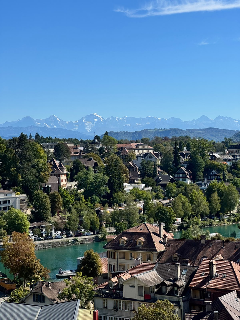
This gave me a much clearer sense of why landscape matters so much to the character of the city.
The heritage property may be urban, but its experience depends strongly on what surrounds it.
Views towards the Alps, the green slopes of the Aare valley and the hills around Bern create a larger spatial setting that cannot be reduced to the World Heritage polygon.
A city designed to keep changing
Back in the Old City, I spent more time looking at the elements that make Bern immediately recognisable.
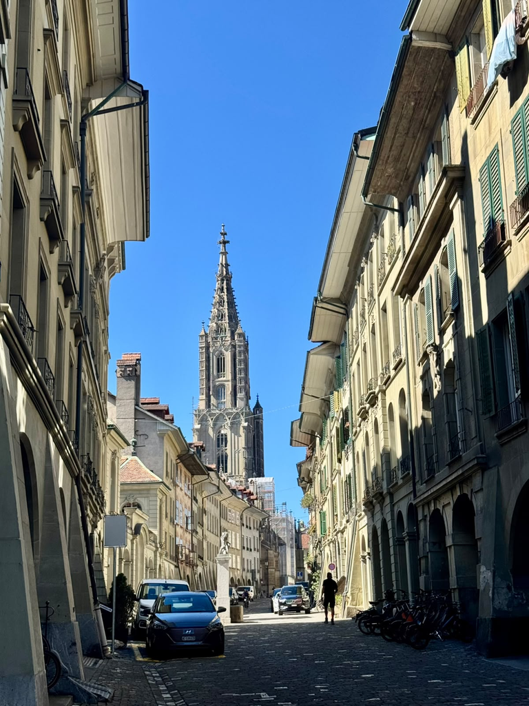
The Zytglogge remains one of the strongest points of orientation. The arcades turn entire streets into sheltered pedestrian environments. The sixteenth-century fountains add colour and smaller points of identity to an otherwise very coherent sandstone cityscape. Bern Minster anchors the skyline and the Münsterplattform opens the dense historic fabric towards the river valley.
There are also smaller passages, cellars, courtyards and changes in level that are easy to miss when moving only between the principal landmarks.
This was where one limitation of my experience became noticeable.
Bern’s physical heritage is exceptionally legible, but I sometimes felt I understood the city more through its form than through interpretation provided in the streets themselves.
The preservation is immediately visible. The reasons behind particular spaces, buildings or transformations are not always equally obvious without already knowing what to look for.
That does not mean interpretive material is absent. Bern offers guided tours and digital interpretation, including routes specifically focused on the UNESCO Old City.
My impression was simply that the urban fabric itself often speaks more strongly than explanatory infrastructure in public space.
For Beyond the Postcard, this raised an interesting question. A place can be extremely well preserved and heavily used while still containing histories that remain less visible to someone encountering it independently. Participation and interpretation are not the same thing, but both concern how people connect meaning to place. What residents recognise intuitively through familiarity may require another form of translation for outsiders.
Who gets to experience the centre?
There was another aspect of Bern that I could observe but not fully investigate: prices, food, accommodation and everyday consumption felt significantly more expensive than in most of the cities I had visited before.
For me as a traveller, this immediately affected how I used the city: where I ate, how long I stayed in particular places and what activities seemed accessible.
But I did not speak with enough local residents to understand how far my experience as a visitor reflected everyday realities for people living in Bern. So I would not turn that impression into a conclusion about accessibility or exclusion.
It did, however, raise a useful question about habitability and heritage.
A historic centre can be physically public and beautifully maintained while the economic conditions of using it vary greatly between people.
Who can live nearby? Who can spend time there without thinking constantly about cost? Which activities remain accessible across different incomes?
These questions would require housing, income, commercial and demographic data, alongside local perspectives, before anything meaningful could be concluded.
Again, walking identified a question rather than answering it.
That distinction has become increasingly important throughout the project.
Seeing Bern twice
That evening I returned to the Gurten.
The reason this time was not heritage at all. I wanted to see the stars and look at Bern from above at night.
It ended up being one of the most useful ways to finish the city.
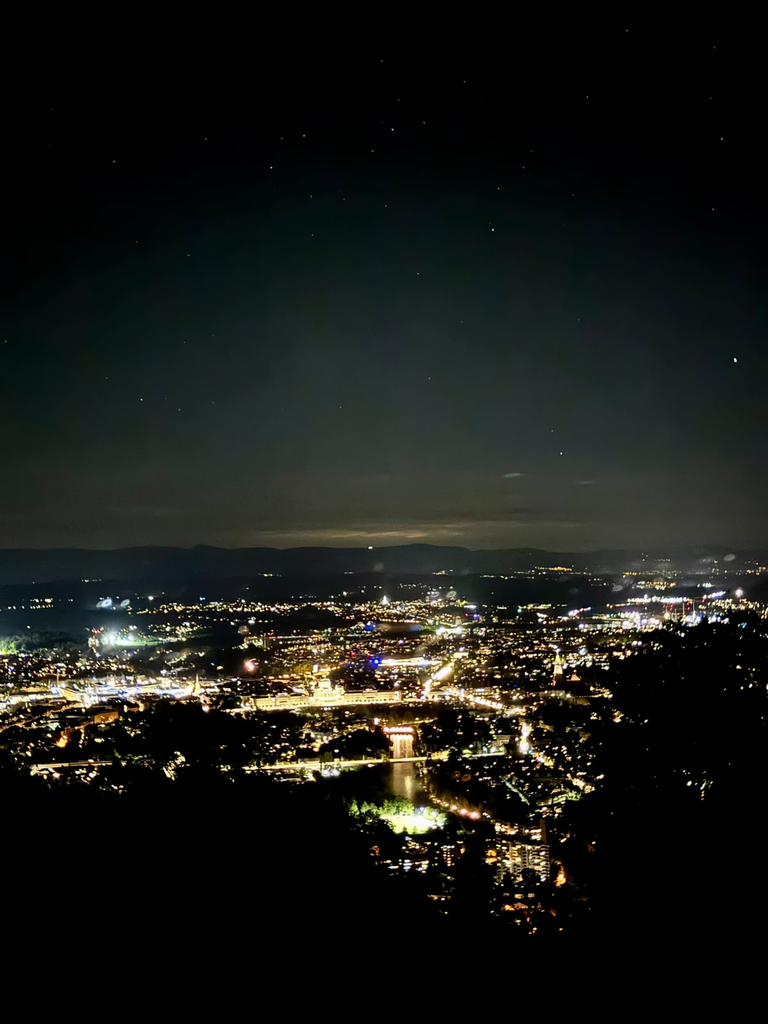
During the day, the city can be read through buildings, streets, monuments and people.
At night, much of that detail disappears.
What remains is the larger geography: a compact concentration of light, surrounded by darkness, hills and the wider landscape.
The Old City becomes harder to distinguish as individual heritage objects but easier to understand as part of a territory.
That shift in scale was important.
World Heritage management necessarily works with boundaries, buildings, regulations and particular attributes of Outstanding Universal Value. But the experience of a heritage city rarely remains inside those categories.
The Aare, Gurten, surrounding countryside and distant Alps are not simply background scenery to Bern.
They help organise how the city is perceived, reached and used.
What Bern left me with
Bern added another layer to the journey.
Amsterdam had emphasised overlapping urban functions. Bruges raised questions about continuity of use. Brussels showed how several centres can coexist inside one capital. Luxembourg made participation and different lived geographies much more explicit. Strasbourg highlighted connections across historical and political boundaries.
Bern made me think about the relationship between the heritage city and its wider landscape.
Its World Heritage value rests strongly on the remarkable continuity of the medieval urban plan. But that plan itself was created in response to geography: a hill enclosed by the Aare.
Eight centuries later, that geography still matters.
The river remains an everyday recreational space. The slopes and bridges shape mobility. The surrounding hills provide immediate access to landscapes that feel rural while remaining closely connected to the city. The Alps remain visually present enough to become part of the identity of urban space.
At the same time, Bern demonstrates something important about preservation.
Its historical character did not survive because the city stopped changing. UNESCO specifically recognises the repeated renewal of its buildings while retaining the fundamental urban structure.
That makes the Old City less an example of a preserved historical moment than of long-term adaptation within a durable spatial framework.
For Beyond the Postcard, perhaps that is Bern’s most useful contribution.
Habitability is not only about what happens inside buildings or how streets are commercially used. It is also about the relationship between a city and the landscapes, resources and everyday practices around it.
Walking from medieval streets into the river, from the city into farmland, and finally looking back towards Bern from the surrounding heights made that relationship difficult to ignore.
The city remained recognisable every time. But from each position, it was a slightly different Bern.