


10/Sep – 13/Sep
Strasbourg felt different from the cities that came before it.
In Amsterdam and Bruges, water had been central to the way I understood the historic city. Brussels had made me think about fragmentation and multiple urban centres. Strasbourg seemed to bring several of these ideas together, but with another layer that became increasingly difficult to ignore: the city is defined by connections across periods, landscapes and borders.
I arrived knowing Strasbourg primarily through its cathedral, its European institutions and its position next to Germany. Walking through it made those elements feel much less separate than they appeared on a map.
The medieval streets of the Grande-Île, nineteenth-century avenues of the Neustadt, canals, parks, European institutions and the Rhine all belong to different chapters of the city, yet they remain surprisingly close to one another.
That became the thread of my three days there: following the city from its historic centre outward, watching one Strasbourg gradually become another without ever completely leaving the previous one behind.
What exactly is World Heritage here?
The UNESCO property is Strasbourg, Grande-Île and Neustadt.
The Grande-Île, the historic island at the centre of the city, was first inscribed on the World Heritage List in 1988. In 2017, the property was extended to include significant parts of the Neustadt, the large urban expansion developed while Strasbourg was under German administration between 1871 and 1918. Today, the property covers 183 hectares, with a much larger buffer zone around it.
That extension is especially important because it changes how the heritage of Strasbourg is understood.
The World Heritage value does not lie only in a medieval centre dominated by an exceptional Gothic cathedral. UNESCO describes the Grande-Île and Neustadt together as an urban ensemble shaped by the interaction of French and Germanic influences over several centuries. Medieval and Renaissance architecture, French eighteenth-century classicism and the monumental urbanism of the German imperial period coexist within the same city.
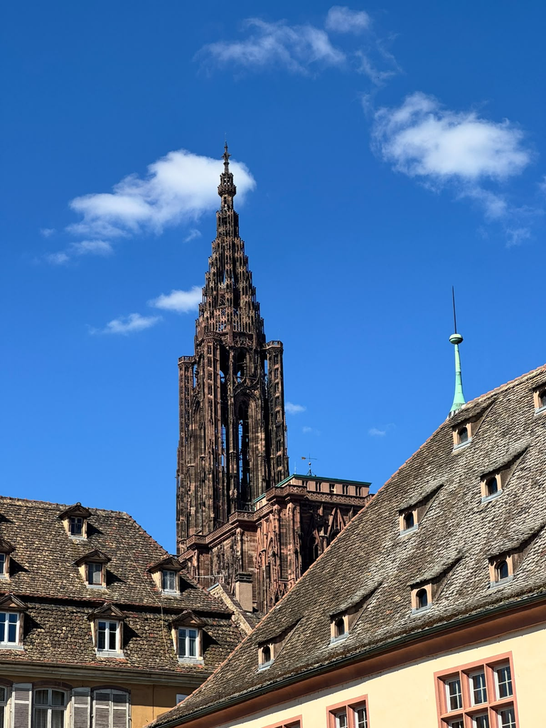
The cathedral remains the major visual reference point. Its spire repeatedly reappeared during my walks, sometimes from surprisingly far away. But Strasbourg’s heritage is also about the city that accumulated around it.
That made the property particularly relevant to Beyond the Postcard. Here, historical layering is not something hidden beneath the present city. In many places, it determines the urban structure itself.
Learning the city through its history
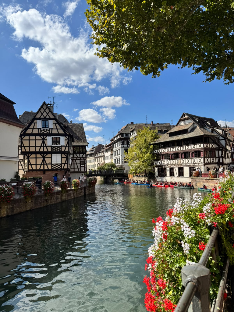
I spent much of my first full day around the Grande-Île, moving through places such as Place Kléber, Place Gutenberg, the Cathedral district, Palais Rohan, the canals around Petite France, the Ponts Couverts and Barrage Vauban.
These are the places through which most visitors first encounter Strasbourg, but walking between them also makes clear how strongly the city is organised around water.
The Grande-Île is literally surrounded by branches of the Ill, while canals and quays repeatedly open and close views through the historic centre. The cathedral appears at the end of narrow streets, disappears behind buildings and then returns again from bridges and squares.
One of the most useful stops was the Musée Historique de la Ville de Strasbourg.
The museum follows around nine centuries of the city’s history, from the medieval period through successive political changes and eventually to the establishment of European institutions. Its central object is an enormous relief model of Strasbourg from 1727, commissioned during the reign of Louis XV.
Seeing the city in miniature was particularly interesting after walking through it.
Streets I had just crossed became part of a wider defensive and urban system. Strasbourg’s position between different political worlds, which can sound abstract when described historically, became much more spatially understandable.
The museum also helped make sense of something that would become central during the rest of my stay: Strasbourg has repeatedly changed political context without completely erasing the city that came before.
It has been a free city within the Holy Roman Empire, incorporated into France, transformed under German rule after 1871, returned to France and later developed into one of Europe’s principal institutional centres.
The result is not a city divided neatly into historical periods. They remain physically mixed.
From the Grande-Île to the Neustadt
The transition from the Grande-Île towards the Neustadt is one of the most interesting walks in Strasbourg.
Around Place de la République, the scale changes.
The narrow medieval fabric gives way to broader avenues, monumental public buildings, gardens and long perspectives. This was part of an ambitious expansion developed after Strasbourg became part of the German Empire in 1871. The Neustadt was conceived as a modern administrative and residential city, influenced partly by Haussmannian planning but expressed through a distinctly German architectural language.
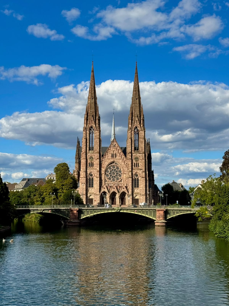
Walking from one to the other makes the logic of the UNESCO extension very convincing.
They are different Strasbourgs, but not isolated ones.
The medieval centre and the nineteenth-century city form a continuous landscape in which the cathedral still acts as a visual anchor. UNESCO explicitly identifies this relationship between Grande-Île and Neustadt, together with the city’s waterways, as part of what gives Strasbourg its particular urban character.
For my project, this raised a slightly different question from the previous cities: what does continuity mean when heritage includes change itself?
Strasbourg’s value depends partly on the fact that new political regimes did not simply reproduce what already existed. They introduced new architectural languages, new institutions and new ways of organising the city.
Preservation here therefore cannot mean fixing Strasbourg at one preferred historical moment.
It requires recognising how multiple histories remain legible at once.
This became visible even through relatively ordinary details. The monumental Notre-Dame Cathedral was continuously filled with visitors, while another historic church I entered, Saint-Pierre, was almost empty.
Two religious buildings can belong to the same historical city while occupying completely different places in its contemporary mental and visitor geography.
The difference was not architectural importance alone. It was also about visibility, narrative and how people move through the city.
A European city beyond the historic centre
By my third day, I deliberately moved farther away from the most obvious heritage landscape.
Following the Canal de la Marne au Rhin, the urban scenery gradually changed until the large contemporary buildings of Strasbourg’s European district began dominating the horizon.
The European Parliament is difficult to miss. Nearby, the Council of Europe and the European Court of Human Rights reinforce the impression of a city whose international role has become physically embedded in its landscape.
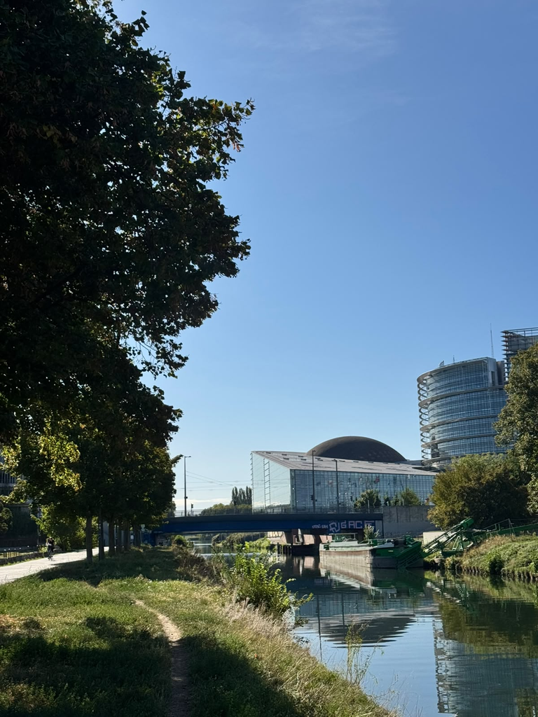
This part of Strasbourg initially looks disconnected from the cathedral and historic streets.
Architecturally, it largely is.
But historically the relationship is more interesting.
A city repeatedly positioned between France and Germany eventually became one of the symbolic centres of European cooperation. Strasbourg today hosts the European Parliament as well as major Council of Europe institutions. UNESCO itself notes the city’s contemporary role as one of Europe’s institutional capitals alongside Brussels and Luxembourg.
That does not mean there is a simple historical progression from conflict to European unity, but the spatial sequence is striking.
In a relatively short walk, it is possible to move from medieval religious architecture to German imperial urbanism and then to institutions created within twentieth-century European political structures.
Once again, several versions of the city exist almost side by side.
Green space as part of the city
From the European district I continued towards the Parc de l’Orangerie.
After several days focused strongly on buildings, heritage boundaries and dense historic streets, the amount of green space in Strasbourg became increasingly noticeable.
The park did not feel like an attraction that needed interpretation. People were walking, running, sitting, moving with children and simply spending time there. That ordinary use mattered.
World Heritage discussions easily become centred on exceptional places. Habitability is often much more visible in spaces whose value comes precisely from being ordinary enough to use without thinking about them.
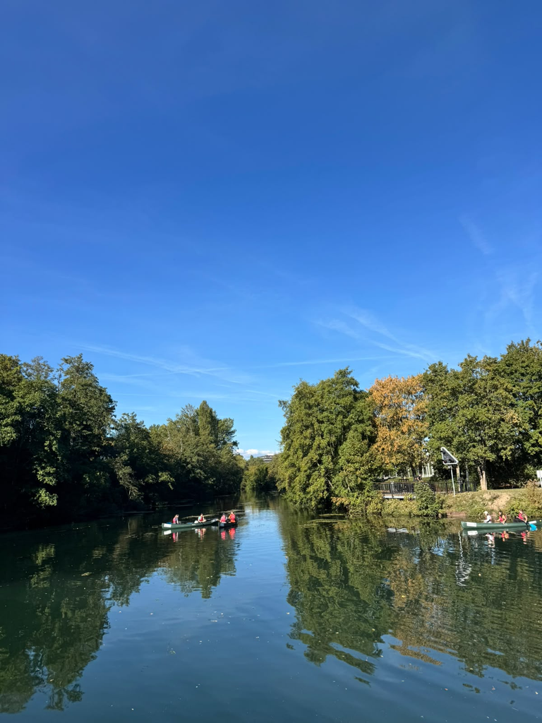
This relationship between heritage and environmental quality is not separate from current heritage management either. UNESCO has documented Strasbourg’s work to incorporate natural values, vegetation and microclimate into the management of the Grande-Île and Neustadt, explicitly linking these questions to the city’s liveability.
That is useful because it widens the meaning of conservation.
Protecting a historic urban landscape is not only about façades and monuments. Trees, waterways, shade, mobility and public space influence how that landscape can actually be inhabited.
Strasbourg made that connection particularly visible because water and greenery repeatedly provide continuity between very different parts of the city.
Walking until France became Germany
I continued east until Parc des Deux Rives.
This was one of the places I most wanted to experience because here the idea of connection becomes almost literal.
The park occupies both banks of the Rhine, one in Strasbourg and the other in the German city of Kehl. Between them is the pedestrian and cycling Passerelle Mimram, created as part of the cross-border garden and conceived explicitly as a symbol of cooperation between the two sides.
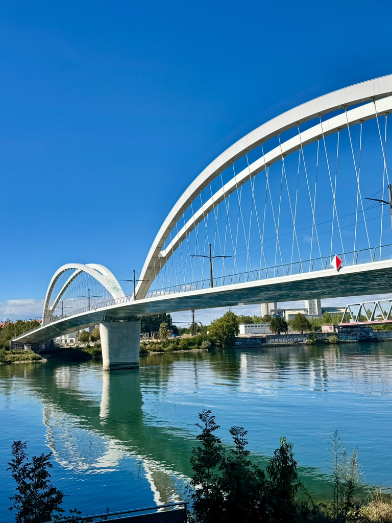
There was no dramatic transition: a river, a bridge, people walking and cycling, and suddenly I was in Germany.
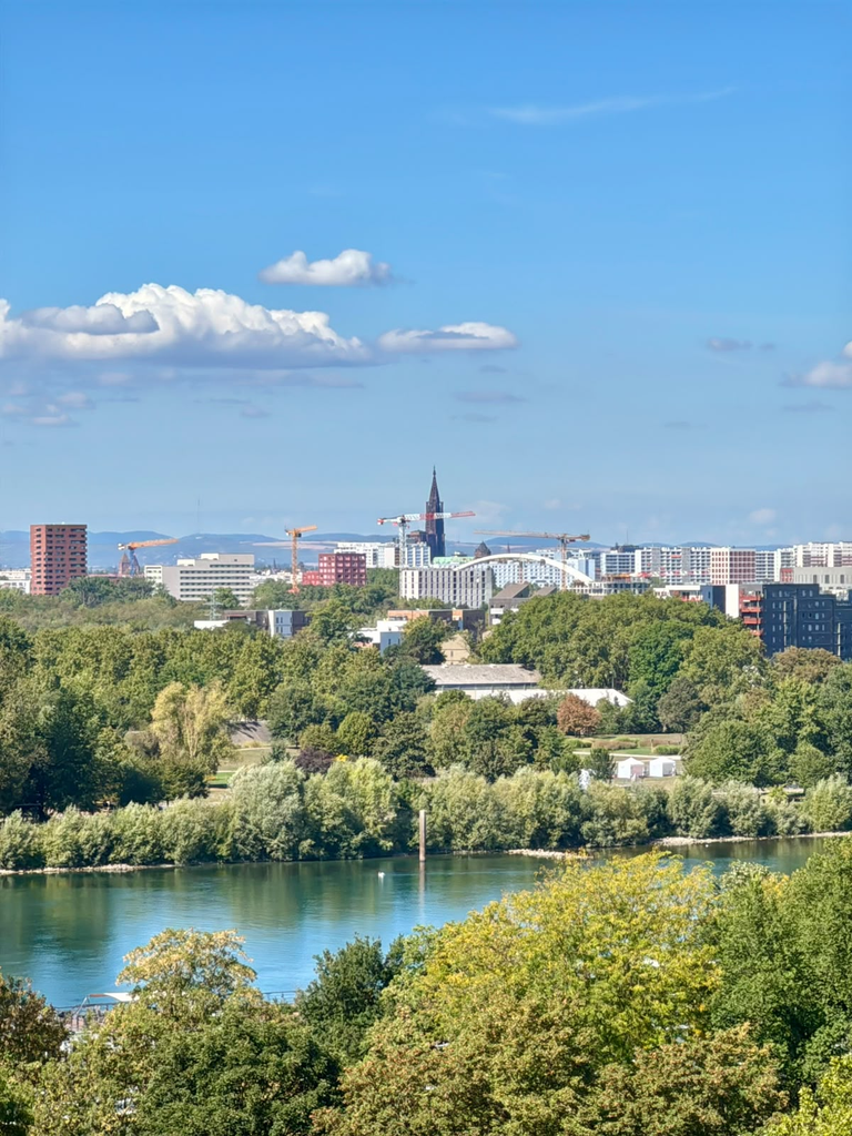
I wandered through Kehl and eventually climbed a viewing tower in one of its parks. From there Strasbourg appeared again in the distance.
What surprised me was how recognisable the cathedral remained.
After spending the day moving through contemporary institutions, canals, parks and another country, the same medieval spire still anchored the city visually from across the Rhine.
It was probably the clearest single image of Strasbourg I took away from the trip.
The border exists politically. Historically it has mattered enormously. Spatially, however, contemporary everyday life can cross it almost casually.
This is not merely symbolic. Strasbourg and Kehl are connected through public transport, pedestrian and cycling infrastructure and a wider cross-border metropolitan reality. A heritage city therefore does not necessarily become less itself by becoming more connected beyond its boundaries.
In Strasbourg, connection seems to be part of the identity.
Continuity without sameness
I returned towards Strasbourg through a very different landscape from the one in which the day had begun.
The European district, Orangerie, Rhine and Kehl had pushed the World Heritage property physically into the background, but they had not made the questions of the project less relevant.
If anything, they made the limitation of looking only inside the UNESCO boundary clearer.
A formal heritage polygon tells us where particular Outstanding Universal Value has been recognised. It cannot by itself describe all the systems that make that place function.
Residents may work outside it. Visitors arrive through infrastructure beyond it. Parks outside the property contribute to quality of life within the city. Political institutions elsewhere shape Strasbourg’s identity internationally. And daily movement extends across a national border.
For a spatial approach, heritage therefore becomes part of a broader network rather than an isolated area. This also affects participation.
The people with an interest in the historic city are not necessarily limited to those living directly inside the UNESCO property. Someone living in the Neustadt, commuting through the centre, studying nearby, crossing daily from Kehl or simply using the parks and public spaces can develop a very different relationship with Strasbourg.
Understanding a living heritage city therefore involves asking not only what is located inside a protected area, but which relationships connect people to it.
That distinction is becoming increasingly important to Beyond the Postcard.
What Strasbourg left me with
Amsterdam had made me think about overlapping urban functions. Bruges brought the question of functional continuity. Brussels emphasised connections between different centres. Luxembourg pushed the project towards participation and the possibility of mapping different lived experiences.
Strasbourg added something else: continuity does not require sameness.
The Grande-Île and Neustadt were created under different political systems and according to very different urban principles, yet today UNESCO recognises them together.
The European district introduces another architectural and political language.
The Rhine is simultaneously a geographical division and a space of connection.
Historic streets, canals, tramways, parks, international institutions and cross-border movement all contribute to a city whose identity seems to have been constructed through repeated encounters with what lies beyond itself.
That perhaps explains why Strasbourg felt surprisingly coherent despite containing so many distinct layers.
The coherence does not come from everything looking the same, it comes from the relationships between them.
Walking from the cathedral to the German border made that visible in a way a list of monuments probably never could. The city gradually shifted from medieval streets to monumental nineteenth-century avenues, contemporary European institutions, large parks and eventually another country, while certain elements — water, movement, landscape and the distant cathedral — continued linking those experiences together.
For Beyond the Postcard, Strasbourg became a reminder that a World Heritage City is not only defined by the landscapes it preserves.
It can also be understood through the connections that allow different landscapes, histories and communities to remain part of the same city.