


03/Sep – 6/Sep
Brussels was the first city on the journey where I struggled to understand what exactly I was looking at.
Amsterdam had its canals. Bruges had an unusually coherent historic centre. Brussels seemed to change almost every few streets.
I arrived expecting this to make the city harder to read. By the end of three days, I was beginning to think that this apparent fragmentation was precisely what made it interesting.
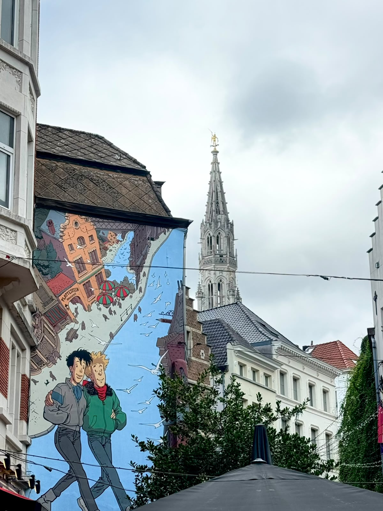
My walks took me through the Grand-Place and its surrounding streets, Marolles, Sablon, the Royal Quarter, the Art Nouveau neighbourhoods around Saint-Gilles and Ixelles, Matongé, the European Quarter and Cinquantenaire. These places are geographically close, but they can feel like very different cities.
Perhaps Brussels is not best understood by looking for one dominant urban identity. It may be better approached as a city made of many centres, landscapes and communities that overlap, sometimes connect naturally and sometimes seem to sit beside one another without fully meeting.
What exactly is World Heritage here?
Unlike Bruges, Brussels does not have an entire historic centre inscribed as one UNESCO property. The World Heritage landscape here is fragmented.
At the heart of the Lower Town is La Grand-Place, inscribed in 1998. The property itself is very small, but extraordinarily dense in historical meaning. The square developed as the political and commercial centre of Brussels and brings together the Gothic Town Hall with the richly decorated guild houses that were largely rebuilt after the bombardment of Brussels by French forces in 1695. UNESCO recognises it as an exceptional example of the successful blending of architectural and artistic styles associated with the political and commercial culture of the city.
Its surroundings are almost as important to understanding it. The buffer zone includes the historic Lower Town, traditionally known as the Îlot Sacré, where the medieval street morphology coexists with later interventions such as the Galeries Royales Saint-Hubert, the Bourse and the nineteenth-century boulevards created after the covering of the Senne.
Brussels also contains another UNESCO property that tells a very different story: the Major Town Houses of the Architect Victor Horta, inscribed in 2000. Hôtel Tassel, Hôtel Solvay, Hôtel van Eetvelde and the Maison & Atelier Horta represent some of the most influential early expressions of Art Nouveau, with new relationships between structure, light, circulation and domestic life.
This already made Brussels unusual within the trip. The World Heritage here is not one continuous historical landscape. It ranges from a monumental civic square to individual houses dispersed through living neighbourhoods.
That fragmentation became useful for thinking about the city itself.
One square, many functions
I first explored central Brussels through the familiar sequence of Manneken Pis, Rue du Chêne, the comic-strip murals, Notre-Dame de la Chapelle, Marolles, Jeu de Balle and Sablon before climbing again towards Mont des Arts, Place Royale and the Royal Quarter.
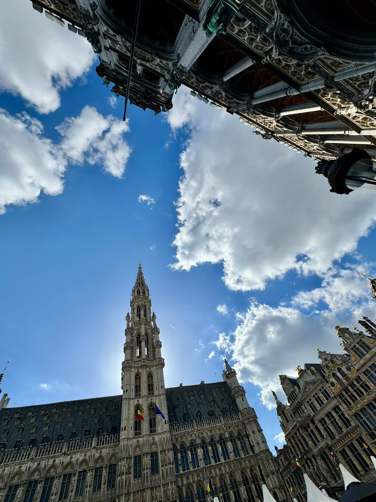
The transitions are surprisingly fast. Around the Grand-Place, historic architecture, restaurants, shops, visitors and municipal functions occupy an extremely compressed space. A short walk towards Marolles produces another landscape entirely. Continue towards Sablon and the commercial and architectural character changes again. Climb towards the Royal Quarter and another Brussels appears.
This became one of the strongest impressions of the city: distance alone explains very little.
A few hundred metres can separate places associated with very different forms of commerce, housing, public life, symbolic power and cultural identity.
The Grand-Place itself made this even clearer when I met Paula Cordeiro and Florence Papazoglakis, who work directly with the World Heritage site.
Our timing could hardly have made the square feel less like a static monument. Brussels Beer Weekend was taking place, the Grand-Place was busy and a torrential downpour began almost as soon as we started exploring it.
We first looked at the square from above and then moved through some of the surrounding spaces, including the small world of the traditional puppet theatre, before continuing across several rooftops. From above, the relationship between the Grand-Place and the dense city around it became much easier to understand.
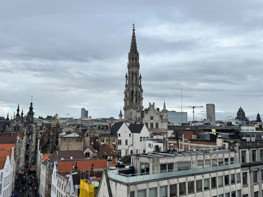
Paula and Florence explained the history of the property, restoration work and some of the questions they encounter in managing such an intensely used area.
One of the themes was how to encourage the centre to remain meaningful for people who actually live in Brussels.
Tourism is obviously central to the economy and international identity of the area, but its concentration also influences which businesses can operate there, how streets are used and what reasons residents have to return to the centre in their everyday lives.
This is not simply a local impression. UNESCO itself identifies strong commercial, real-estate and tourism pressures within the Grand-Place buffer zone, alongside questions of mobility, housing, social mix, vacant buildings and upper floors. The management plan has explicitly sought a more diverse functional mix, including housing and higher-quality, more diversified commerce rather than an economy dominated by activities aimed primarily at mass tourism.
Walking the surrounding streets makes the issue tangible.
Chocolate, waffles, fries, beer and souvenir businesses appear repeatedly. These activities are part of Brussels and part of the experience visitors seek, but their concentration can also make parts of the historic centre increasingly specialised. The important question is not whether those businesses should exist.
It is what happens when one set of functions becomes much more competitive than others within a very limited urban area.
The floors above the city
One detail from my conversation with Paula and Florence stayed with me particularly strongly.
Ground floors are only one part of the centre.
Some commercial properties leave the upper floors unused or use them for storage, even where policies try to discourage vacancy. The issue appears in UNESCO’s own assessment of the buffer zone, which identifies abandoned buildings and storeys among the challenges faced by the historic centre.
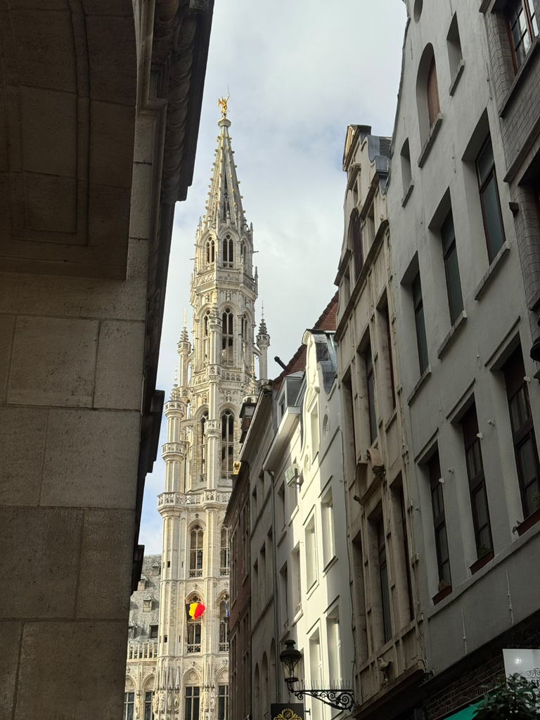
Once they mentioned it, I started looking upwards. That changed the way I read the streets.
A ground floor can be intensely active while several levels above it contribute very little to the daily life of the neighbourhood. Architecturally, the street remains complete. Functionally, parts of it can be surprisingly empty.
In a city where housing affordability is a major concern and visible homelessness is part of the central urban landscape, those empty floors become difficult not to notice. My short visit could not establish the scale of the phenomenon or its relationship to the wider housing market, but it revealed precisely the kind of question that walking alone would probably not have led me to ask.
This is where conversations began to change the project. Observation had shown me commercial specialisation. Local professional knowledge pointed towards what was happening vertically, behind and above the façades. The city suddenly had another geography.
Many Brussels within Brussels
The following walks made this increasingly obvious.
In Marolles, Jeu de Balle and Rue Haute, the city felt markedly different from Sablon only a short distance away. Moving through Mont des Arts towards Place Royale introduced another layer associated with monumental institutions and state representation.
Elsewhere, Saint-Gilles and Ixelles added an entirely different form of heritage.
Victor Horta’s houses are remarkable precisely because they were conceived as places to live. Their innovation was not limited to decoration. UNESCO highlights the way Horta reorganised domestic space through open plans, light, new materials and circulation adapted to the lives of their occupants.
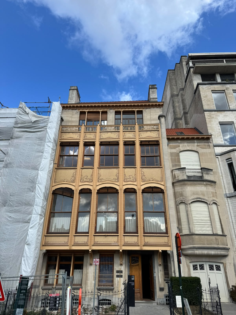
Today those buildings exist within neighbourhoods that continue to change around them.
Avenue Louise provides a particularly clear example. UNESCO notes that the environment of Hôtel Solvay changed significantly as what had been an elegant residential avenue became a major urban artery shaped by later property development and large office buildings.
This creates a very different relationship between heritage and city from the Grand-Place. At the Grand-Place, the challenge involves managing an extremely concentrated monumental and visitor landscape. With Horta, isolated heritage properties have to remain meaningful within broader neighbourhoods whose morphology, mobility and functions have continued evolving.
Walking onwards through Flagey and Matongé before reaching the European Quarter added still more versions of Brussels.
The changes were cultural as much as architectural: languages, businesses, rhythms of movement, public spaces and the people occupying them could vary substantially over very short distances.
By the time I reached the European institutions, the city had shifted again.
A city of centres
On my final day I spent time around Cinquantenaire, where something simple caught my attention: residents and visitors appeared to use the same monumental landscape quite naturally.
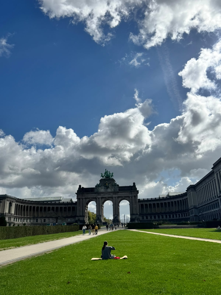
People exercised, crossed the park, sat on the grass, photographed the monuments and simply passed through.
It was a useful counterpoint to some of the more specialised spaces I had encountered in the historic centre.
Later that day I met Karel Dendooven from Bruges, and our conversation inevitably returned to tourism, urban functions and the question of who historic centres are ultimately able to accommodate.
What Brussels added to this discussion was a different spatial scale. Here, the issue did not feel limited to one historic core.
When I described the city to Paula and Florence as somewhat disconnected, they offered a more useful interpretation: Brussels is made of multiple small centres.
That distinction matters. What initially looks like fragmentation can also represent diversity and polycentricity. Neighbourhoods can maintain strong identities precisely because they are not absorbed into a single homogeneous centre.
The difficulty is how those centres relate to one another.
A city containing multiple identities is not necessarily problematic. In fact, this may be one of Brussels’ greatest strengths. The question is whether different populations, activities and places can intersect in ways that allow the city to remain shared rather than becoming increasingly specialised into separate territories.
Tourism is one example. Institutions are another. Housing, commerce, mobility and cultural identity produce their own geographies as well.
These landscapes do not align neatly.
Looking at the city through its connections
Brussels therefore pushed the project in a slightly different direction. Amsterdam had made me think about overlapping urban landscapes. Bruges made me consider the continuity of everyday functions within an extraordinarily coherent historic centre. Brussels introduced the importance of connections between landscapes.
A city can contain many different centres without needing to collapse them into one identity. Diversity is not something to solve. But understanding how these different Brussels interact requires looking beyond the physical form of individual heritage sites.
Who uses the Grand-Place, and when? What brings residents back to the historic centre? How does a commercial street change when the majority of its ground floors serve one type of user? What happens above those shops? How do residents experience the transitions between neighbourhoods that an outside visitor can only observe superficially? Which spaces successfully accommodate several different groups at once?
These are questions that neither heritage inventories nor demographic maps can answer by themselves.
Spatial data can show housing, mobility, land use, commercial activity and population patterns. Walking can reveal where transitions become perceptible. Conversations can explain processes that remain invisible from the street. More structured participation can then reveal something neither an external observer nor an aggregate dataset can provide: how different groups actually understand and use the same city.
This was becoming increasingly important to Beyond the Postcard.
The objective was no longer simply to look beyond the tourist image of each city. It was becoming a way of asking how many different urban realities can occupy the same geographical space, and how we might begin to recognise them.
What Brussels left me with
I never found one Brussels. And after three days, I no longer thought I was supposed to.
There was the monumental Brussels of the Grand-Place and Royal Quarter; the neighbourhood life of Marolles; the Art Nouveau city embedded in Saint-Gilles and Ixelles; the diasporic and commercial landscapes around Matongé; the institutional European city; and the parks and public spaces where some of those distinctions became less important.
They are not independent cities.
People move between them, economic pressures cross their boundaries and decisions taken in one part of the city affect others. Yet each produces a different experience of what Brussels is.
Perhaps this is why its World Heritage is so interesting.
The Grand-Place represents an extraordinarily concentrated historical centre. Horta’s houses are scattered pieces of architectural innovation embedded in everyday neighbourhoods. Around both of them is a contemporary capital that is multilingual, international, residential, commercial and institutional all at once.
Brussels made the idea of multiple cities within one city much less metaphorical for me. They can sometimes be walked between in a matter of minutes. The challenge, and perhaps also the opportunity, is not to make them identical, but to understand where they meet, who moves between them and what allows their differences to remain part of one shared city.