


6/Sep – 10/Sep
Luxembourg was the only stop on this journey that did not feel entirely like an arrival.
I had lived and worked there before, knew parts of the city well and already had friends and professional connections. That changed the project immediately. In Amsterdam, Bruges and Brussels I was largely trying to understand a city in a few days. In Luxembourg I could return to places I already knew, but with a different question in mind and, thanks especially to Shaaf Milani-Nia and the people she connected me with, with much greater access to those who interpret, manage, research and make decisions about the city.
That made Luxembourg less of a first impression and more of a conversation.
My first evening, however, started somewhere much less formal: the Schueberfouer.
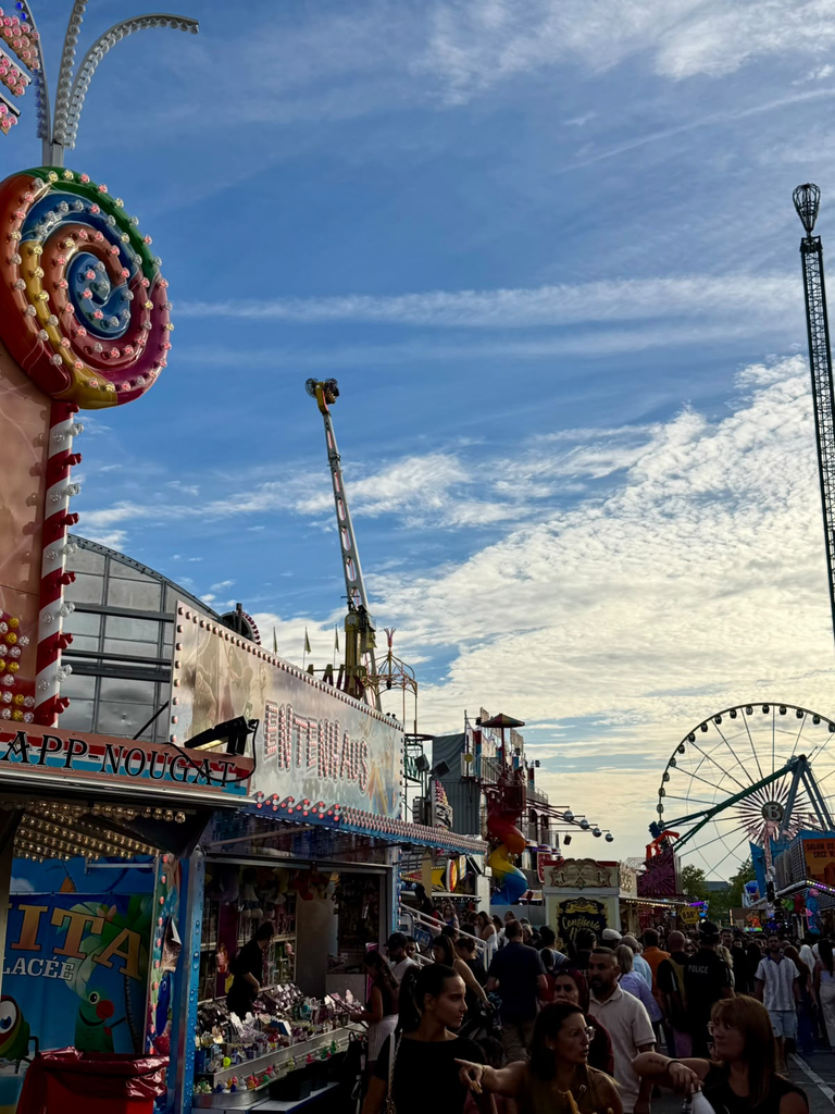
I knew the fair existed, but I had underestimated it completely. The whole Champ du Glacis had become an enormous landscape of rides, food stalls, lights, music and people. What seemed at first almost unrelated to the World Heritage project quickly became a useful introduction to another side of heritage.
The Schueberfouer was founded in 1340 by John the Blind as an annual market. It first took place around the Plateau du Saint-Esprit, later moved towards Limpertsberg and eventually settled at the Glacis in 1893. Over centuries it evolved from a commercial and cattle market into the large funfair it is today, while remaining deeply embedded in local collective life. In 2026, 214 fairground establishments occupied the site.
It was an unexpectedly appropriate beginning. Heritage in Luxembourg was going to be much easier to understand if I stopped thinking only about what was built.
A fortress that became a city
The UNESCO property is officially called City of Luxembourg: its Old Quarters and Fortifications. It was inscribed on the World Heritage List in 1994 and covers 29.94 hectares, surrounded by a 108.73-hectare buffer zone.
Its geography explains much of its history.
Luxembourg developed around the Bock promontory, a steep rocky outcrop above the Alzette valley. Count Siegfried acquired the site in 963 and established a castle there, while settlements developed both above and below the cliffs. Over the following centuries, Luxembourg’s strategic position made it one of Europe’s most important fortified cities. Burgundian, Spanish, French, Austrian and Prussian powers successively modified and reinforced its defences before much of the fortress was dismantled after the Treaty of London in 1867.
What remains is not simply one wall or one monument.
The World Heritage property is a combination of fortifications, streets, public buildings and old quarters whose form was profoundly shaped by defence, topography and the coexistence of upper and lower settlements. UNESCO itself describes the old quarters as carrying the imprint of the people who once lived and worked there.
This became much more tangible on my second day, when Pit, a guide from the Luxembourg City Tourist Office whom I had met through Shaaf’s network, offered to show me the city.
We started at Place Guillaume II. Four hours later, I was surprised four hours had passed.
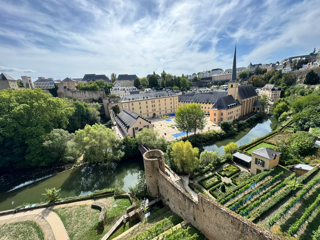
We moved through most of the major places inside the World Heritage area, but the value of the tour was not simply seeing them.
Pit seemed to carry an archive of small stories.
Dates, buildings, political changes and military engineering were constantly mixed with anecdotes, legends and details that made individual places easier to remember. By the time we reached the Bock, the fortress no longer felt like a collection of disconnected remains.
The Bock Casemates made this especially clear.
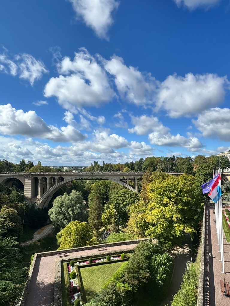
The promontory is where the city’s early history is conventionally anchored, while the underground defensive system developed much later. Spanish engineers began constructing casemates there in the seventeenth century, later expanded under French and Austrian control. Parts of the surviving network still allow the visitor to move physically through the military logic that once shaped Luxembourg.
Pit also told me the story of Melusina, the legendary wife of Siegfried who, after her secret was discovered, disappeared into the Alzette.
It would be easy to dismiss this as tourist folklore. Yet stories like this perform a different heritage function from a date on an interpretation panel. They connect landscape, memory and identity. The Bock becomes simultaneously geological formation, military infrastructure, foundation story and mythical landscape. The official tourism narrative still explicitly links Siegfried, the Bock and Melusina today.
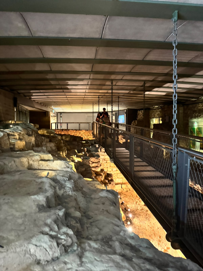
This was one of the strongest lessons of the tour: a city’s heritage is held together not only by surviving structures, but also by the stories through which those structures are made legible.
Later that day, I visited Shaaf at the Ville de Luxembourg offices and met part of the team working around the World Heritage site and related city projects.
That shifted the journey again. Until that point, I had largely been looking at Luxembourg as an inherited urban landscape. The following days were increasingly about how that landscape is managed in the present.
Who gets to shape a heritage city?
The next morning, Shaaf and several colleagues joined me for a small discussion at the Lëtzebuerg City Museum.
We talked about the history of the World Heritage property, how interventions within and around it are approached, and something that had become increasingly central to my own project: how to bring people into decisions about the city they inhabit.
Luxembourg makes that question particularly interesting.
At the end of 2025, almost 70% of Luxembourg City’s residents were foreign nationals, and municipal information describes a city comprising a very large number of nationalities. This international character is one of the city’s defining qualities, but it complicates the idea of a single stable “local population”.
People arrive for work, study, European institutions or international companies. Some settle permanently; others remain for only part of their lives. Many people who experience Luxembourg every day do not live within the municipality at all.
So who exactly should be heard when discussing the future of a heritage city?
The answer cannot simply be “residents”, if residency itself contains such different relationships with place.
That discussion connected strongly with the direction Beyond the Postcard had been taking since Amsterdam. A physical city can be mapped with remarkable precision, but the cities people actually experience are much less stable.
A long-term resident, a recent international arrival, a cross-border worker, a student, a person living in the historic centre and someone commuting into it each morning may all occupy Luxembourg differently.
Their maps of relevance would probably not be identical.
This is where participation becomes more than consultation as a procedural step. It can become a way of identifying urban geographies that conventional spatial data do not necessarily reveal: places of attachment, perceived barriers, overlooked routes, spaces people avoid, places where different groups meet, or parts of the city that matter greatly to one community and almost not at all to another.
The challenge is then to connect this situated knowledge with the analytical tools already used to understand the city.
That intersection between participation and spatial analysis became one of the most important ideas I took from Luxembourg.
Several cities separated by a few metres of height
After our conversation, I walked down towards the Grund and followed the Alzette through the lower city.
Luxembourg’s topography makes the idea of multiple urban landscapes unusually literal.
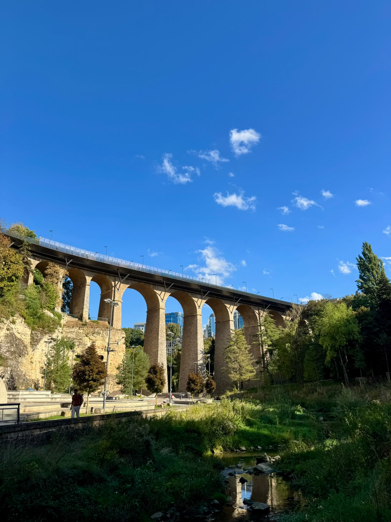
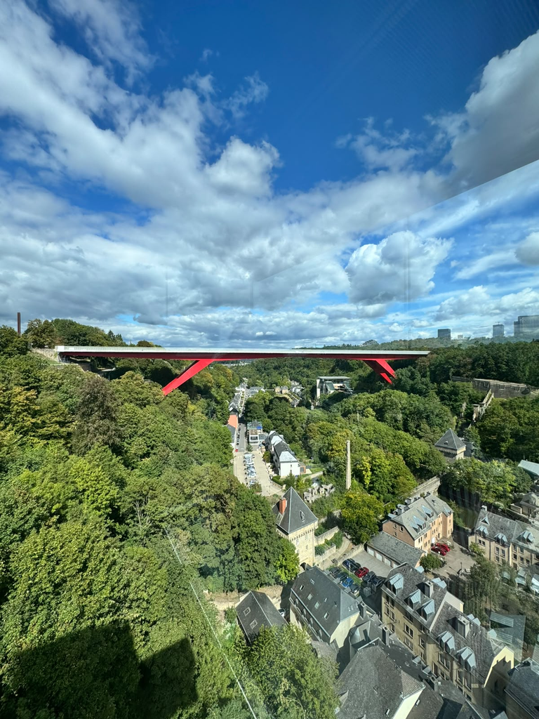
The upper city, Grund, Clausen, Pfaffenthal and the plateaus around them can be very close geographically while feeling remarkably distinct. Elevation, bridges, lifts, roads and paths determine how those pieces of city connect.
Historically, the same terrain helped make Luxembourg defensible. Today it produces a very different set of questions about accessibility, mobility and everyday urban experience.
Walking along the river, past quieter residential areas and towards spaces such as the skatepark, I was reminded how many audiences a small city can accommodate within an extremely compressed geography.
The monumental city seen from the Bock is one Luxembourg. The low-lying neighbourhood along the river is another.
A skatepark under infrastructure, busy streets around the commercial centre, institutional spaces, green valleys and fortified viewpoints all belong to the same city, but they invite different behaviours and different people.
This is where the UNESCO property becomes particularly interesting from a spatial perspective.
The official boundary is precise. The experience of heritage is not.
A person may cross into and out of the World Heritage area without noticing a formal boundary, while a steep slope, bridge or lift may produce a much stronger perceived transition.
The shape of the city therefore matters not only historically, but experientially.
UNESCO’s own work in Luxembourg has already connected heritage with this broader understanding of access. An initiative developed for the anniversary of the inscription created accessible cultural routes in cooperation with community organisations and framed accessibility and inclusiveness as part of the management of the historic urban landscape.
That is a useful reminder that making heritage available does not only mean keeping a monument open.
It also means asking who can reach it, understand it, recognise themselves in it and use the city around it.
Beyond the World Heritage boundary
My final day moved deliberately away from heritage management in the narrow sense.
Through Shaaf, I met Maurice Bauer, who combines two perspectives that are especially interesting for Luxembourg: he is a member of the Chamber of Deputies and also an alderman of Luxembourg City. At Parliament, he gave me a tour of the Chamber and we discussed some of the major challenges facing Luxembourg today.
Two issues returned repeatedly: housing and mobility.
Neither is specifically a World Heritage problem. That was precisely why they mattered.
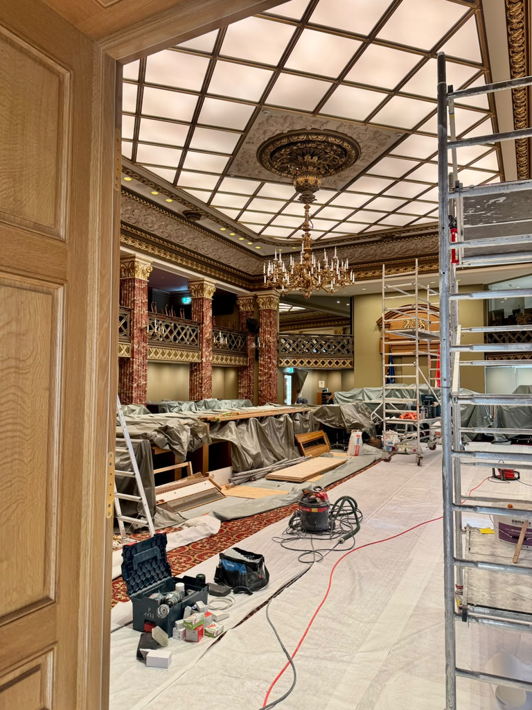
A heritage area does not exist independently from the housing market that determines where people can live, or the transport system that determines how they reach it.
Later, at LISER, I continued one of those conversations with Magdalena and Constance, focusing on housing.
The discussion did not produce a simple distinction between life inside and outside the UNESCO area, and I do not think one should be forced onto it. Housing in Luxembourg operates at a much larger metropolitan and national scale.
The pressure itself is well documented. Recent LISER research shows that housing costs for private-sector tenants have been rising faster than income, with housing costs reaching an average of 39% of income for private tenants in 2023.
But what interested me during the trip was a more experiential consequence.
Where you can afford to live changes how you experience the city.
Someone living within walking distance of the centre has one Luxembourg. Someone relying on a longer daily commute has another. Someone crossing the border each day may have a relationship with the city structured almost entirely around working hours, transport corridors and particular services.
These are not separate from questions of heritage and habitability simply because they happen outside the UNESCO polygon.
They shape who is present in the centre, when they are present, how long they stay and what kinds of everyday relationships they can build with it.
The same is true of mobility.
Luxembourg’s valleys and plateaus already produce a highly particular local geography. At a wider scale, commuting and residential location add another layer of distance.
This is why a heritage management question can quickly become an urban question.
And an urban question can just as quickly become regional.
Heritage as an ongoing negotiation
Returning to a city I already knew changed the way I understood the whole project.
When I lived in Luxembourg previously, I knew the Grund, the city centre, Kirchberg, public transport and housing difficulties as parts of everyday life. During this visit, the World Heritage framework made those same places appear connected in a different way.
The history of Luxembourg is a history of adaptation. The fortress was repeatedly rebuilt by different European powers. After 1867, enormous sections of its military infrastructure were dismantled, allowing the city to expand. Other parts survived and were repurposed. UNESCO itself notes that some former defensive structures were integrated into nineteenth-century urban projects and that historic buildings have acquired new administrative or cultural uses while maintaining their overall character.
So the question has never really been whether Luxembourg should change, because it always has. The more difficult question is how new interventions relate to what already exists and which values they preserve, transform or create.
This is also where the conversations with Shaaf and her colleagues became particularly relevant.
Managing a World Heritage City does not mean deciding between conservation and contemporary life. Housing, mobility, accessibility, public space, climate adaptation, infrastructure, tourism and demographic change all interact with the protected urban landscape.
And because those changes are experienced differently, the technical question of what can be built or modified is only part of the challenge.
There is also a social question: how do we know what matters to the people using the city?
Luxembourg’s international population makes this especially complex, but also especially promising.
If people have different durations of residence, languages, routines and levels of familiarity with the city’s history, traditional participation formats may not reach them equally.
The objective cannot simply be to ask “the local community” what it thinks, as if that were one homogeneous group.
It may be more useful to ask which communities are present, which are absent from a particular process, how different groups experience the same places and whether their perspectives can be connected spatially.
This is where I increasingly see a possible bridge between participatory approaches and GIS.
A map can represent the UNESCO property, buildings, land use, transport networks, population or housing data. Participatory methods can reveal another layer: perceptions, meanings, conflicts, attachments and experiences. Neither replaces the other.
Together, they can help expose the multiple cities contained within the same city.
For Luxembourg, that could mean understanding not only where heritage is located, but how different groups relate to it, which parts of the city they associate with everyday life, where physical or social barriers emerge, and how proposed changes are perceived across different urban experiences.
My four days were nowhere near enough to answer those questions, but they were enough to make them considerably more precise.
What Luxembourg left me with
Luxembourg was the city where Beyond the Postcard stopped feeling only like a way of observing and started to suggest how observation might feed into something more systematic.
The Schueberfouer showed how a centuries-old tradition can remain intensely contemporary.
Pit showed me how the physical city becomes meaningful through stories, details and memory.
The Bock and its casemates revealed how military geography still structures the way the city is understood.
Walking through the Grund made the city’s verticality and its multiple everyday landscapes visible.
The discussions with Shaaf and her colleagues shifted the question from how heritage is interpreted to who participates in defining its future.
Maurice Bauer and the researchers at LISER widened the scale again, showing how housing and mobility influence the relationship people are able to have with the city long before they enter a heritage discussion.
This was possible partly because Luxembourg was different from the other stops. I had lived and worked there before, and Shaaf’s openness gave me access to far more people and perspectives than I could reasonably expect during a short visit elsewhere. That makes direct comparison with the other cities inappropriate.
It also made Luxembourg exceptionally useful. Across the trip, I had been observing several versions of each city: visitor landscapes, residential landscapes, commercial landscapes, institutional landscapes and the quieter geographies of everyday life.
In Luxembourg, I began thinking more seriously about how those landscapes could be identified with people rather than only observed from outside.
The city is small enough for the Bock, Parliament, a riverside neighbourhood, an international workplace and a centuries-old fair to appear within an extraordinarily compact geography. Yet the people moving through that geography may inhabit very different Luxembourgs.
Understanding those differences seems to me increasingly relevant to the future of urban heritage.
The next step would not be to create another definition of what makes Luxembourg habitable.
It would be to build ways of listening more carefully to how different people already inhabit it, connect those perspectives to the places they refer to, and place them alongside the analytical evidence used to plan and manage the city.
That would turn participation into more than an addition to heritage management.
It could become another way of mapping the living city itself.